
Size of this PNG preview of this SVG file:
800 × 521 pixels. Other resolutions:
320 × 208 pixels |
640 × 417 pixels |
1,024 × 667 pixels |
1,280 × 833 pixels |
2,560 × 1,666 pixels |
1,696 × 1,104 pixels.
Original file (SVG file, nominally 1,696 × 1,104 pixels, file size: 109 KB)
| This is a file from the
Wikimedia Commons. Information from its
description page there is shown below. Commons is a freely licensed media file repository. You can help. |
Summary
| Description |
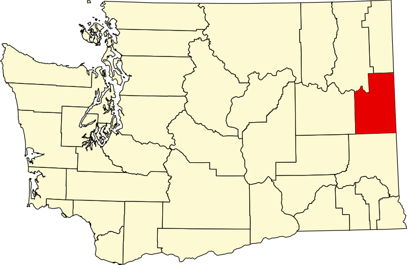
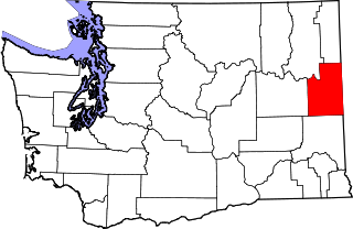
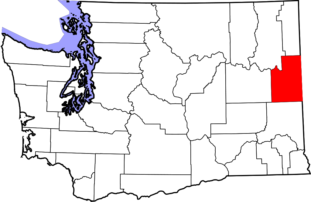
English: This is a locator map showing
Spokane County in Washington. For more information, see
Commons:United States county locator maps. |
| Date | |
| Source |
Own work: English: The maps use data from
nationalatlas.gov, specifically
countyp020.tar.gz on the
Raw Data Download page. The maps also use state outline data from
statesp020.tar.gz. The Florida maps use
hydrogm020.tar.gz to display Lake Okeechobee. |
| Author | David Benbennick |
Licensing
| I, the copyright holder of this work, release this work into the
public domain. This applies worldwide. In some countries this may not be legally possible; if so: I grant anyone the right to use this work for any purpose, without any conditions, unless such conditions are required by law. |
File history
Click on a date/time to view the file as it appeared at that time.
| Date/Time | Thumbnail | Dimensions | User | Comment | |
|---|---|---|---|---|---|
| current | 23:43, 24 June 2024 |
| 1,696 × 1,104 (109 KB) | Nux | fix rendering (remove clipping) |
| 18:06, 12 February 2006 |
 | 5,936 × 3,863 (215 KB) | David Benbennick | {{subst:User:Dbenbenn/clm|county=Spokane County|state=Washington|type=county}} |
File usage
The following pages on the English Wikipedia use this file (pages on other projects are not listed):
- Airway Heights, Washington
- Amber, Washington
- Buckeye, Washington
- Chattaroy, Washington
- Cheney, Washington
- Colbert, Washington
- Country Homes, Washington
- Dartford, Washington
- Deep Creek, Washington
- Deer Park, Washington
- Denison, Washington
- Dynamite, Washington
- Elk, Washington
- Espanola, Washington
- Fairchild Air Force Base
- Fairfield, Washington
- Fairwood, Spokane County, Washington
- Four Lakes, Washington
- Freeman, Washington
- Geiger Heights, Washington
- Glenrose, Washington
- Green Bluff, Washington
- Hazard, Washington
- Latah, Washington
- Liberty Lake, Washington
- List of counties in Washington
- Marshall, Washington
- Mead, Washington
- Medical Lake, Washington
- Mica, Washington
- Milan, Washington
- Millwood, Washington
- Mock, Washington
- National Register of Historic Places listings in Spokane County, Washington
- Newman Lake, Washington
- Nine Mile Falls, Washington
- Opportunity, Washington
- Orchard Prairie, Washington
- Otis Orchards-East Farms, Washington
- Peone, Washington
- Plaza, Washington
- Rockford, Washington
- Rodna, Washington
- Spangle, Washington
- Spokane, Washington
- Spokane Bridge, Washington
- Spokane County, Washington
- Spokane Valley, Washington
- Spokane bombing attempt
- Town and Country, Washington
- Tyler, Washington
- Upper Columbia Academy
- Valleyford, Washington
- Veradale, Washington
- Waverly, Washington
- User:AridCeption/sandbox
- User:Nyttend/County templates/WA
- File talk:Map of Washington highlighting Spokane County.svg
- Template:Spokane County, Washington
- Category:Populated places in Spokane County, Washington
Global file usage
The following other wikis use this file:
- Usage on ar.wikipedia.org
- Usage on bg.wikipedia.org
- Usage on bpy.wikipedia.org
- Usage on ca.wikipedia.org
- Spokane (Washington)
- Airway Heights
- Cheney (Washington)
- Country Homes
- Deer Park (Washington)
- Fairfield (Washington)
- Fairwood (comtat de Spokane)
- Latah (Washington)
- Liberty Lake
- Medical Lake
- Millwood (Washington)
- Otis Orchards-East Farms
- Rockford (Washington)
- Spangle
- Town and Country (Washington)
- Waverly (Washington)
- Plantilla:Comtat de Spokane
- Amber (Washington)
- Usage on cdo.wikipedia.org
- Usage on ceb.wikipedia.org
- Usage on ce.wikipedia.org
- Usage on cs.wikipedia.org
- Usage on cy.wikipedia.org
- Usage on de.wikipedia.org
View more global usage of this file.
Metadata
Size of this PNG preview of this SVG file:
800 × 521 pixels. Other resolutions:
320 × 208 pixels |
640 × 417 pixels |
1,024 × 667 pixels |
1,280 × 833 pixels |
2,560 × 1,666 pixels |
1,696 × 1,104 pixels.
Original file (SVG file, nominally 1,696 × 1,104 pixels, file size: 109 KB)
| This is a file from the
Wikimedia Commons. Information from its
description page there is shown below. Commons is a freely licensed media file repository. You can help. |
Summary
| Description |
English: This is a locator map showing
Spokane County in Washington. For more information, see
Commons:United States county locator maps. |
| Date | |
| Source |
Own work: English: The maps use data from
nationalatlas.gov, specifically
countyp020.tar.gz on the
Raw Data Download page. The maps also use state outline data from
statesp020.tar.gz. The Florida maps use
hydrogm020.tar.gz to display Lake Okeechobee. |
| Author | David Benbennick |
Licensing
| I, the copyright holder of this work, release this work into the
public domain. This applies worldwide. In some countries this may not be legally possible; if so: I grant anyone the right to use this work for any purpose, without any conditions, unless such conditions are required by law. |
File history
Click on a date/time to view the file as it appeared at that time.
| Date/Time | Thumbnail | Dimensions | User | Comment | |
|---|---|---|---|---|---|
| current | 23:43, 24 June 2024 |
| 1,696 × 1,104 (109 KB) | Nux | fix rendering (remove clipping) |
| 18:06, 12 February 2006 |
| 5,936 × 3,863 (215 KB) | David Benbennick | {{subst:User:Dbenbenn/clm|county=Spokane County|state=Washington|type=county}} |
File usage
The following pages on the English Wikipedia use this file (pages on other projects are not listed):
- Airway Heights, Washington
- Amber, Washington
- Buckeye, Washington
- Chattaroy, Washington
- Cheney, Washington
- Colbert, Washington
- Country Homes, Washington
- Dartford, Washington
- Deep Creek, Washington
- Deer Park, Washington
- Denison, Washington
- Dynamite, Washington
- Elk, Washington
- Espanola, Washington
- Fairchild Air Force Base
- Fairfield, Washington
- Fairwood, Spokane County, Washington
- Four Lakes, Washington
- Freeman, Washington
- Geiger Heights, Washington
- Glenrose, Washington
- Green Bluff, Washington
- Hazard, Washington
- Latah, Washington
- Liberty Lake, Washington
- List of counties in Washington
- Marshall, Washington
- Mead, Washington
- Medical Lake, Washington
- Mica, Washington
- Milan, Washington
- Millwood, Washington
- Mock, Washington
- National Register of Historic Places listings in Spokane County, Washington
- Newman Lake, Washington
- Nine Mile Falls, Washington
- Opportunity, Washington
- Orchard Prairie, Washington
- Otis Orchards-East Farms, Washington
- Peone, Washington
- Plaza, Washington
- Rockford, Washington
- Rodna, Washington
- Spangle, Washington
- Spokane, Washington
- Spokane Bridge, Washington
- Spokane County, Washington
- Spokane Valley, Washington
- Spokane bombing attempt
- Town and Country, Washington
- Tyler, Washington
- Upper Columbia Academy
- Valleyford, Washington
- Veradale, Washington
- Waverly, Washington
- User:AridCeption/sandbox
- User:Nyttend/County templates/WA
- File talk:Map of Washington highlighting Spokane County.svg
- Template:Spokane County, Washington
- Category:Populated places in Spokane County, Washington
Global file usage
The following other wikis use this file:
- Usage on ar.wikipedia.org
- Usage on bg.wikipedia.org
- Usage on bpy.wikipedia.org
- Usage on ca.wikipedia.org
- Spokane (Washington)
- Airway Heights
- Cheney (Washington)
- Country Homes
- Deer Park (Washington)
- Fairfield (Washington)
- Fairwood (comtat de Spokane)
- Latah (Washington)
- Liberty Lake
- Medical Lake
- Millwood (Washington)
- Otis Orchards-East Farms
- Rockford (Washington)
- Spangle
- Town and Country (Washington)
- Waverly (Washington)
- Plantilla:Comtat de Spokane
- Amber (Washington)
- Usage on cdo.wikipedia.org
- Usage on ceb.wikipedia.org
- Usage on ce.wikipedia.org
- Usage on cs.wikipedia.org
- Usage on cy.wikipedia.org
- Usage on de.wikipedia.org
View more global usage of this file.