
Map_of_Nordic_Council.png (596 × 558 pixels, file size: 13 KB, MIME type: image/png)
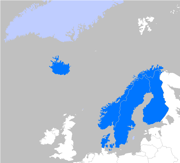
Map of members in the Nordic council; Dark blue= members, Light blue= associate members.
| I, the copyright holder of this work, hereby release it into the
public domain. This applies worldwide. If this is not legally possible: |
 | This file is a candidate to be copied to
Wikimedia Commons.
Any user may perform this transfer; refer to Wikipedia:Moving files to Commons for details. If this file has problems with attribution, copyright, or is otherwise ineligible for Commons, then remove this tag and DO NOT transfer it; repeat violators may be blocked from editing. Other Instructions
| ||
| |||
| This media file is either in the public domain or published under a free license, and contains no inbound file links. If this media file is useful, then it should be transferred to the Wikimedia Commons. If this media is not useful, then please propose it for deletion or list it at files for discussion. |
File history
Click on a date/time to view the file as it appeared at that time.
| Date/Time | Thumbnail | Dimensions | User | Comment | |
|---|---|---|---|---|---|
| current | 17:49, 16 April 2007 |
| 596 × 558 (13 KB) | Theeuro ( talk | contribs) | Revised to include Svalbard, Aaland, Faroe Islands and Jan Mayen as part of their respective greater administrative regions. Jan Mayen Island is shown disproportionatly large on this map. DARK ORANGE = Members LIGHT ORANGE = Associate Members |
| 13:49, 16 April 2007 |
 | 628 × 568 (14 KB) | Theeuro ( talk | contribs) | Map of members in the Nordic council |
You cannot overwrite this file.
File usage
Map_of_Nordic_Council.png (596 × 558 pixels, file size: 13 KB, MIME type: image/png)
Map of members in the Nordic council; Dark blue= members, Light blue= associate members.
| I, the copyright holder of this work, hereby release it into the
public domain. This applies worldwide. If this is not legally possible: |
|
| This file is a candidate to be copied to
Wikimedia Commons.
Any user may perform this transfer; refer to Wikipedia:Moving files to Commons for details. If this file has problems with attribution, copyright, or is otherwise ineligible for Commons, then remove this tag and DO NOT transfer it; repeat violators may be blocked from editing. Other Instructions
| ||
| |||
| This media file is either in the public domain or published under a free license, and contains no inbound file links. If this media file is useful, then it should be transferred to the Wikimedia Commons. If this media is not useful, then please propose it for deletion or list it at files for discussion. |
File history
Click on a date/time to view the file as it appeared at that time.
| Date/Time | Thumbnail | Dimensions | User | Comment | |
|---|---|---|---|---|---|
| current | 17:49, 16 April 2007 |
| 596 × 558 (13 KB) | Theeuro ( talk | contribs) | Revised to include Svalbard, Aaland, Faroe Islands and Jan Mayen as part of their respective greater administrative regions. Jan Mayen Island is shown disproportionatly large on this map. DARK ORANGE = Members LIGHT ORANGE = Associate Members |
| 13:49, 16 April 2007 |
| 628 × 568 (14 KB) | Theeuro ( talk | contribs) | Map of members in the Nordic council |
You cannot overwrite this file.