
Original file (SVG file, nominally 512 × 545 pixels, file size: 140 KB)
| This is a file from the
Wikimedia Commons. Information from its
description page there is shown below. Commons is a freely licensed media file repository. You can help. |
| Description |
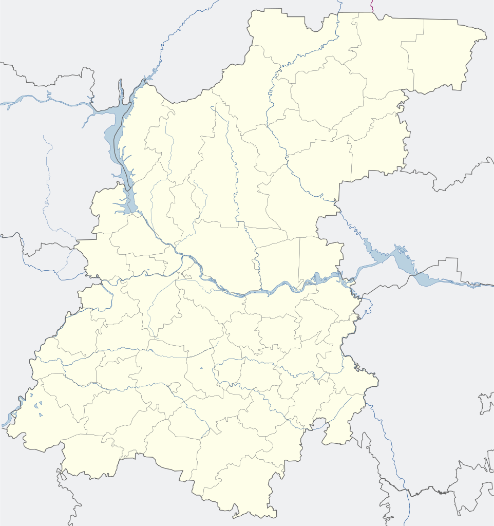
English: Map of the Nizhny Novgorod region (for the PozMap template) Русский: Карта Нижегородской области (для шаблона ПозКарта) |
| Date | |
| Source | Own work |
| Author |
English: Evgeny Katyshev Русский: Евгений Катышев |
| Permission ( Reusing this file) |
This file is licensed under the
Creative Commons
Attribution-Share Alike 3.0 Unported license.
|
| Other versions |
|

.svg)
File history
Click on a date/time to view the file as it appeared at that time.
| Date/Time | Thumbnail | Dimensions | User | Comment | |
|---|---|---|---|---|---|
| current | 06:13, 11 October 2015 |
| 512 × 545 (140 KB) | Stasyan117 | Незачем выделять зелёным |
| 07:57, 4 June 2015 |
 | 512 × 545 (140 KB) | AlexTref871 | Добавлена новая территория Сормовского и Московского районов | |
| 09:55, 30 November 2014 |
 | 512 × 545 (140 KB) | AlexTref871 | Границы города были расширены за счёт присоединения Зелёного города к Нижегородскому району. Поменял цвет с «горьковского» красного на... | |
| 17:27, 17 September 2012 |
 | 765 × 815 (204 KB) | Nzeemin | Oblast/borders colors changed according to standard; fixed rivers and borders near the map edges | |
| 05:35, 24 April 2008 |
 | 765 × 815 (175 KB) | Lzhl | ||
| 05:31, 24 April 2008 |
 | 765 × 815 (351 KB) | Lzhl | ||
| 05:24, 24 April 2008 |
 | 765 × 815 (351 KB) | Lzhl | ||
| 05:21, 24 April 2008 |
 | 765 × 815 (351 KB) | Lzhl | {{Information |Description={{ru|Карта Нижегородской области (для шаблона ПозКарта)}} |Source=Собственная работа |Date=24.04.2008 |Author=Евгений Катышев |Permission={{PD-self}] |oth |
File usage
More than 100 pages use this file. The following list shows the first 100 pages that use this file only. A full list is available.
.svg)
- 2014 Winter Olympics torch relay
- Ababkovo, Nizhny Novgorod Oblast
- Abaimovo
- Abramovo, Arzamassky District, Nizhny Novgorod Oblast
- Abramovo, Krasnooktyabrsky District, Nizhny Novgorod Oblast
- Alexandrovka, Russia
- Ardatov, Nizhny Novgorod Oblast
- Arya (urban-type settlement)
- Arzamas
- Balakhna
- Belyayevo
- Blizhne-Pesochnoye
- Bogorodsk, Bogorodsky District, Nizhny Novgorod Oblast
- Bolshoye Kozino
- Bolshoye Murashkino, Nizhny Novgorod Oblast
- Bolshoye Zagarino
- Bor, Nizhny Novgorod Oblast
- Buturlino, Nizhny Novgorod Oblast
- Chkalovsk, Russia
- Dalneye Konstantinovo
- Doschatoye
- Dzerzhinsk, Russia
- Frolishchi
- Gavrilovka, Dzerzhinsk, Nizhny Novgorod Oblast
- Gidrotorf
- Gorbatov, Nizhny Novgorod Oblast
- Gorbatovka
- Gorodets, Nizhny Novgorod Oblast
- Gremyachevo
- Ilyinogorsk
- Imeni M. I. Kalinina
- Imeni Stepana Razina
- Istomino Airfield
- Knyaginino, Nizhny Novgorod Oblast
- Kovernino, Koverninsky District, Nizhny Novgorod Oblast
- Krasnye Baki
- Kstovo
- Kulebaki
- Lake Beloye (Nizhny Novgorod Oblast)
- Lesogorsk (work settlement), Nizhny Novgorod Oblast
- Lukino, Nizhny Novgorod Oblast
- Lukoyanov
- Lyskovo, Nizhny Novgorod Oblast
- Maloye Kozino
- Mukhtolovo
- Navashino
- Nazarovo
- Nizhny Novgorod
- Pavlovo, Pavlovsky District, Nizhny Novgorod Oblast
- Perevoz, Nizhny Novgorod Oblast
- Pervomaysk, Nizhny Novgorod Oblast
- Pervomaysky, Gorodetsky District, Nizhny Novgorod Oblast
- Pervoye Maya, Nizhny Novgorod Oblast
- Pilna
- Pizhma, Nizhny Novgorod Oblast
- Pravdinsk, Balakhna
- Puchezh-Katunki crater
- Pyra, Russia
- Reshetikha
- Sarov
- Satis, Pervomaysk, Nizhny Novgorod Oblast
- Savasleyka (air base)
- Seltso (inhabited locality)
- Semyonov, Nizhny Novgorod Oblast
- Semyonovka, Russia
- Sergach
- Shakhunya
- Sharanga (urban-type settlement)
- Shatki, Nizhny Novgorod Oblast
- Shaygino
- Shimorskoye
- Smolino, Nizhny Novgorod Oblast
- Sokolskoye, Nizhny Novgorod Oblast
- Sosnovskoye, Sosnovsky District, Nizhny Novgorod Oblast
- Stepanovsky
- Strigino International Airport
- Sukhobezvodnoye
- Tonkino, Nizhny Novgorod Oblast
- Tonshayevo
- Tsentralny, Volodarsky District, Nizhny Novgorod Oblast
- Tumbotino
- Uren, Russia
- Vacha, Nizhny Novgorod Oblast
- Varnavino, Nizhny Novgorod Oblast
- Vasilsursk
- Veletma
- Vetluga
- Vetluzhsky, Nizhny Novgorod Oblast
- Vilya (urban-type settlement)
- Volga Federal District
- Volodarsk, Russia
- Vorotynets
- Vorsma
- Voskresenskoye, Voskresensky District, Nizhny Novgorod Oblast
- Voznesenskoye, Voznesensky District, Nizhny Novgorod Oblast
- Vyezdnoye
- Vyksa
- Zavolzhye, Nizhny Novgorod Oblast
- Zelyony Gorod
- Zhyolnino
View more links to this file.
Global file usage
The following other wikis use this file:
- Usage on af.wikipedia.org
- Usage on alt.wikipedia.org
- Usage on ar.wikipedia.org
- Usage on ast.wikipedia.org
- Usage on azb.wikipedia.org
- Usage on ba.wikipedia.org
- Usage on be.wikipedia.org
- Ніжні Ноўгарад
- Арзамас
- Сароў
- Дзяржынск (Ніжагародская вобласць)
- Кстова
- Багародск
- Балахна
- Бор (Расія)
- Валадарск (горад)
- Ворсма
- Выкса
- Вятлуга (горад)
- Гарбатаў (горад)
- Імя М. І. Калініна
- Гарадзец (Ніжагародская вобласць)
- Заволжа (горад)
- Княгініна
- Кулябакі
- Лукаянаў
- Лыскава (горад)
- Імя Сцяпана Разіна
- Навашына
- Паўлава (горад)
- Первамайск (Ніжагародская вобласць)
- Перавоз (Ніжагародская вобласць)
- Сямёнаў (горад)
- Сяргач
- Урэнь
- Чкалаўск
- Шахунья
- Шаблон:На карце/Расія Ніжагародская вобласць
- Пільна
- Варатынец
- Разлівайкі
- Сасноўскае (Сасноўскі раён)
- Васільсурск
- Ардатаў (Ніжагародская вобласць)
- Варнавіна (Ніжагародская вобласць)
- Шаткі
- Таншаева
View more global usage of this file.
.svg)
Metadata
.svg)
Original file (SVG file, nominally 512 × 545 pixels, file size: 140 KB)
| This is a file from the
Wikimedia Commons. Information from its
description page there is shown below. Commons is a freely licensed media file repository. You can help. |
| Description |
English: Map of the Nizhny Novgorod region (for the PozMap template) Русский: Карта Нижегородской области (для шаблона ПозКарта) |
| Date | |
| Source | Own work |
| Author |
English: Evgeny Katyshev Русский: Евгений Катышев |
| Permission ( Reusing this file) |
This file is licensed under the
Creative Commons
Attribution-Share Alike 3.0 Unported license.
|
| Other versions |
|
File history
Click on a date/time to view the file as it appeared at that time.
| Date/Time | Thumbnail | Dimensions | User | Comment | |
|---|---|---|---|---|---|
| current | 06:13, 11 October 2015 |
| 512 × 545 (140 KB) | Stasyan117 | Незачем выделять зелёным |
| 07:57, 4 June 2015 |
| 512 × 545 (140 KB) | AlexTref871 | Добавлена новая территория Сормовского и Московского районов | |
| 09:55, 30 November 2014 |
| 512 × 545 (140 KB) | AlexTref871 | Границы города были расширены за счёт присоединения Зелёного города к Нижегородскому району. Поменял цвет с «горьковского» красного на... | |
| 17:27, 17 September 2012 |
| 765 × 815 (204 KB) | Nzeemin | Oblast/borders colors changed according to standard; fixed rivers and borders near the map edges | |
| 05:35, 24 April 2008 |
| 765 × 815 (175 KB) | Lzhl | ||
| 05:31, 24 April 2008 |
| 765 × 815 (351 KB) | Lzhl | ||
| 05:24, 24 April 2008 |
| 765 × 815 (351 KB) | Lzhl | ||
| 05:21, 24 April 2008 |
| 765 × 815 (351 KB) | Lzhl | {{Information |Description={{ru|Карта Нижегородской области (для шаблона ПозКарта)}} |Source=Собственная работа |Date=24.04.2008 |Author=Евгений Катышев |Permission={{PD-self}] |oth |
File usage
More than 100 pages use this file. The following list shows the first 100 pages that use this file only. A full list is available.
- 2014 Winter Olympics torch relay
- Ababkovo, Nizhny Novgorod Oblast
- Abaimovo
- Abramovo, Arzamassky District, Nizhny Novgorod Oblast
- Abramovo, Krasnooktyabrsky District, Nizhny Novgorod Oblast
- Alexandrovka, Russia
- Ardatov, Nizhny Novgorod Oblast
- Arya (urban-type settlement)
- Arzamas
- Balakhna
- Belyayevo
- Blizhne-Pesochnoye
- Bogorodsk, Bogorodsky District, Nizhny Novgorod Oblast
- Bolshoye Kozino
- Bolshoye Murashkino, Nizhny Novgorod Oblast
- Bolshoye Zagarino
- Bor, Nizhny Novgorod Oblast
- Buturlino, Nizhny Novgorod Oblast
- Chkalovsk, Russia
- Dalneye Konstantinovo
- Doschatoye
- Dzerzhinsk, Russia
- Frolishchi
- Gavrilovka, Dzerzhinsk, Nizhny Novgorod Oblast
- Gidrotorf
- Gorbatov, Nizhny Novgorod Oblast
- Gorbatovka
- Gorodets, Nizhny Novgorod Oblast
- Gremyachevo
- Ilyinogorsk
- Imeni M. I. Kalinina
- Imeni Stepana Razina
- Istomino Airfield
- Knyaginino, Nizhny Novgorod Oblast
- Kovernino, Koverninsky District, Nizhny Novgorod Oblast
- Krasnye Baki
- Kstovo
- Kulebaki
- Lake Beloye (Nizhny Novgorod Oblast)
- Lesogorsk (work settlement), Nizhny Novgorod Oblast
- Lukino, Nizhny Novgorod Oblast
- Lukoyanov
- Lyskovo, Nizhny Novgorod Oblast
- Maloye Kozino
- Mukhtolovo
- Navashino
- Nazarovo
- Nizhny Novgorod
- Pavlovo, Pavlovsky District, Nizhny Novgorod Oblast
- Perevoz, Nizhny Novgorod Oblast
- Pervomaysk, Nizhny Novgorod Oblast
- Pervomaysky, Gorodetsky District, Nizhny Novgorod Oblast
- Pervoye Maya, Nizhny Novgorod Oblast
- Pilna
- Pizhma, Nizhny Novgorod Oblast
- Pravdinsk, Balakhna
- Puchezh-Katunki crater
- Pyra, Russia
- Reshetikha
- Sarov
- Satis, Pervomaysk, Nizhny Novgorod Oblast
- Savasleyka (air base)
- Seltso (inhabited locality)
- Semyonov, Nizhny Novgorod Oblast
- Semyonovka, Russia
- Sergach
- Shakhunya
- Sharanga (urban-type settlement)
- Shatki, Nizhny Novgorod Oblast
- Shaygino
- Shimorskoye
- Smolino, Nizhny Novgorod Oblast
- Sokolskoye, Nizhny Novgorod Oblast
- Sosnovskoye, Sosnovsky District, Nizhny Novgorod Oblast
- Stepanovsky
- Strigino International Airport
- Sukhobezvodnoye
- Tonkino, Nizhny Novgorod Oblast
- Tonshayevo
- Tsentralny, Volodarsky District, Nizhny Novgorod Oblast
- Tumbotino
- Uren, Russia
- Vacha, Nizhny Novgorod Oblast
- Varnavino, Nizhny Novgorod Oblast
- Vasilsursk
- Veletma
- Vetluga
- Vetluzhsky, Nizhny Novgorod Oblast
- Vilya (urban-type settlement)
- Volga Federal District
- Volodarsk, Russia
- Vorotynets
- Vorsma
- Voskresenskoye, Voskresensky District, Nizhny Novgorod Oblast
- Voznesenskoye, Voznesensky District, Nizhny Novgorod Oblast
- Vyezdnoye
- Vyksa
- Zavolzhye, Nizhny Novgorod Oblast
- Zelyony Gorod
- Zhyolnino
View more links to this file.
Global file usage
The following other wikis use this file:
- Usage on af.wikipedia.org
- Usage on alt.wikipedia.org
- Usage on ar.wikipedia.org
- Usage on ast.wikipedia.org
- Usage on azb.wikipedia.org
- Usage on ba.wikipedia.org
- Usage on be.wikipedia.org
- Ніжні Ноўгарад
- Арзамас
- Сароў
- Дзяржынск (Ніжагародская вобласць)
- Кстова
- Багародск
- Балахна
- Бор (Расія)
- Валадарск (горад)
- Ворсма
- Выкса
- Вятлуга (горад)
- Гарбатаў (горад)
- Імя М. І. Калініна
- Гарадзец (Ніжагародская вобласць)
- Заволжа (горад)
- Княгініна
- Кулябакі
- Лукаянаў
- Лыскава (горад)
- Імя Сцяпана Разіна
- Навашына
- Паўлава (горад)
- Первамайск (Ніжагародская вобласць)
- Перавоз (Ніжагародская вобласць)
- Сямёнаў (горад)
- Сяргач
- Урэнь
- Чкалаўск
- Шахунья
- Шаблон:На карце/Расія Ніжагародская вобласць
- Пільна
- Варатынец
- Разлівайкі
- Сасноўскае (Сасноўскі раён)
- Васільсурск
- Ардатаў (Ніжагародская вобласць)
- Варнавіна (Ніжагародская вобласць)
- Шаткі
- Таншаева
View more global usage of this file.