No higher resolution available.
Map_of_Cumberland_County_Pennsylvania_School_Districts.png (419 × 268 pixels, file size: 7 KB, MIME type: image/png)
| This is a file from the
Wikimedia Commons. Information from its
description page there is shown below. Commons is a freely licensed media file repository. You can help. |
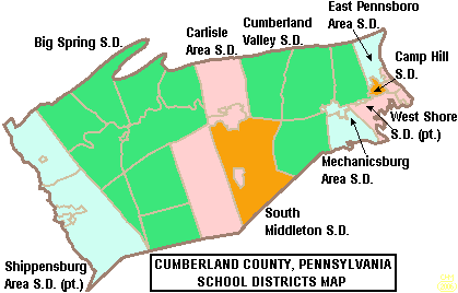
| Description | Map of Cumberland County, Pennsylvania, United States Public School Districts |
| Date | |
| Source | taken from US Census website [1] and modified by User:Ruhrfisch |
| Author | US Census, Ruhrfisch |
| Permission ( Reusing this file) |
US Census / US Government work is public domain, my modifications licensed under the GNU Free Documentation License |

|
Permission is granted to copy, distribute and/or modify this document under the terms of the GNU Free Documentation License, Version 1.2 or any later version published by the Free Software Foundation; with no Invariant Sections, no Front-Cover Texts, and no Back-Cover Texts. A copy of the license is included in the section entitled GNU Free Documentation License. |
| This file is licensed under the Creative Commons Attribution-Share Alike 3.0 Unported license. | ||
| ||
| This licensing tag was added to this file as part of the GFDL licensing update. |
File history
Click on a date/time to view the file as it appeared at that time.
| Date/Time | Thumbnail | Dimensions | User | Comment | |
|---|---|---|---|---|---|
| current | 01:09, 6 November 2008 |
| 419 × 268 (7 KB) | Agorist | pngcrush -brute |
| 20:19, 19 June 2006 |
 | 419 × 268 (14 KB) | Ruhrfisch | {{Information| |Description= Map of Cumberland County, Pennsylvania, United States Public School Districts |Source= taken from US Census website [http://factfinder.census.gov/] and modified by User:Ruhrfisch |Date= June 2006 |Author= US Census, Ruhr |
File usage
The following pages on the English Wikipedia use this file (pages on other projects are not listed):
- Big Spring School District
- Boiling Springs High School (Pennsylvania)
- Camp Hill High School
- Camp Hill School District
- Carlisle Area School District
- Carlisle High School (Carlisle, Pennsylvania)
- Cedar Cliff High School
- Cumberland County, Pennsylvania
- Cumberland Valley High School
- Cumberland Valley School District
- East Pennsboro Area School District
- East Pennsboro High School
- Harrisburg Academy
- Mechanicsburg Area School District
- Mechanicsburg Area Senior High School
- Red Land High School
- Shippensburg Area School District
- South Middleton School District
- Trinity High School (Camp Hill, Pennsylvania)
- West Shore School District
- User:Epoloch/Projects
- Template:Cumberland County, Pennsylvania School Districts
Global file usage
The following other wikis use this file:
- Usage on ja.wikipedia.org
- Usage on www.wikidata.org
No higher resolution available.
Map_of_Cumberland_County_Pennsylvania_School_Districts.png (419 × 268 pixels, file size: 7 KB, MIME type: image/png)
| This is a file from the
Wikimedia Commons. Information from its
description page there is shown below. Commons is a freely licensed media file repository. You can help. |
| Description | Map of Cumberland County, Pennsylvania, United States Public School Districts |
| Date | |
| Source | taken from US Census website [1] and modified by User:Ruhrfisch |
| Author | US Census, Ruhrfisch |
| Permission ( Reusing this file) |
US Census / US Government work is public domain, my modifications licensed under the GNU Free Documentation License |
|
|
Permission is granted to copy, distribute and/or modify this document under the terms of the GNU Free Documentation License, Version 1.2 or any later version published by the Free Software Foundation; with no Invariant Sections, no Front-Cover Texts, and no Back-Cover Texts. A copy of the license is included in the section entitled GNU Free Documentation License. |
| This file is licensed under the Creative Commons Attribution-Share Alike 3.0 Unported license. | ||
| ||
| This licensing tag was added to this file as part of the GFDL licensing update. |
File history
Click on a date/time to view the file as it appeared at that time.
| Date/Time | Thumbnail | Dimensions | User | Comment | |
|---|---|---|---|---|---|
| current | 01:09, 6 November 2008 |
| 419 × 268 (7 KB) | Agorist | pngcrush -brute |
| 20:19, 19 June 2006 |
| 419 × 268 (14 KB) | Ruhrfisch | {{Information| |Description= Map of Cumberland County, Pennsylvania, United States Public School Districts |Source= taken from US Census website [http://factfinder.census.gov/] and modified by User:Ruhrfisch |Date= June 2006 |Author= US Census, Ruhr |
File usage
The following pages on the English Wikipedia use this file (pages on other projects are not listed):
- Big Spring School District
- Boiling Springs High School (Pennsylvania)
- Camp Hill High School
- Camp Hill School District
- Carlisle Area School District
- Carlisle High School (Carlisle, Pennsylvania)
- Cedar Cliff High School
- Cumberland County, Pennsylvania
- Cumberland Valley High School
- Cumberland Valley School District
- East Pennsboro Area School District
- East Pennsboro High School
- Harrisburg Academy
- Mechanicsburg Area School District
- Mechanicsburg Area Senior High School
- Red Land High School
- Shippensburg Area School District
- South Middleton School District
- Trinity High School (Camp Hill, Pennsylvania)
- West Shore School District
- User:Epoloch/Projects
- Template:Cumberland County, Pennsylvania School Districts
Global file usage
The following other wikis use this file:
- Usage on ja.wikipedia.org
- Usage on www.wikidata.org