Map_Willoughby_coves.jpg (568 × 434 pixels, file size: 121 KB, MIME type: image/jpeg)
Summary
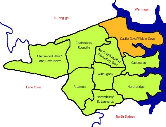
Map of Castle Cove and Middle Cove in relation to other suburbs controlled by the Willoughby council, NSW, Australia. Image created by uploader.
Licensing
 | I, the creator of this work, hereby grant the permission to copy, distribute and/or modify this document under the terms of the GNU Free Documentation License, Version 1.2 or any later version published by the Free Software Foundation; with no Invariant Sections, no Front-Cover Texts, and no Back-Cover Texts. Subject to disclaimers. |
|
| This work is licensed under the
Creative Commons
Attribution-ShareAlike 3.0 License. This licensing tag was added to this file as part of the GFDL licensing update. |
 | This file is a candidate to be copied to
Wikimedia Commons.
Any user may perform this transfer; refer to Wikipedia:Moving files to Commons for details. If this file has problems with attribution, copyright, or is otherwise ineligible for Commons, then remove this tag and DO NOT transfer it; repeat violators may be blocked from editing. Other Instructions
| ||
| |||
File history
Click on a date/time to view the file as it appeared at that time.
| Date/Time | Thumbnail | Dimensions | User | Comment | |
|---|---|---|---|---|---|
| current | 15:45, 16 August 2006 |
| 568 × 434 (121 KB) | Ladida ( talk | contribs) | Map of Castle Cove and Middle Cove in relation to other suburbs controlled by the Willoughby council, NSW, Australia. Image created by uploader. |
You cannot overwrite this file.
File usage
Metadata
Map_Willoughby_coves.jpg (568 × 434 pixels, file size: 121 KB, MIME type: image/jpeg)
Summary
Map of Castle Cove and Middle Cove in relation to other suburbs controlled by the Willoughby council, NSW, Australia. Image created by uploader.
Licensing
|
| I, the creator of this work, hereby grant the permission to copy, distribute and/or modify this document under the terms of the GNU Free Documentation License, Version 1.2 or any later version published by the Free Software Foundation; with no Invariant Sections, no Front-Cover Texts, and no Back-Cover Texts. Subject to disclaimers. |
|
| This work is licensed under the
Creative Commons
Attribution-ShareAlike 3.0 License. This licensing tag was added to this file as part of the GFDL licensing update. |
|
| This file is a candidate to be copied to
Wikimedia Commons.
Any user may perform this transfer; refer to Wikipedia:Moving files to Commons for details. If this file has problems with attribution, copyright, or is otherwise ineligible for Commons, then remove this tag and DO NOT transfer it; repeat violators may be blocked from editing. Other Instructions
| ||
| |||
File history
Click on a date/time to view the file as it appeared at that time.
| Date/Time | Thumbnail | Dimensions | User | Comment | |
|---|---|---|---|---|---|
| current | 15:45, 16 August 2006 |
| 568 × 434 (121 KB) | Ladida ( talk | contribs) | Map of Castle Cove and Middle Cove in relation to other suburbs controlled by the Willoughby council, NSW, Australia. Image created by uploader. |
You cannot overwrite this file.