No higher resolution available.
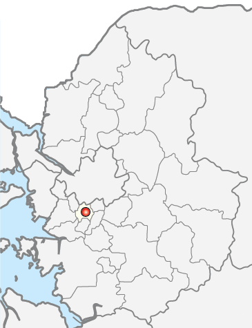
Map_Anyang-si.png (365 × 475 pixels, file size: 46 KB, MIME type: image/png)
| This is a file from the
Wikimedia Commons. Information from its
description page there is shown below. Commons is a freely licensed media file repository. You can help. |

|
File:Anyang Gyeonggi South Korea.svg is a vector version of this file. It should be used in place of this PNG file when not inferior.
File:Map Anyang-si.png →
File:Anyang Gyeonggi South Korea.svg
For more information, see
Help:SVG. |
 |

|
Permission is granted to copy, distribute and/or modify this document under the terms of the GNU Free Documentation License, Version 1.2 or any later version published by the Free Software Foundation; with no Invariant Sections, no Front-Cover Texts, and no Back-Cover Texts. A copy of the license is included in the section entitled GNU Free Documentation License. |
| This file is licensed under the Creative Commons Attribution-Share Alike 3.0 Unported license. | ||
| ||
| This licensing tag was added to this file as part of the GFDL licensing update. |
made from Maps of Korea
File history
Click on a date/time to view the file as it appeared at that time.
| Date/Time | Thumbnail | Dimensions | User | Comment | |
|---|---|---|---|---|---|
| current | 15:37, 10 May 2014 |
| 365 × 475 (46 KB) | Geoarchive | Edit distorted and incorrect borders Change Colors |
| 03:17, 25 June 2011 |
 | 300 × 278 (6 KB) | Asfreeas | color and form match | |
| 02:13, 19 February 2006 |
 | 301 × 278 (8 KB) | Hyolee2 | manan-gu,dongan-gu | |
| 02:32, 21 December 2004 |
 | 300 × 279 (6 KB) | Visviva | {{GFDL}}made from Maps of Korea |
File usage
The following pages on the English Wikipedia use this file (pages on other projects are not listed):
Global file usage
The following other wikis use this file:
- Usage on fa.wikipedia.org
- Usage on fr.wikipedia.org
- Usage on it.wikipedia.org
- Usage on ja.wikipedia.org
- Usage on ko.wikipedia.org
- Usage on lfn.wikipedia.org
- Usage on nl.wikipedia.org
- Usage on pt.wikipedia.org
- Usage on su.wikipedia.org
- Usage on tl.wikipedia.org
- Usage on vi.wikipedia.org
Metadata
No higher resolution available.
Map_Anyang-si.png (365 × 475 pixels, file size: 46 KB, MIME type: image/png)
| This is a file from the
Wikimedia Commons. Information from its
description page there is shown below. Commons is a freely licensed media file repository. You can help. |
|
|
File:Anyang Gyeonggi South Korea.svg is a vector version of this file. It should be used in place of this PNG file when not inferior.
File:Map Anyang-si.png →
File:Anyang Gyeonggi South Korea.svg
For more information, see
Help:SVG. |
|
|
|
Permission is granted to copy, distribute and/or modify this document under the terms of the GNU Free Documentation License, Version 1.2 or any later version published by the Free Software Foundation; with no Invariant Sections, no Front-Cover Texts, and no Back-Cover Texts. A copy of the license is included in the section entitled GNU Free Documentation License. |
| This file is licensed under the Creative Commons Attribution-Share Alike 3.0 Unported license. | ||
| ||
| This licensing tag was added to this file as part of the GFDL licensing update. |
made from Maps of Korea
File history
Click on a date/time to view the file as it appeared at that time.
| Date/Time | Thumbnail | Dimensions | User | Comment | |
|---|---|---|---|---|---|
| current | 15:37, 10 May 2014 |
| 365 × 475 (46 KB) | Geoarchive | Edit distorted and incorrect borders Change Colors |
| 03:17, 25 June 2011 |
| 300 × 278 (6 KB) | Asfreeas | color and form match | |
| 02:13, 19 February 2006 |
| 301 × 278 (8 KB) | Hyolee2 | manan-gu,dongan-gu | |
| 02:32, 21 December 2004 |
| 300 × 279 (6 KB) | Visviva | {{GFDL}}made from Maps of Korea |
File usage
The following pages on the English Wikipedia use this file (pages on other projects are not listed):
Global file usage
The following other wikis use this file:
- Usage on fa.wikipedia.org
- Usage on fr.wikipedia.org
- Usage on it.wikipedia.org
- Usage on ja.wikipedia.org
- Usage on ko.wikipedia.org
- Usage on lfn.wikipedia.org
- Usage on nl.wikipedia.org
- Usage on pt.wikipedia.org
- Usage on su.wikipedia.org
- Usage on tl.wikipedia.org
- Usage on vi.wikipedia.org