
Size of this PNG preview of this SVG file:
375 × 375 pixels. Other resolutions:
240 × 240 pixels |
480 × 480 pixels |
768 × 768 pixels |
1,024 × 1,024 pixels |
2,048 × 2,048 pixels.
Original file (SVG file, nominally 375 × 375 pixels, file size: 69 KB)
| This is a file from the
Wikimedia Commons. Information from its
description page there is shown below. Commons is a freely licensed media file repository. You can help. |
| Description |
|
|||
| Date | ||||
| Source | own work using free available sources | |||
| Author |
Michiel1972,
|
|||
| Permission ( Reusing this file) |
Attribution ShareAlike 3.0 |

This file is licensed under the
Creative Commons
Attribution-Share Alike 3.0 Unported license.
- You are free:
- to share – to copy, distribute and transmit the work
- to remix – to adapt the work
- Under the following conditions:
- attribution – You must give appropriate credit, provide a link to the license, and indicate if changes were made. You may do so in any reasonable manner, but not in any way that suggests the licensor endorses you or your use.
- share alike – If you remix, transform, or build upon the material, you must distribute your contributions under the same or compatible license as the original.
File history
Click on a date/time to view the file as it appeared at that time.
| Date/Time | Thumbnail | Dimensions | User | Comment | |
|---|---|---|---|---|---|
| current | 10:39, 19 April 2009 |
| 375 × 375 (69 KB) | Michiel1972 | {{Information |Description=<!--correct utf8, ALSO show buurt boundaries outside the "wijk" of the shown "buurt" --> |Source=own work, using free avaliable sources |Date= |Author=Michiel1972, {{Attribution|nolink=[http://www.cbs.nl Centraal Bureau voor de |
| 18:27, 18 April 2009 |
 | 375 × 375 (28 KB) | Michiel1972 | {{Information |Description=<!--correct utf8, corrected /removed buurt boundaries outside the "wijk" of the shown "buurt" --> |Source=own work, using free avaliable sources |Date= |Author=Michiel1972, {{Attribution|nolink=[http://www.cbs.nl Centraal Burea | |
| 20:21, 19 March 2009 |
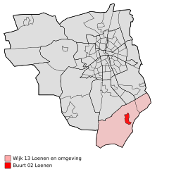
 | 375 × 375 (32 KB) | Michiel1972 | {{Information |Description=*{{subst:PAGENAME}} *locator map showing municipality boundary (2009) and statistical district/neighbourhood boundaries according to CBS *Numbering and names of neighboorhoods as defined by CBS in the 2008 Esri publication brt_2 |
File usage
The following pages on the English Wikipedia use this file (pages on other projects are not listed):
Global file usage
The following other wikis use this file:
- Usage on arz.wikipedia.org
- Usage on fa.wikipedia.org
- Usage on fy.wikipedia.org
- Usage on nl.wikipedia.org
- Usage on www.wikidata.org
Size of this PNG preview of this SVG file:
375 × 375 pixels. Other resolutions:
240 × 240 pixels |
480 × 480 pixels |
768 × 768 pixels |
1,024 × 1,024 pixels |
2,048 × 2,048 pixels.
Original file (SVG file, nominally 375 × 375 pixels, file size: 69 KB)
| This is a file from the
Wikimedia Commons. Information from its
description page there is shown below. Commons is a freely licensed media file repository. You can help. |
| Description |
|
|||
| Date | ||||
| Source | own work using free available sources | |||
| Author |
Michiel1972,
|
|||
| Permission ( Reusing this file) |
Attribution ShareAlike 3.0 |
This file is licensed under the
Creative Commons
Attribution-Share Alike 3.0 Unported license.
- You are free:
- to share – to copy, distribute and transmit the work
- to remix – to adapt the work
- Under the following conditions:
- attribution – You must give appropriate credit, provide a link to the license, and indicate if changes were made. You may do so in any reasonable manner, but not in any way that suggests the licensor endorses you or your use.
- share alike – If you remix, transform, or build upon the material, you must distribute your contributions under the same or compatible license as the original.
File history
Click on a date/time to view the file as it appeared at that time.
| Date/Time | Thumbnail | Dimensions | User | Comment | |
|---|---|---|---|---|---|
| current | 10:39, 19 April 2009 |
| 375 × 375 (69 KB) | Michiel1972 | {{Information |Description=<!--correct utf8, ALSO show buurt boundaries outside the "wijk" of the shown "buurt" --> |Source=own work, using free avaliable sources |Date= |Author=Michiel1972, {{Attribution|nolink=[http://www.cbs.nl Centraal Bureau voor de |
| 18:27, 18 April 2009 |
| 375 × 375 (28 KB) | Michiel1972 | {{Information |Description=<!--correct utf8, corrected /removed buurt boundaries outside the "wijk" of the shown "buurt" --> |Source=own work, using free avaliable sources |Date= |Author=Michiel1972, {{Attribution|nolink=[http://www.cbs.nl Centraal Burea | |
| 20:21, 19 March 2009 |
| 375 × 375 (32 KB) | Michiel1972 | {{Information |Description=*{{subst:PAGENAME}} *locator map showing municipality boundary (2009) and statistical district/neighbourhood boundaries according to CBS *Numbering and names of neighboorhoods as defined by CBS in the 2008 Esri publication brt_2 |
File usage
The following pages on the English Wikipedia use this file (pages on other projects are not listed):
Global file usage
The following other wikis use this file:
- Usage on arz.wikipedia.org
- Usage on fa.wikipedia.org
- Usage on fy.wikipedia.org
- Usage on nl.wikipedia.org
- Usage on www.wikidata.org