No higher resolution available.
Map-Bro-Gernev.png (758 × 581 pixels, file size: 141 KB, MIME type: image/png)
| This is a file from the
Wikimedia Commons. Information from its
description page there is shown below. Commons is a freely licensed media file repository. You can help. |
Summary
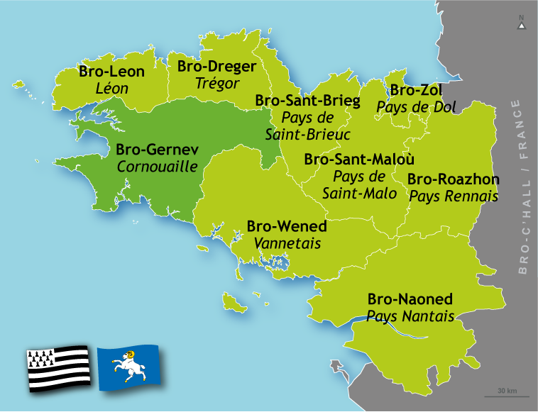
| Description |
English: Position's map of Cornouaille (Brittany)
Français : Carte de positionnement de Cornouaille (Bretagne)
Brezhoneg: Kartenn Bro-Gernev (Breizh) |
| Source | http://www.geobreizh.com |
| Author | Mikael Bodlore-Penlaez |
Licensing
I, the copyright holder of this work, hereby publish it under the following license:
This file is licensed under the
Creative Commons
Attribution 3.0 Unported license.
- You are free:
- to share – to copy, distribute and transmit the work
- to remix – to adapt the work
- Under the following conditions:
- attribution – You must give appropriate credit, provide a link to the license, and indicate if changes were made. You may do so in any reasonable manner, but not in any way that suggests the licensor endorses you or your use.
File history
Click on a date/time to view the file as it appeared at that time.
| Date/Time | Thumbnail | Dimensions | User | Comment | |
|---|---|---|---|---|---|
| current | 18:34, 11 January 2009 |
| 758 × 581 (141 KB) | Mixel~commonswiki | {{Information |Description={{en|1=Position's map of Cornouaille (Brittany)}} {{fr|1=Carte de positionnement de Cornouaille (Bretagne)}} {{br|1=Kartenn Bro-Gernev (Breizh)}} |Source=http://www.geobreizh.com |Author=Mikael Bodlore-Penlaez |Date= |Permission |
File usage
The following pages on the English Wikipedia use this file (pages on other projects are not listed):
Global file usage
The following other wikis use this file:
- Usage on an.wikipedia.org
- Usage on br.wikipedia.org
- Usage on ca.wikipedia.org
- Usage on cy.wikipedia.org
- Usage on de.wikipedia.org
- Usage on el.wikipedia.org
- Usage on eo.wikipedia.org
- Usage on es.wikipedia.org
- Usage on eu.wikipedia.org
- Usage on fr.wikipedia.org
- Usage on fr.wiktionary.org
- Usage on ga.wikipedia.org
- Usage on gl.wikipedia.org
- Usage on gv.wikipedia.org
- Usage on it.wikipedia.org
- Usage on kw.wikipedia.org
- Usage on nl.wikipedia.org
- Usage on no.wikipedia.org
- Usage on pl.wikipedia.org
- Usage on pt.wikipedia.org
- Usage on ru.wikipedia.org
- Usage on www.wikidata.org
No higher resolution available.
Map-Bro-Gernev.png (758 × 581 pixels, file size: 141 KB, MIME type: image/png)
| This is a file from the
Wikimedia Commons. Information from its
description page there is shown below. Commons is a freely licensed media file repository. You can help. |
Summary
| Description |
English: Position's map of Cornouaille (Brittany)
Français : Carte de positionnement de Cornouaille (Bretagne)
Brezhoneg: Kartenn Bro-Gernev (Breizh) |
| Source | http://www.geobreizh.com |
| Author | Mikael Bodlore-Penlaez |
Licensing
I, the copyright holder of this work, hereby publish it under the following license:
This file is licensed under the
Creative Commons
Attribution 3.0 Unported license.
- You are free:
- to share – to copy, distribute and transmit the work
- to remix – to adapt the work
- Under the following conditions:
- attribution – You must give appropriate credit, provide a link to the license, and indicate if changes were made. You may do so in any reasonable manner, but not in any way that suggests the licensor endorses you or your use.
File history
Click on a date/time to view the file as it appeared at that time.
| Date/Time | Thumbnail | Dimensions | User | Comment | |
|---|---|---|---|---|---|
| current | 18:34, 11 January 2009 |
| 758 × 581 (141 KB) | Mixel~commonswiki | {{Information |Description={{en|1=Position's map of Cornouaille (Brittany)}} {{fr|1=Carte de positionnement de Cornouaille (Bretagne)}} {{br|1=Kartenn Bro-Gernev (Breizh)}} |Source=http://www.geobreizh.com |Author=Mikael Bodlore-Penlaez |Date= |Permission |
File usage
The following pages on the English Wikipedia use this file (pages on other projects are not listed):
Global file usage
The following other wikis use this file:
- Usage on an.wikipedia.org
- Usage on br.wikipedia.org
- Usage on ca.wikipedia.org
- Usage on cy.wikipedia.org
- Usage on de.wikipedia.org
- Usage on el.wikipedia.org
- Usage on eo.wikipedia.org
- Usage on es.wikipedia.org
- Usage on eu.wikipedia.org
- Usage on fr.wikipedia.org
- Usage on fr.wiktionary.org
- Usage on ga.wikipedia.org
- Usage on gl.wikipedia.org
- Usage on gv.wikipedia.org
- Usage on it.wikipedia.org
- Usage on kw.wikipedia.org
- Usage on nl.wikipedia.org
- Usage on no.wikipedia.org
- Usage on pl.wikipedia.org
- Usage on pt.wikipedia.org
- Usage on ru.wikipedia.org
- Usage on www.wikidata.org