Photos • Location


Size of this preview:
800 × 356 pixels. Other resolutions:
320 × 142 pixels |
640 × 285 pixels |
1,250 × 556 pixels.
Original file (1,250 × 556 pixels, file size: 653 KB, MIME type: image/jpeg)
| This is a file from the
Wikimedia Commons. Information from its
description page there is shown below. Commons is a freely licensed media file repository. You can help. |
Summary
| Description |
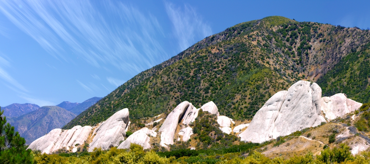
English: Located at the Highway 138 and Interstate 15 junction, the Mormon Rocks are visual evidence of the San Andreas fault lying beneath the California surface. Elevation: 1008 m. region: US 7200-7598 State Highway 138, Phelan, CA 92371, USA. |
| Date | |
| Source | Own work |
| Author | Hear2heaL |
| Camera location |
| View this and other nearby images on: OpenStreetMap |
|
|---|
1px = 3.9×3.9 m
Licensing
I, the copyright holder of this work, hereby publish it under the following license:
This file is licensed under the
Creative Commons
Attribution-Share Alike 3.0 Unported license.
- You are free:
- to share – to copy, distribute and transmit the work
- to remix – to adapt the work
- Under the following conditions:
- attribution – You must give appropriate credit, provide a link to the license, and indicate if changes were made. You may do so in any reasonable manner, but not in any way that suggests the licensor endorses you or your use.
- share alike – If you remix, transform, or build upon the material, you must distribute your contributions under the same or compatible license as the original.
File history
Click on a date/time to view the file as it appeared at that time.
| Date/Time | Thumbnail | Dimensions | User | Comment | |
|---|---|---|---|---|---|
| current | 21:24, 18 August 2010 |
| 1,250 × 556 (653 KB) | Hear2heaL | Reverted to version as of 21:42, 17 August 2010 |
| 22:45, 17 August 2010 |
 | 200 × 89 (6 KB) | Hear2heaL | Smaller version form. | |
| 21:42, 17 August 2010 |
 | 1,250 × 556 (653 KB) | Hear2heaL | {{Information |Description={{en|1=Located at the Highway 138 and Interstate 15 junction, the Mormon Rocks are visual evidence of the San Andreas fault lying beneath the California surface. }} |Source={{own}} |Author= Hear2heaL |Date=200 |
File usage
The following pages on the English Wikipedia use this file (pages on other projects are not listed):
Global file usage
The following other wikis use this file:
- Usage on es.wikipedia.org
- Usage on gl.wikipedia.org
- Usage on ko.wikipedia.org
Metadata
Size of this preview:
800 × 356 pixels. Other resolutions:
320 × 142 pixels |
640 × 285 pixels |
1,250 × 556 pixels.
Original file (1,250 × 556 pixels, file size: 653 KB, MIME type: image/jpeg)
| This is a file from the
Wikimedia Commons. Information from its
description page there is shown below. Commons is a freely licensed media file repository. You can help. |
Summary
| Description |
English: Located at the Highway 138 and Interstate 15 junction, the Mormon Rocks are visual evidence of the San Andreas fault lying beneath the California surface. Elevation: 1008 m. region: US 7200-7598 State Highway 138, Phelan, CA 92371, USA. |
| Date | |
| Source | Own work |
| Author | Hear2heaL |
| Camera location |
| View this and other nearby images on: OpenStreetMap |
|
|---|
1px = 3.9×3.9 m
Licensing
I, the copyright holder of this work, hereby publish it under the following license:
This file is licensed under the
Creative Commons
Attribution-Share Alike 3.0 Unported license.
- You are free:
- to share – to copy, distribute and transmit the work
- to remix – to adapt the work
- Under the following conditions:
- attribution – You must give appropriate credit, provide a link to the license, and indicate if changes were made. You may do so in any reasonable manner, but not in any way that suggests the licensor endorses you or your use.
- share alike – If you remix, transform, or build upon the material, you must distribute your contributions under the same or compatible license as the original.
File history
Click on a date/time to view the file as it appeared at that time.
| Date/Time | Thumbnail | Dimensions | User | Comment | |
|---|---|---|---|---|---|
| current | 21:24, 18 August 2010 |
| 1,250 × 556 (653 KB) | Hear2heaL | Reverted to version as of 21:42, 17 August 2010 |
| 22:45, 17 August 2010 |
| 200 × 89 (6 KB) | Hear2heaL | Smaller version form. | |
| 21:42, 17 August 2010 |
| 1,250 × 556 (653 KB) | Hear2heaL | {{Information |Description={{en|1=Located at the Highway 138 and Interstate 15 junction, the Mormon Rocks are visual evidence of the San Andreas fault lying beneath the California surface. }} |Source={{own}} |Author= Hear2heaL |Date=200 |
File usage
The following pages on the English Wikipedia use this file (pages on other projects are not listed):
Global file usage
The following other wikis use this file:
- Usage on es.wikipedia.org
- Usage on gl.wikipedia.org
- Usage on ko.wikipedia.org