Photos • Location


 This is a photo of a monument in Poland identified in WLM database by the ID
593768.
This is a photo of a monument in Poland identified in WLM database by the ID
593768.


Size of this preview:
800 × 524 pixels. Other resolutions:
320 × 210 pixels |
640 × 419 pixels |
1,063 × 696 pixels.
Original file (1,063 × 696 pixels, file size: 229 KB, MIME type: image/jpeg)
| This is a file from the
Wikimedia Commons. Information from its
description page there is shown below. Commons is a freely licensed media file repository. You can help. |
Summary
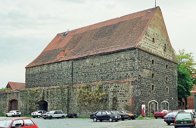
| Description | Lubań - Dom Solny z XVI w. |
| Date | |
| Source | Own work |
| Author | Hydrus |
| Openstreetmap entry | Link to Openstreetmap |
| Object location |
| View this and other nearby images on: OpenStreetMap |
|
|---|
Licensing
| I, the copyright holder of this work, release this work into the
public domain. This applies worldwide. In some countries this may not be legally possible; if so: I grant anyone the right to use this work for any purpose, without any conditions, unless such conditions are required by law. |
File history
Click on a date/time to view the file as it appeared at that time.
| Date/Time | Thumbnail | Dimensions | User | Comment | |
|---|---|---|---|---|---|
| current | 10:19, 9 September 2009 |
| 1,063 × 696 (229 KB) | Tadam | porprawa perspektywy |
| 21:49, 5 November 2006 |
 | 1,024 × 682 (388 KB) | Hydrus | {{Information |Description=Lubań - Dom Solny z XVI w. |Source=own work |Date=1999 |Author=Przemysław Janiszewski |Permission= }} |
File usage
The following pages on the English Wikipedia use this file (pages on other projects are not listed):
Global file usage
The following other wikis use this file:
- Usage on be.wikipedia.org
- Usage on bg.wikipedia.org
- Usage on cs.wikipedia.org
- Usage on da.wikipedia.org
- Usage on de.wikipedia.org
- Usage on de.wikivoyage.org
- Usage on lt.wikipedia.org
- Usage on pl.wikipedia.org
- Usage on ru.wikipedia.org
- Usage on sv.wikipedia.org
- Usage on www.wikidata.org
Metadata
Size of this preview:
800 × 524 pixels. Other resolutions:
320 × 210 pixels |
640 × 419 pixels |
1,063 × 696 pixels.
Original file (1,063 × 696 pixels, file size: 229 KB, MIME type: image/jpeg)
| This is a file from the
Wikimedia Commons. Information from its
description page there is shown below. Commons is a freely licensed media file repository. You can help. |
Summary
| Description | Lubań - Dom Solny z XVI w. |
| Date | |
| Source | Own work |
| Author | Hydrus |
| Openstreetmap entry | Link to Openstreetmap |
| Object location |
| View this and other nearby images on: OpenStreetMap |
|
|---|
Licensing
| I, the copyright holder of this work, release this work into the
public domain. This applies worldwide. In some countries this may not be legally possible; if so: I grant anyone the right to use this work for any purpose, without any conditions, unless such conditions are required by law. |
File history
Click on a date/time to view the file as it appeared at that time.
| Date/Time | Thumbnail | Dimensions | User | Comment | |
|---|---|---|---|---|---|
| current | 10:19, 9 September 2009 |
| 1,063 × 696 (229 KB) | Tadam | porprawa perspektywy |
| 21:49, 5 November 2006 |
| 1,024 × 682 (388 KB) | Hydrus | {{Information |Description=Lubań - Dom Solny z XVI w. |Source=own work |Date=1999 |Author=Przemysław Janiszewski |Permission= }} |
File usage
The following pages on the English Wikipedia use this file (pages on other projects are not listed):
Global file usage
The following other wikis use this file:
- Usage on be.wikipedia.org
- Usage on bg.wikipedia.org
- Usage on cs.wikipedia.org
- Usage on da.wikipedia.org
- Usage on de.wikipedia.org
- Usage on de.wikivoyage.org
- Usage on lt.wikipedia.org
- Usage on pl.wikipedia.org
- Usage on ru.wikipedia.org
- Usage on sv.wikipedia.org
- Usage on www.wikidata.org