No higher resolution available.
Location_Bié.PNG (361 × 363 pixels, file size: 97 KB, MIME type: image/png)
| This is a file from the
Wikimedia Commons. Information from its
description page there is shown below. Commons is a freely licensed media file repository. You can help. |
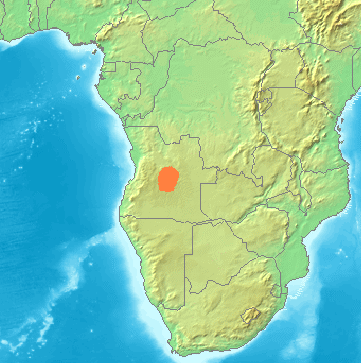
| Description | Locator maps for mountain ranges , Bié (Angola) |
| Source | demis maps, see below |
| Author |
This image is in the
public domain because it came from the site
https://www.demis.nl/products/web-map-server/examples/ and was released by the
copyright holder. Permission is granted to copy, distribute and/or modify this map since it is based on free of copyright images from:
www.demis.nl. See also
approval email on de.wp and
its clarification.
|
| This work has been released into the
public domain by its
copyright holder,
www.demis.nl. This applies worldwide. In some countries this may not be legally possible; if so: www.demis.nl grants anyone the right to use this work for any purpose, without any conditions, unless such conditions are required by law.
|
File history
Click on a date/time to view the file as it appeared at that time.
| Date/Time | Thumbnail | Dimensions | User | Comment | |
|---|---|---|---|---|---|
| current | 03:16, 23 November 2021 |
| 361 × 363 (97 KB) | Hallel | Reverted to version as of 14:38, 29 June 2007 (UTC) |
| 15:59, 11 August 2021 |
 | 361 × 363 (241 KB) | Fährtenleser | falsche Lage korrigiert (Grundlage: http://mountainbiodiversity.org/explore sowie Topographie | |
| 14:38, 29 June 2007 |
 | 361 × 363 (97 KB) | Michiel1972 | {{Information |Description=Locator maps for mountain ranges , Bié (Angola) |Source=demis maps, see below |Date= |Author= |Permission=see below |other_versions= }} {{PD-Demis}} Category:Maps of mountain_ranges_of_Europe |
File usage
The following pages on the English Wikipedia use this file (pages on other projects are not listed):
Global file usage
The following other wikis use this file:
- Usage on bg.wikipedia.org
- Usage on ca.wikipedia.org
- Usage on ceb.wikipedia.org
- Usage on cs.wikipedia.org
- Usage on de.wikipedia.org
- Usage on es.wikipedia.org
- Usage on fr.wikipedia.org
- Usage on hr.wikipedia.org
- Usage on hu.wikipedia.org
- Usage on it.wikipedia.org
- Usage on lt.wikipedia.org
- Usage on nl.wikipedia.org
- Usage on pl.wikipedia.org
- Usage on pt.wikipedia.org
- Usage on sh.wikipedia.org
- Usage on uk.wikipedia.org
- Usage on www.wikidata.org
- Usage on zh.wikipedia.org
No higher resolution available.
Location_Bié.PNG (361 × 363 pixels, file size: 97 KB, MIME type: image/png)
| This is a file from the
Wikimedia Commons. Information from its
description page there is shown below. Commons is a freely licensed media file repository. You can help. |
| Description | Locator maps for mountain ranges , Bié (Angola) |
| Source | demis maps, see below |
| Author |
This image is in the
public domain because it came from the site
https://www.demis.nl/products/web-map-server/examples/ and was released by the
copyright holder. Permission is granted to copy, distribute and/or modify this map since it is based on free of copyright images from:
www.demis.nl. See also
approval email on de.wp and
its clarification.
|
| This work has been released into the
public domain by its
copyright holder,
www.demis.nl. This applies worldwide. In some countries this may not be legally possible; if so: www.demis.nl grants anyone the right to use this work for any purpose, without any conditions, unless such conditions are required by law.
|
File history
Click on a date/time to view the file as it appeared at that time.
| Date/Time | Thumbnail | Dimensions | User | Comment | |
|---|---|---|---|---|---|
| current | 03:16, 23 November 2021 |
| 361 × 363 (97 KB) | Hallel | Reverted to version as of 14:38, 29 June 2007 (UTC) |
| 15:59, 11 August 2021 |
| 361 × 363 (241 KB) | Fährtenleser | falsche Lage korrigiert (Grundlage: http://mountainbiodiversity.org/explore sowie Topographie | |
| 14:38, 29 June 2007 |
| 361 × 363 (97 KB) | Michiel1972 | {{Information |Description=Locator maps for mountain ranges , Bié (Angola) |Source=demis maps, see below |Date= |Author= |Permission=see below |other_versions= }} {{PD-Demis}} Category:Maps of mountain_ranges_of_Europe |
File usage
The following pages on the English Wikipedia use this file (pages on other projects are not listed):
Global file usage
The following other wikis use this file:
- Usage on bg.wikipedia.org
- Usage on ca.wikipedia.org
- Usage on ceb.wikipedia.org
- Usage on cs.wikipedia.org
- Usage on de.wikipedia.org
- Usage on es.wikipedia.org
- Usage on fr.wikipedia.org
- Usage on hr.wikipedia.org
- Usage on hu.wikipedia.org
- Usage on it.wikipedia.org
- Usage on lt.wikipedia.org
- Usage on nl.wikipedia.org
- Usage on pl.wikipedia.org
- Usage on pt.wikipedia.org
- Usage on sh.wikipedia.org
- Usage on uk.wikipedia.org
- Usage on www.wikidata.org
- Usage on zh.wikipedia.org