LocationIndonesia.png (250 × 115 pixels, file size: 12 KB, MIME type: image/png)
| This is a file from the
Wikimedia Commons. Information from its
description page there is shown below. Commons is a freely licensed media file repository. You can help. |
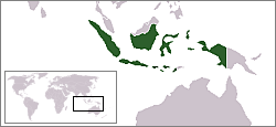
Location map for the
Indonesia.
Originally created for English Wikipedia by
Vardion.
| |
This work has been released into the
public domain by its author,
Vardion, at the
English Wikipedia project. This applies worldwide. In case this is not legally possible: |

|
File:LocationIndonesia.svg is a vector version of this file. It should be used in place of this PNG file when not inferior.
File:LocationIndonesia.png →
File:LocationIndonesia.svg
For more information, see
Help:SVG. |
 |
File history
Click on a date/time to view the file as it appeared at that time.
| Date/Time | Thumbnail | Dimensions | User | Comment | |
|---|---|---|---|---|---|
| current | 05:00, 14 December 2004 |
| 250 × 115 (12 KB) | EugeneZelenko | Location map for the Indonesia.<br/>Originally created for English Wikipedia by Vardion.<br/>{{PD}}<br/> Category:Country locator maps |
File usage
Global file usage
The following other wikis use this file:
- Usage on af.wikipedia.org
- Usage on ar.wikipedia.org
- Usage on ar.wikinews.org
- Usage on as.wikipedia.org
- Usage on ba.wikipedia.org
- Usage on bg.wikipedia.org
- Usage on bn.wikipedia.org
- Usage on bpy.wikipedia.org
- Usage on br.wikipedia.org
- Usage on bs.wikipedia.org
- Usage on cv.wikipedia.org
- Usage on de.wikinews.org
- Usage on dsb.wikipedia.org
- Usage on dv.wikipedia.org
- Usage on en.wikinews.org
- Wikinews:2005/April
- Wikinews:2005/April/20
- Australian blitz on fish poaching
- Historic summit, commemoration by Asian-African leaders in Bandung
- Eastern Indonesia struck by earthquake
- Indonesia warns Australia over West Papuan asylum seekers
- Australian resort manager faces possible 10-year prison sentence in Indonesia
- Usage on en.wikivoyage.org
- Usage on en.wiktionary.org
- Usage on es.wikipedia.org
- Usuario:Lirg122/Taller
- Phrynarachne coerulescens
- Phrynarachne dissimilis
- Phrynarachne kannegieteri
- Runcinia soeensis
- Epidius pallidus
- Stephanopis aruana
- Stephanopis secata
- Stiphropus gruberi
- Pseudamyciaea
- Reinickella
- Scopticus
- Narcaeus
- Musaeus
- Schedorhinotermes brachyceps
- Schedorhinotermes holmgreni
- Schedorhinotermes leopoldi
- Schedorhinotermes makassarensis
- Schedorhinotermes tenuis
View more global usage of this file.
LocationIndonesia.png (250 × 115 pixels, file size: 12 KB, MIME type: image/png)
| This is a file from the
Wikimedia Commons. Information from its
description page there is shown below. Commons is a freely licensed media file repository. You can help. |
Location map for the
Indonesia.
Originally created for English Wikipedia by
Vardion.
| |
This work has been released into the
public domain by its author,
Vardion, at the
English Wikipedia project. This applies worldwide. In case this is not legally possible: |
|
|
File:LocationIndonesia.svg is a vector version of this file. It should be used in place of this PNG file when not inferior.
File:LocationIndonesia.png →
File:LocationIndonesia.svg
For more information, see
Help:SVG. |
|
File history
Click on a date/time to view the file as it appeared at that time.
| Date/Time | Thumbnail | Dimensions | User | Comment | |
|---|---|---|---|---|---|
| current | 05:00, 14 December 2004 |
| 250 × 115 (12 KB) | EugeneZelenko | Location map for the Indonesia.<br/>Originally created for English Wikipedia by Vardion.<br/>{{PD}}<br/> Category:Country locator maps |
File usage
Global file usage
The following other wikis use this file:
- Usage on af.wikipedia.org
- Usage on ar.wikipedia.org
- Usage on ar.wikinews.org
- Usage on as.wikipedia.org
- Usage on ba.wikipedia.org
- Usage on bg.wikipedia.org
- Usage on bn.wikipedia.org
- Usage on bpy.wikipedia.org
- Usage on br.wikipedia.org
- Usage on bs.wikipedia.org
- Usage on cv.wikipedia.org
- Usage on de.wikinews.org
- Usage on dsb.wikipedia.org
- Usage on dv.wikipedia.org
- Usage on en.wikinews.org
- Wikinews:2005/April
- Wikinews:2005/April/20
- Australian blitz on fish poaching
- Historic summit, commemoration by Asian-African leaders in Bandung
- Eastern Indonesia struck by earthquake
- Indonesia warns Australia over West Papuan asylum seekers
- Australian resort manager faces possible 10-year prison sentence in Indonesia
- Usage on en.wikivoyage.org
- Usage on en.wiktionary.org
- Usage on es.wikipedia.org
- Usuario:Lirg122/Taller
- Phrynarachne coerulescens
- Phrynarachne dissimilis
- Phrynarachne kannegieteri
- Runcinia soeensis
- Epidius pallidus
- Stephanopis aruana
- Stephanopis secata
- Stiphropus gruberi
- Pseudamyciaea
- Reinickella
- Scopticus
- Narcaeus
- Musaeus
- Schedorhinotermes brachyceps
- Schedorhinotermes holmgreni
- Schedorhinotermes leopoldi
- Schedorhinotermes makassarensis
- Schedorhinotermes tenuis
View more global usage of this file.