
Original file (1,357 × 628 pixels, file size: 21 KB, MIME type: image/png)
| This is a file from the
Wikimedia Commons. Information from its
description page there is shown below. Commons is a freely licensed media file repository. You can help. |

|
This locator map image could be re-created using
vector graphics as an
SVG file. This has several advantages; see
Commons:Media for cleanup for more information. If an SVG form of this image is available, please upload it and afterwards replace this template with
{{
vector version available|new image name}}
.
It is recommended to name the SVG file “LocationIndia.svg”—then the template Vector version available (or Vva) does not need the new image name parameter. |
Summary
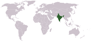
Location map for w:India.
User:dbenbenn modified Image:BlankMap-World.png.
Licensing
| |
This work has been released into the
public domain by its author,
Vardion, at the
English Wikipedia project. This applies worldwide. In case this is not legally possible: |
File history
Click on a date/time to view the file as it appeared at that time.
| Date/Time | Thumbnail | Dimensions | User | Comment | |
|---|---|---|---|---|---|
| current | 07:35, 11 September 2021 |
| 1,357 × 628 (21 KB) | Ytpks896 | Reverted to version as of 22:39, 12 February 2005 (UTC) |
| 13:37, 29 July 2021 |
 | 1,427 × 628 (103 KB) | Ytpks896 | Reverted to version as of 03:16, 1 May 2008 (UTC) | |
| 00:33, 15 February 2010 |
 | 1,357 × 628 (24 KB) | King Zebu | Reverted to version as of 09:17, 3 June 2005 Please discuss before making such edits in future. | |
| 03:16, 1 May 2008 |
 | 1,427 × 628 (103 KB) | KAVO | (Changed to colours more noticeable: *Light green - Claimed by India, not administered by India **(Aksai Chin, Azad Kashmir, Northern Areas, Shaksgam Valley) *Deep Green - Disputed with other nations, administered by India **(Arunachal Pradesh, Jammu and | |
| 09:17, 3 June 2005 |
 | 1,357 × 628 (24 KB) | Nichalp | NPOV map, please discuss any changes with me for NPOV status | |
| 22:39, 12 February 2005 |
 | 1,357 × 628 (21 KB) | Dbenbenn | higher resolution version, without black border | |
| 20:28, 5 December 2004 |
 | 250 × 115 (18 KB) | EugeneZelenko | Location map for India.<br/>Originally created for English Wikipedia by Vardion.<br/>{{GFDL}} |
File usage
Global file usage
The following other wikis use this file:
- Usage on ar.wikinews.org
- Usage on ckb.wikipedia.org
- Usage on en.wikinews.org
- Usage on en.wikivoyage.org
- Usage on en.wiktionary.org
- Usage on es.wikipedia.org
- Camaricus bipunctatus
- Camaricus khandalaensis
- Camaricus siltorsus
- Camaricus rinkae
- Lysiteles catulus
- Lysiteles brunettii
- Oxytate chlorion
- Oxytate greenae
- Oxytate elongata
- Oxytate kanishkai
- Phrynarachne peeliana
- Phrynarachne tuberosa
- Runcinia ghorpadei
- Runcinia escheri
- Runcinia khandari
- Runcinia sitadongri
- Runcinia roonwali
- Runcinia yogeshi
- Epidius longimanus
- Epidius mahavira
- Stiphropus duriusculus
- Synema mysorense
- Schedorhinotermes eleanorae
- Schedorhinotermes nancowriensis
- Schedorhinotermes tiwarii
- Usage on fr.wikinews.org
- Usage on fur.wikipedia.org
- Usage on he.wikivoyage.org
- Usage on hr.wikipedia.org
- Usage on hr.wikiquote.org
- Usage on incubator.wikimedia.org
View more global usage of this file.
Metadata
Original file (1,357 × 628 pixels, file size: 21 KB, MIME type: image/png)
| This is a file from the
Wikimedia Commons. Information from its
description page there is shown below. Commons is a freely licensed media file repository. You can help. |
|
|
This locator map image could be re-created using
vector graphics as an
SVG file. This has several advantages; see
Commons:Media for cleanup for more information. If an SVG form of this image is available, please upload it and afterwards replace this template with
{{
vector version available|new image name}}
.
It is recommended to name the SVG file “LocationIndia.svg”—then the template Vector version available (or Vva) does not need the new image name parameter. |
Summary
Location map for w:India.
User:dbenbenn modified Image:BlankMap-World.png.
Licensing
| |
This work has been released into the
public domain by its author,
Vardion, at the
English Wikipedia project. This applies worldwide. In case this is not legally possible: |
File history
Click on a date/time to view the file as it appeared at that time.
| Date/Time | Thumbnail | Dimensions | User | Comment | |
|---|---|---|---|---|---|
| current | 07:35, 11 September 2021 |
| 1,357 × 628 (21 KB) | Ytpks896 | Reverted to version as of 22:39, 12 February 2005 (UTC) |
| 13:37, 29 July 2021 |
| 1,427 × 628 (103 KB) | Ytpks896 | Reverted to version as of 03:16, 1 May 2008 (UTC) | |
| 00:33, 15 February 2010 |
| 1,357 × 628 (24 KB) | King Zebu | Reverted to version as of 09:17, 3 June 2005 Please discuss before making such edits in future. | |
| 03:16, 1 May 2008 |
| 1,427 × 628 (103 KB) | KAVO | (Changed to colours more noticeable: *Light green - Claimed by India, not administered by India **(Aksai Chin, Azad Kashmir, Northern Areas, Shaksgam Valley) *Deep Green - Disputed with other nations, administered by India **(Arunachal Pradesh, Jammu and | |
| 09:17, 3 June 2005 |
| 1,357 × 628 (24 KB) | Nichalp | NPOV map, please discuss any changes with me for NPOV status | |
| 22:39, 12 February 2005 |
| 1,357 × 628 (21 KB) | Dbenbenn | higher resolution version, without black border | |
| 20:28, 5 December 2004 |
| 250 × 115 (18 KB) | EugeneZelenko | Location map for India.<br/>Originally created for English Wikipedia by Vardion.<br/>{{GFDL}} |
File usage
Global file usage
The following other wikis use this file:
- Usage on ar.wikinews.org
- Usage on ckb.wikipedia.org
- Usage on en.wikinews.org
- Usage on en.wikivoyage.org
- Usage on en.wiktionary.org
- Usage on es.wikipedia.org
- Camaricus bipunctatus
- Camaricus khandalaensis
- Camaricus siltorsus
- Camaricus rinkae
- Lysiteles catulus
- Lysiteles brunettii
- Oxytate chlorion
- Oxytate greenae
- Oxytate elongata
- Oxytate kanishkai
- Phrynarachne peeliana
- Phrynarachne tuberosa
- Runcinia ghorpadei
- Runcinia escheri
- Runcinia khandari
- Runcinia sitadongri
- Runcinia roonwali
- Runcinia yogeshi
- Epidius longimanus
- Epidius mahavira
- Stiphropus duriusculus
- Synema mysorense
- Schedorhinotermes eleanorae
- Schedorhinotermes nancowriensis
- Schedorhinotermes tiwarii
- Usage on fr.wikinews.org
- Usage on fur.wikipedia.org
- Usage on he.wikivoyage.org
- Usage on hr.wikipedia.org
- Usage on hr.wikiquote.org
- Usage on incubator.wikimedia.org
View more global usage of this file.