LocationGermany.png (250 × 115 pixels, file size: 6 KB, MIME type: image/png)
| This is a file from the
Wikimedia Commons. Information from its
description page there is shown below. Commons is a freely licensed media file repository. You can help. |
Summary
| Description |
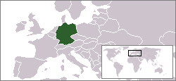
Deutsch: Locator map von Deutschland English: Location map of
Germany. Svenska: Tyskland markerat på karta |
| Source | |
| Author | Originally created for English Wikipedia by en:User:Vardion. |
Licensing
| |
This work has been released into the
public domain by its author,
Vardion, at the
English Wikipedia project. This applies worldwide. In case this is not legally possible: |

|
File:LocationGermany.svg is a vector version of this file. It should be used in place of this PNG file when not inferior.
File:LocationGermany.png →
File:LocationGermany.svg
For more information, see
Help:SVG. |
 |
File history
Click on a date/time to view the file as it appeared at that time.
| Date/Time | Thumbnail | Dimensions | User | Comment | |
|---|---|---|---|---|---|
| current | 12:03, 4 June 2006 |
| 250 × 115 (6 KB) | Rain74 | adding Serbia-Montenegro border |
| 02:55, 8 December 2004 |
 | 250 × 115 (6 KB) | EugeneZelenko | Location map for the Germany.<br/>Originally created for English Wikipedia by Vardion.<br/>{{GFDL}} |
File usage
Global file usage
The following other wikis use this file:
- Usage on arc.wikipedia.org
- Usage on ar.wikinews.org
- أنجيلا ميركل تزور قوات ألمانيا في أفغانستان
- قالب:ألمانيا
- بايرن ميونيخ يهزم تشيلسي ويفوز بكأس السوبر الأوروبي
- علماء ألمان يحصلون على عنصر كيميائي جديد
- ألمانيا تحذر من "شرعنة" البؤر الاستيطانية العشوائية
- نتنياهو يرفض استقبال وزير خارجية ألمانيا
- مسؤولة ألمانية: المحجبات يتعرضن للتمييز
- 6 ملايين لاجئ ينتظرون العبور إلى أوروبا
- ألمانيا تجلي 60 ألف شخص لتفكيك قنبلة من مخلفات الحرب
- أنجيلا ميركل تدعو إلى تصنيف دول المغرب العربي دولا آمنة
- حزب ميركل يفوز في الانتخابات الألمانية
- ألمانيا تنتقد بناء المستوطنات بالضفة المحتلة
- قيادي بحزب ألماني يميني متطرف يعتنق الإسلام
- موافقة أعضاء الحزب الاشتراكي على الانضمام للائتلاف الحكومي الذي ترأسه ميركل
- مظاهرات في برلين تطالب بوقف قصف الغوطة وعفرين
- ألمانيا تؤكد عدم قدرة أوروبا الاعتماد على الولايات المتحدة
- اتهامات ألمانية بضلوع روسيا في هجمات سيبرانية
- Usage on av.wikipedia.org
- Usage on bg.wikipedia.org
- Usage on bn.wikipedia.org
- Usage on bpy.wikipedia.org
- Usage on br.wikipedia.org
- Usage on ca.wikinews.org
- Categoria:Alemanya
- Mor als 83 anys Markus Wolf, ex-cap dels serveis secrets exteriors de l'RDA
- Angela Merkel rebutja qualsevol negociació sobre l'austeritat
- Plantilla:Infotaula Alemanya
- La CDU de Merkel entoma una derrota històrica a l'estat més poblat d'Alemanya
- Alemanya: una majoria dels alemanys en favor d'una sortida de l'euro
- Alemanya legalitza un gènere neutre
- Vuitanta ciutats espiades pel Estats Units
- Alemanya: Berlín no es calma enfront de la punxa del telèfon mòbil d'Angela Merkel
- Alemanya: cap a un acord de no espionatge amb els Estats Units
- Alemanya: una estructura d'espionatge al seu de l'ambaixada britànica
- Mor a Alemanya el treballador de Nacions Unides contagiat d'Ebola a Libèria
- Tiroteig registrat a Munic deixa 10 persones mortes i 27 ferits
- Mor als 87 anys l'excanceller alemany Helmut Kohl
- Usage on cy.wikipedia.org
- Usage on de.wikipedia.org
- Usage on de.wikinews.org
View more global usage of this file.
LocationGermany.png (250 × 115 pixels, file size: 6 KB, MIME type: image/png)
| This is a file from the
Wikimedia Commons. Information from its
description page there is shown below. Commons is a freely licensed media file repository. You can help. |
Summary
| Description |
Deutsch: Locator map von Deutschland English: Location map of
Germany. Svenska: Tyskland markerat på karta |
| Source | |
| Author | Originally created for English Wikipedia by en:User:Vardion. |
Licensing
| |
This work has been released into the
public domain by its author,
Vardion, at the
English Wikipedia project. This applies worldwide. In case this is not legally possible: |
|
|
File:LocationGermany.svg is a vector version of this file. It should be used in place of this PNG file when not inferior.
File:LocationGermany.png →
File:LocationGermany.svg
For more information, see
Help:SVG. |
|
File history
Click on a date/time to view the file as it appeared at that time.
| Date/Time | Thumbnail | Dimensions | User | Comment | |
|---|---|---|---|---|---|
| current | 12:03, 4 June 2006 |
| 250 × 115 (6 KB) | Rain74 | adding Serbia-Montenegro border |
| 02:55, 8 December 2004 |
| 250 × 115 (6 KB) | EugeneZelenko | Location map for the Germany.<br/>Originally created for English Wikipedia by Vardion.<br/>{{GFDL}} |
File usage
Global file usage
The following other wikis use this file:
- Usage on arc.wikipedia.org
- Usage on ar.wikinews.org
- أنجيلا ميركل تزور قوات ألمانيا في أفغانستان
- قالب:ألمانيا
- بايرن ميونيخ يهزم تشيلسي ويفوز بكأس السوبر الأوروبي
- علماء ألمان يحصلون على عنصر كيميائي جديد
- ألمانيا تحذر من "شرعنة" البؤر الاستيطانية العشوائية
- نتنياهو يرفض استقبال وزير خارجية ألمانيا
- مسؤولة ألمانية: المحجبات يتعرضن للتمييز
- 6 ملايين لاجئ ينتظرون العبور إلى أوروبا
- ألمانيا تجلي 60 ألف شخص لتفكيك قنبلة من مخلفات الحرب
- أنجيلا ميركل تدعو إلى تصنيف دول المغرب العربي دولا آمنة
- حزب ميركل يفوز في الانتخابات الألمانية
- ألمانيا تنتقد بناء المستوطنات بالضفة المحتلة
- قيادي بحزب ألماني يميني متطرف يعتنق الإسلام
- موافقة أعضاء الحزب الاشتراكي على الانضمام للائتلاف الحكومي الذي ترأسه ميركل
- مظاهرات في برلين تطالب بوقف قصف الغوطة وعفرين
- ألمانيا تؤكد عدم قدرة أوروبا الاعتماد على الولايات المتحدة
- اتهامات ألمانية بضلوع روسيا في هجمات سيبرانية
- Usage on av.wikipedia.org
- Usage on bg.wikipedia.org
- Usage on bn.wikipedia.org
- Usage on bpy.wikipedia.org
- Usage on br.wikipedia.org
- Usage on ca.wikinews.org
- Categoria:Alemanya
- Mor als 83 anys Markus Wolf, ex-cap dels serveis secrets exteriors de l'RDA
- Angela Merkel rebutja qualsevol negociació sobre l'austeritat
- Plantilla:Infotaula Alemanya
- La CDU de Merkel entoma una derrota històrica a l'estat més poblat d'Alemanya
- Alemanya: una majoria dels alemanys en favor d'una sortida de l'euro
- Alemanya legalitza un gènere neutre
- Vuitanta ciutats espiades pel Estats Units
- Alemanya: Berlín no es calma enfront de la punxa del telèfon mòbil d'Angela Merkel
- Alemanya: cap a un acord de no espionatge amb els Estats Units
- Alemanya: una estructura d'espionatge al seu de l'ambaixada britànica
- Mor a Alemanya el treballador de Nacions Unides contagiat d'Ebola a Libèria
- Tiroteig registrat a Munic deixa 10 persones mortes i 27 ferits
- Mor als 87 anys l'excanceller alemany Helmut Kohl
- Usage on cy.wikipedia.org
- Usage on de.wikipedia.org
- Usage on de.wikinews.org
View more global usage of this file.