
Original file (1,617 × 1,551 pixels, file size: 1.13 MB, MIME type: image/jpeg)
| This is a file from the
Wikimedia Commons. Information from its
description page there is shown below. Commons is a freely licensed media file repository. You can help. |
| Description |
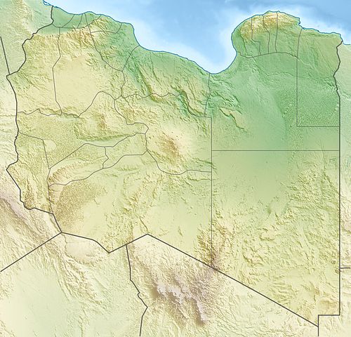
Deutsch: Physische Positionskarte von
Libyen
Quadratische Plattkarte, N-S-Streckung 110 %. Geographische Begrenzung der Karte:
Equirectangular projection, N/S stretching 110 %. Geographic limits of the map:
|
| Date | |
| Source | Own work, using map data from administrative map by NordNordWest. The relief was created from SRTM-30 relief data |
| Author | Carport |
| Permission ( Reusing this file) |
This file is licensed under the
Creative Commons
Attribution-Share Alike 3.0 Unported license.
|
| Other versions |
|

. قرامطة زوامل
File history
Click on a date/time to view the file as it appeared at that time.
| Date/Time | Thumbnail | Dimensions | User | Comment | |
|---|---|---|---|---|---|
| current | 17:28, 9 May 2011 |
| 1,617 × 1,551 (1.13 MB) | Carport | right file... |
| 17:25, 9 May 2011 |
 | 1,617 × 1,551 (1.13 MB) | Carport | update | |
| 16:33, 11 March 2010 |
 | 1,617 × 1,551 (1.22 MB) | Carport | {{Information |Description={{de|Physische Positionskarte von {{w|Libyen|3=de}}}} Quadratische Plattkarte, N-S-Streckung 110 %. Geographische Begrenzung der Karte: * N: 33.4° N * S: 19.1° N * W: 9.1° O * O: 25.5° O {{en|Physical location map of {{w|Lib |
File usage
- 1963 Marj earthquake
- 2019 Tajoura migrant center airstrike
- 23rd July Lake
- Acacus Mountains
- Acacus Sandstone
- Apollonia (Cyrenaica)
- Battle of Bir Hakeim
- Battle of Ras Lanuf
- Beda Fomm
- Benghazi
- Bikku Bitti
- Cyrene, Libya
- El-Kouf National Park
- El Sharara oil field
- Fatimid invasion of Egypt (914–915)
- Fezzan valleys
- Gabal El Uweinat
- Germa Museum
- Gharyan volcanic field
- Gulf of Sidra
- Haruj
- Haua Fteah
- Idehan Ubari
- Jabal Arkanu
- Leptis Magna
- Mausoleum of Gasr Doga
- Mizdah Formation
- Nafusa Mountains
- Necropolis of Cyrene
- Operation Sonnenblume
- Port of Benghazi
- Ras Ajdir
- Rebiana, Libya
- Rebiana Sand Sea
- SS Shuntien (1934)
- SS Yoma
- Slavery in Libya
- Takarkori
- Tarab Formation
- Tripoli, Libya
- Wadi Ghan Dam
- Wadi Kaam Dam
- Wadi Lebda Dam
- Wadi Mejenin Dam
- Wadi Qattara Dam
- Wadi Wishka Dam
- Waw an Namus
- Zelten oil field
- User:Gruzinim/sandbox/Giado concentration camp
- User:Kōkogaku-sha/Takarkori
- User:Noclador/sandbox/Piazza Marittima di Messina
- User:Ty654/List of earthquakes from 1930-1939 exceeding magnitude 6+
- Module:Location map/data/Libya
- Module:Location map/data/Libya/doc
Global file usage
The following other wikis use this file:
- Usage on ar.wikipedia.org
- Usage on arz.wikipedia.org
- Usage on ast.wikipedia.org
- Usage on az.wikipedia.org
- Usage on ba.wikipedia.org
- Usage on be.wikipedia.org
- Usage on bg.wikipedia.org
- Триполи
- Бенгази
- Сирт
- Сирт (залив)
- Таджура
- Тобрук
- Ал Азизия
- Дарна
- Бардия
- Ел Агейла
- Мурзук
- Шаблон:ПК Либия
- Лептис Магна
- Кирена
- Гадамес
- Ал Байда
- Адждабия
- Адири
- Налут
- Аубари
- Уау ан Намус
- Марса Брега
- Рас Лануф
- Бин Джауад
- Мисрата
- Зауия
- Хумс
- Сидер
- Сабха
- Бани Уалид
- Зинтан
- Дарияна (Либия)
- Тадрарт Акакус
- Газала
- Киренайка (плато)
View more global usage of this file.
Metadata
Original file (1,617 × 1,551 pixels, file size: 1.13 MB, MIME type: image/jpeg)
| This is a file from the
Wikimedia Commons. Information from its
description page there is shown below. Commons is a freely licensed media file repository. You can help. |
| Description |
Deutsch: Physische Positionskarte von
Libyen
Quadratische Plattkarte, N-S-Streckung 110 %. Geographische Begrenzung der Karte:
Equirectangular projection, N/S stretching 110 %. Geographic limits of the map:
|
| Date | |
| Source | Own work, using map data from administrative map by NordNordWest. The relief was created from SRTM-30 relief data |
| Author | Carport |
| Permission ( Reusing this file) |
This file is licensed under the
Creative Commons
Attribution-Share Alike 3.0 Unported license.
|
| Other versions |
|
. قرامطة زوامل
File history
Click on a date/time to view the file as it appeared at that time.
| Date/Time | Thumbnail | Dimensions | User | Comment | |
|---|---|---|---|---|---|
| current | 17:28, 9 May 2011 |
| 1,617 × 1,551 (1.13 MB) | Carport | right file... |
| 17:25, 9 May 2011 |
| 1,617 × 1,551 (1.13 MB) | Carport | update | |
| 16:33, 11 March 2010 |
| 1,617 × 1,551 (1.22 MB) | Carport | {{Information |Description={{de|Physische Positionskarte von {{w|Libyen|3=de}}}} Quadratische Plattkarte, N-S-Streckung 110 %. Geographische Begrenzung der Karte: * N: 33.4° N * S: 19.1° N * W: 9.1° O * O: 25.5° O {{en|Physical location map of {{w|Lib |
File usage
- 1963 Marj earthquake
- 2019 Tajoura migrant center airstrike
- 23rd July Lake
- Acacus Mountains
- Acacus Sandstone
- Apollonia (Cyrenaica)
- Battle of Bir Hakeim
- Battle of Ras Lanuf
- Beda Fomm
- Benghazi
- Bikku Bitti
- Cyrene, Libya
- El-Kouf National Park
- El Sharara oil field
- Fatimid invasion of Egypt (914–915)
- Fezzan valleys
- Gabal El Uweinat
- Germa Museum
- Gharyan volcanic field
- Gulf of Sidra
- Haruj
- Haua Fteah
- Idehan Ubari
- Jabal Arkanu
- Leptis Magna
- Mausoleum of Gasr Doga
- Mizdah Formation
- Nafusa Mountains
- Necropolis of Cyrene
- Operation Sonnenblume
- Port of Benghazi
- Ras Ajdir
- Rebiana, Libya
- Rebiana Sand Sea
- SS Shuntien (1934)
- SS Yoma
- Slavery in Libya
- Takarkori
- Tarab Formation
- Tripoli, Libya
- Wadi Ghan Dam
- Wadi Kaam Dam
- Wadi Lebda Dam
- Wadi Mejenin Dam
- Wadi Qattara Dam
- Wadi Wishka Dam
- Waw an Namus
- Zelten oil field
- User:Gruzinim/sandbox/Giado concentration camp
- User:Kōkogaku-sha/Takarkori
- User:Noclador/sandbox/Piazza Marittima di Messina
- User:Ty654/List of earthquakes from 1930-1939 exceeding magnitude 6+
- Module:Location map/data/Libya
- Module:Location map/data/Libya/doc
Global file usage
The following other wikis use this file:
- Usage on ar.wikipedia.org
- Usage on arz.wikipedia.org
- Usage on ast.wikipedia.org
- Usage on az.wikipedia.org
- Usage on ba.wikipedia.org
- Usage on be.wikipedia.org
- Usage on bg.wikipedia.org
- Триполи
- Бенгази
- Сирт
- Сирт (залив)
- Таджура
- Тобрук
- Ал Азизия
- Дарна
- Бардия
- Ел Агейла
- Мурзук
- Шаблон:ПК Либия
- Лептис Магна
- Кирена
- Гадамес
- Ал Байда
- Адждабия
- Адири
- Налут
- Аубари
- Уау ан Намус
- Марса Брега
- Рас Лануф
- Бин Джауад
- Мисрата
- Зауия
- Хумс
- Сидер
- Сабха
- Бани Уалид
- Зинтан
- Дарияна (Либия)
- Тадрарт Акакус
- Газала
- Киренайка (плато)
View more global usage of this file.