Photos • Location


Size of this preview:
796 × 600 pixels. Other resolutions:
319 × 240 pixels |
637 × 480 pixels |
1,019 × 768 pixels |
1,280 × 965 pixels |
1,600 × 1,206 pixels.
Original file (1,600 × 1,206 pixels, file size: 188 KB, MIME type: image/jpeg)
| This is a file from the
Wikimedia Commons. Information from its
description page there is shown below. Commons is a freely licensed media file repository. You can help. |
Summary
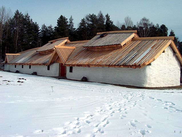
| Description | Langhuset på Veien (Veien Kulturminnepark) |
| Date | |
| Source | Own work |
| Author | T. Bjornstad 07:37, 2 April 2007 (UTC) |
| Permission ( Reusing this file) |
Public Domain |
| Object location |
| View this and other nearby images on: OpenStreetMap |
|
|---|
Licensing
| I, the copyright holder of this work, release this work into the
public domain. This applies worldwide. In some countries this may not be legally possible; if so: I grant anyone the right to use this work for any purpose, without any conditions, unless such conditions are required by law. |
File history
Click on a date/time to view the file as it appeared at that time.
| Date/Time | Thumbnail | Dimensions | User | Comment | |
|---|---|---|---|---|---|
| current | 07:37, 2 April 2007 |
| 1,600 × 1,206 (188 KB) | ToB | {{Information |Description=Langhuset på Veien (Veien Kulturminnepark) |Source=Own work |Date=March 2005 |Author=~~~~ |Permission=Public Domain |other_versions=None }} Category:Veien Kulturminnepark |
File usage
The following pages on the English Wikipedia use this file (pages on other projects are not listed):
Global file usage
The following other wikis use this file:
- Usage on fr.wikipedia.org
- Usage on nl.wikipedia.org
- Usage on no.wikipedia.org
Metadata
Size of this preview:
796 × 600 pixels. Other resolutions:
319 × 240 pixels |
637 × 480 pixels |
1,019 × 768 pixels |
1,280 × 965 pixels |
1,600 × 1,206 pixels.
Original file (1,600 × 1,206 pixels, file size: 188 KB, MIME type: image/jpeg)
| This is a file from the
Wikimedia Commons. Information from its
description page there is shown below. Commons is a freely licensed media file repository. You can help. |
Summary
| Description | Langhuset på Veien (Veien Kulturminnepark) |
| Date | |
| Source | Own work |
| Author | T. Bjornstad 07:37, 2 April 2007 (UTC) |
| Permission ( Reusing this file) |
Public Domain |
| Object location |
| View this and other nearby images on: OpenStreetMap |
|
|---|
Licensing
| I, the copyright holder of this work, release this work into the
public domain. This applies worldwide. In some countries this may not be legally possible; if so: I grant anyone the right to use this work for any purpose, without any conditions, unless such conditions are required by law. |
File history
Click on a date/time to view the file as it appeared at that time.
| Date/Time | Thumbnail | Dimensions | User | Comment | |
|---|---|---|---|---|---|
| current | 07:37, 2 April 2007 |
| 1,600 × 1,206 (188 KB) | ToB | {{Information |Description=Langhuset på Veien (Veien Kulturminnepark) |Source=Own work |Date=March 2005 |Author=~~~~ |Permission=Public Domain |other_versions=None }} Category:Veien Kulturminnepark |
File usage
The following pages on the English Wikipedia use this file (pages on other projects are not listed):
Global file usage
The following other wikis use this file:
- Usage on fr.wikipedia.org
- Usage on nl.wikipedia.org
- Usage on no.wikipedia.org