
Original file (SVG file, nominally 1,116 × 1,305 pixels, file size: 2.3 MB)
| This is a file from the
Wikimedia Commons. Information from its
description page there is shown below. Commons is a freely licensed media file repository. You can help. |
| Description |
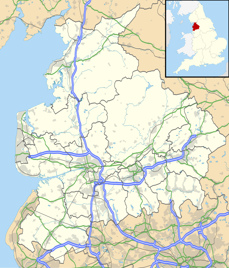
Map of Lancashire, UK with the following information shown:
Equirectangular map projection on WGS 84 datum, with N/S stretched 165% Geographic limits:
|
| Date | |
| Source |
|
| Author | Nilfanion, created using Ordnance Survey data |
| Permission ( Reusing this file) |
This file is licensed under the
Creative Commons
Attribution-Share Alike 3.0 Unported license. Attribution: Contains Ordnance Survey data © Crown copyright and database right
|
| Other versions | File:Lancashire UK district map (blank).svg - Blank map |
.svg)
File history
Click on a date/time to view the file as it appeared at that time.
| Date/Time | Thumbnail | Dimensions | User | Comment | |
|---|---|---|---|---|---|
| current | 18:59, 26 September 2010 |
| 1,116 × 1,305 (2.3 MB) | Nilfanion | {{Information |Description=Map of Lancashire, UK with the following information shown: *Administrative borders *Coastline, lakes and rivers *Roads and railways *Urban areas Equirectangular map projection on WGS 84 datum, with N/S stretch |
File usage
More than 100 pages use this file. The following list shows the first 100 pages that use this file only. A full list is available.
- Abbey Village
- Abbeystead
- Accrington
- Acre, Lancashire
- Adlington, Lancashire
- Anglezarke
- Astley Hall, Chorley
- Bacup
- Barnoldswick
- Barrow Nook
- Bay Horse
- Blackburn
- Blackpool
- Blackpool Airport
- Bleasdale
- Bolton-le-Sands
- Brierfield, Lancashire
- Brownhill
- Burnley
- Burscough
- Carnforth
- Carnforth railway station
- Catforth
- Centre points of the United Kingdom
- Charnock Richard MSA
- Chorley
- Clayton-le-Moors
- Clayton-le-Woods
- Cleveleys
- Clitheroe
- Cockerham
- Colne
- Coppull
- Darwen
- Downholland Cross
- Dunnockshaw
- Eccleston, Lancashire
- Edenfield
- Euxton
- Euxton Balshaw Lane railway station
- Farington
- Fleetwood
- Freckleton
- Galgate
- Goosnargh
- Great Altcar
- Great Harwood
- Grimsargh
- Halton-with-Aughton
- Haskayne
- Haslingden
- Heysham
- Heysham Port railway station
- Higham, Lancashire
- Kirkham, Lancashire
- Knott End-on-Sea
- Lancashire Infantry Museum
- Lancaster, Lancashire
- Lancaster (Forton) Services
- Lancaster railway station
- Langho
- Lathom
- List of places in Lancashire
- Longridge
- Longton, Lancashire
- Lostock Hall
- Lytham St Annes
- Melling-with-Wrayton
- Morecambe railway station
- Nelson, Lancashire
- Newton-in-Bowland
- Oakenshaw, Lancashire
- Ormskirk
- Oswaldtwistle
- Padiham
- Parbold
- Poulton-le-Fylde
- Preston, Lancashire
- Preston railway station
- Rawtenstall
- Read, Lancashire
- Reedley Hallows
- Ribchester
- River Wyre
- Salwick
- Scarisbrick
- Silverdale, Lancashire
- Silverdale railway station
- Stonyhurst
- Stubbins
- Tarleton
- Thornton, Lancashire
- Thornton-Cleveleys
- Trawden
- Turf Moor
- Up Holland
- Walton-le-Dale
- Warton, Fylde
- Whalley, Lancashire
- Witton Country Park
View more links to this file.
Global file usage
The following other wikis use this file:
- Usage on ar.wikipedia.org
- Usage on bg.wikipedia.org
- Usage on ceb.wikipedia.org
- Usage on es.wikipedia.org
- Preston
- Lancaster (Lancashire)
- Blackpool
- Blackburn
- Burnley
- Aeropuerto Internacional de Blackpool
- Plantilla:Mapa de localización de Lancashire
- Oswaldtwistle
- Great Harwood
- Clayton-le-Moors
- Church (Lancashire)
- Accrington
- Darwen
- Poulton-le-Fylde
- Banks (Lancashire)
- Altham
- Catedral de San Pedro (Lancaster)
- Chorley
- Catedral de Santa Alfonsa (Preston)
- Carnforth
- Great Eccleston
- Bacup
- Chipping
- Bamber Bridge
- Cleveleys
- Adlington
- Clifton (Lancashire)
- Barnoldswick
- Goosnargh
- Barrowford
- Nelson (Lancashire)
- Great Knowley
- Morecambe
- Newburgh (Lancashire)
- Nether Kellet
- New Longton
- Newton-with-Scales
- Old Langho
- Hapton
- Croston
- Cliviger
- Clitheroe
- Colne
- Earby
- Coppull
- Eccleston
- Barrow (Lancashire)
View more global usage of this file.
Metadata
Original file (SVG file, nominally 1,116 × 1,305 pixels, file size: 2.3 MB)
| This is a file from the
Wikimedia Commons. Information from its
description page there is shown below. Commons is a freely licensed media file repository. You can help. |
| Description |
Map of Lancashire, UK with the following information shown:
Equirectangular map projection on WGS 84 datum, with N/S stretched 165% Geographic limits:
|
| Date | |
| Source |
|
| Author | Nilfanion, created using Ordnance Survey data |
| Permission ( Reusing this file) |
This file is licensed under the
Creative Commons
Attribution-Share Alike 3.0 Unported license. Attribution: Contains Ordnance Survey data © Crown copyright and database right
|
| Other versions | File:Lancashire UK district map (blank).svg - Blank map |
File history
Click on a date/time to view the file as it appeared at that time.
| Date/Time | Thumbnail | Dimensions | User | Comment | |
|---|---|---|---|---|---|
| current | 18:59, 26 September 2010 |
| 1,116 × 1,305 (2.3 MB) | Nilfanion | {{Information |Description=Map of Lancashire, UK with the following information shown: *Administrative borders *Coastline, lakes and rivers *Roads and railways *Urban areas Equirectangular map projection on WGS 84 datum, with N/S stretch |
File usage
More than 100 pages use this file. The following list shows the first 100 pages that use this file only. A full list is available.
- Abbey Village
- Abbeystead
- Accrington
- Acre, Lancashire
- Adlington, Lancashire
- Anglezarke
- Astley Hall, Chorley
- Bacup
- Barnoldswick
- Barrow Nook
- Bay Horse
- Blackburn
- Blackpool
- Blackpool Airport
- Bleasdale
- Bolton-le-Sands
- Brierfield, Lancashire
- Brownhill
- Burnley
- Burscough
- Carnforth
- Carnforth railway station
- Catforth
- Centre points of the United Kingdom
- Charnock Richard MSA
- Chorley
- Clayton-le-Moors
- Clayton-le-Woods
- Cleveleys
- Clitheroe
- Cockerham
- Colne
- Coppull
- Darwen
- Downholland Cross
- Dunnockshaw
- Eccleston, Lancashire
- Edenfield
- Euxton
- Euxton Balshaw Lane railway station
- Farington
- Fleetwood
- Freckleton
- Galgate
- Goosnargh
- Great Altcar
- Great Harwood
- Grimsargh
- Halton-with-Aughton
- Haskayne
- Haslingden
- Heysham
- Heysham Port railway station
- Higham, Lancashire
- Kirkham, Lancashire
- Knott End-on-Sea
- Lancashire Infantry Museum
- Lancaster, Lancashire
- Lancaster (Forton) Services
- Lancaster railway station
- Langho
- Lathom
- List of places in Lancashire
- Longridge
- Longton, Lancashire
- Lostock Hall
- Lytham St Annes
- Melling-with-Wrayton
- Morecambe railway station
- Nelson, Lancashire
- Newton-in-Bowland
- Oakenshaw, Lancashire
- Ormskirk
- Oswaldtwistle
- Padiham
- Parbold
- Poulton-le-Fylde
- Preston, Lancashire
- Preston railway station
- Rawtenstall
- Read, Lancashire
- Reedley Hallows
- Ribchester
- River Wyre
- Salwick
- Scarisbrick
- Silverdale, Lancashire
- Silverdale railway station
- Stonyhurst
- Stubbins
- Tarleton
- Thornton, Lancashire
- Thornton-Cleveleys
- Trawden
- Turf Moor
- Up Holland
- Walton-le-Dale
- Warton, Fylde
- Whalley, Lancashire
- Witton Country Park
View more links to this file.
Global file usage
The following other wikis use this file:
- Usage on ar.wikipedia.org
- Usage on bg.wikipedia.org
- Usage on ceb.wikipedia.org
- Usage on es.wikipedia.org
- Preston
- Lancaster (Lancashire)
- Blackpool
- Blackburn
- Burnley
- Aeropuerto Internacional de Blackpool
- Plantilla:Mapa de localización de Lancashire
- Oswaldtwistle
- Great Harwood
- Clayton-le-Moors
- Church (Lancashire)
- Accrington
- Darwen
- Poulton-le-Fylde
- Banks (Lancashire)
- Altham
- Catedral de San Pedro (Lancaster)
- Chorley
- Catedral de Santa Alfonsa (Preston)
- Carnforth
- Great Eccleston
- Bacup
- Chipping
- Bamber Bridge
- Cleveleys
- Adlington
- Clifton (Lancashire)
- Barnoldswick
- Goosnargh
- Barrowford
- Nelson (Lancashire)
- Great Knowley
- Morecambe
- Newburgh (Lancashire)
- Nether Kellet
- New Longton
- Newton-with-Scales
- Old Langho
- Hapton
- Croston
- Cliviger
- Clitheroe
- Colne
- Earby
- Coppull
- Eccleston
- Barrow (Lancashire)
View more global usage of this file.