Photos • Location


Size of this preview:
798 × 149 pixels. Other resolutions:
320 × 60 pixels |
2,280 × 426 pixels.
Original file (2,280 × 426 pixels, file size: 98 KB, MIME type: image/jpeg)
| This is a file from the
Wikimedia Commons. Information from its
description page there is shown below. Commons is a freely licensed media file repository. You can help. |
Summary
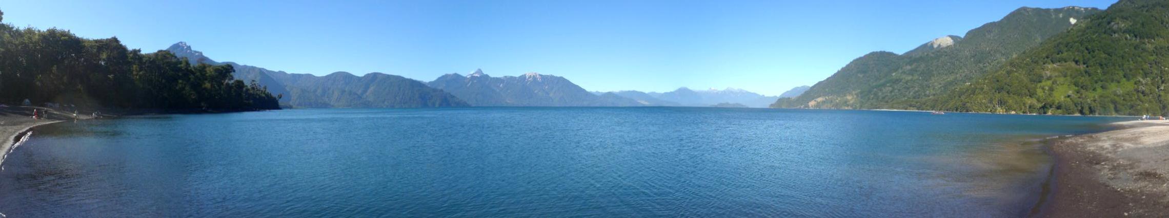
| Description | El lago Todos los Santos, ubicado en la Región de los Lagos, Chile, visto desde el camping que está cerca del camino que lleva a Ensenada. |
| Date | Martes 19 de febrero del 2008 |
| Source | Own work |
| Author | Jorge Morales Piderit |
| Permission ( Reusing this file) |
Dominio público |
| Camera location |
| View this and other nearby images on: OpenStreetMap |
|
|---|
Licensing
| I, the copyright holder of this work, release this work into the
public domain. This applies worldwide. In some countries this may not be legally possible; if so: I grant anyone the right to use this work for any purpose, without any conditions, unless such conditions are required by law. |
File history
Click on a date/time to view the file as it appeared at that time.
| Date/Time | Thumbnail | Dimensions | User | Comment | |
|---|---|---|---|---|---|
| current | 21:49, 11 March 2008 |
| 2,280 × 426 (98 KB) | Jorge | {{Information |Description=El lago Todos los Santos, ubicado en la Región de los Lagos, Chile, visto desde el camping que está cerca del camino que lleva a Ensenada. |Source=self-made |Date=Martes 19 de febrero del 2008 |Author= Jorge Morales Piderit [[ |
File usage
The following pages on the English Wikipedia use this file (pages on other projects are not listed):
Global file usage
The following other wikis use this file:
- Usage on de.wikipedia.org
- Usage on he.wikipedia.org
- Usage on hy.wikipedia.org
- Usage on lt.wikipedia.org
- Usage on pl.wikipedia.org
- Usage on ru.wikipedia.org
- Usage on uk.wikipedia.org
Size of this preview:
798 × 149 pixels. Other resolutions:
320 × 60 pixels |
2,280 × 426 pixels.
Original file (2,280 × 426 pixels, file size: 98 KB, MIME type: image/jpeg)
| This is a file from the
Wikimedia Commons. Information from its
description page there is shown below. Commons is a freely licensed media file repository. You can help. |
Summary
| Description | El lago Todos los Santos, ubicado en la Región de los Lagos, Chile, visto desde el camping que está cerca del camino que lleva a Ensenada. |
| Date | Martes 19 de febrero del 2008 |
| Source | Own work |
| Author | Jorge Morales Piderit |
| Permission ( Reusing this file) |
Dominio público |
| Camera location |
| View this and other nearby images on: OpenStreetMap |
|
|---|
Licensing
| I, the copyright holder of this work, release this work into the
public domain. This applies worldwide. In some countries this may not be legally possible; if so: I grant anyone the right to use this work for any purpose, without any conditions, unless such conditions are required by law. |
File history
Click on a date/time to view the file as it appeared at that time.
| Date/Time | Thumbnail | Dimensions | User | Comment | |
|---|---|---|---|---|---|
| current | 21:49, 11 March 2008 |
| 2,280 × 426 (98 KB) | Jorge | {{Information |Description=El lago Todos los Santos, ubicado en la Región de los Lagos, Chile, visto desde el camping que está cerca del camino que lleva a Ensenada. |Source=self-made |Date=Martes 19 de febrero del 2008 |Author= Jorge Morales Piderit [[ |
File usage
The following pages on the English Wikipedia use this file (pages on other projects are not listed):
Global file usage
The following other wikis use this file:
- Usage on de.wikipedia.org
- Usage on he.wikipedia.org
- Usage on hy.wikipedia.org
- Usage on lt.wikipedia.org
- Usage on pl.wikipedia.org
- Usage on ru.wikipedia.org
- Usage on uk.wikipedia.org