Original file (1,266 × 1,048 pixels, file size: 676 KB, MIME type: image/jpeg)
| This is a file from the
Wikimedia Commons. Information from its
description page there is shown below. Commons is a freely licensed media file repository. You can help. |
Summary
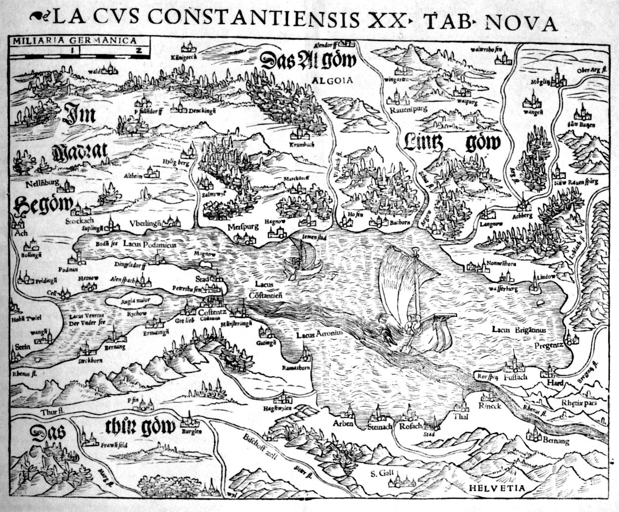
| Description | Lacus Constantiensis XX TAB NOVA |
| Date | |
| Source |
Geographia Universalis, Vetus Et Nova, Complectens Claudii Ptolemaei Alexandrini Enarrationis Libros VIII Basileae//Basel//gedruckt von Henricus Petri |
| Author | Unknown author |
| Other versions | http://reader.digitale-sammlungen.de/de/fs1/object/display/bsb10812204_00386.html |
Licensing
|
This work is in the public domain in its country of origin and other countries and areas where the copyright term is the author's life plus 70 years or fewer. This work is in the public domain in the United States because it was published (or registered with the U.S. Copyright Office) before January 1, 1929. | |
| This file has been identified as being free of known restrictions under copyright law, including all related and neighboring rights. | |
File history
Click on a date/time to view the file as it appeared at that time.
| Date/Time | Thumbnail | Dimensions | User | Comment | |
|---|---|---|---|---|---|
| current | 10:55, 6 April 2006 |
| 1,266 × 1,048 (676 KB) | Fb78 | {{en|Map of Lake Constance and its surroundings, by Johannes Zwick and Thomas Blarer. Printed in Ptolemaios Geographia Universalis, ed. by Sebastian Münster, Basel 1540}} Category:16th century maps Category:Historical maps of Europe [[Category:B |
File usage
Global file usage
The following other wikis use this file:
- Usage on de.wikipedia.org
- Usage on de.wikisource.org
- Usage on fr.wikipedia.org
- Usage on pl.wikipedia.org
- Usage on sl.wikipedia.org
Metadata
Original file (1,266 × 1,048 pixels, file size: 676 KB, MIME type: image/jpeg)
| This is a file from the
Wikimedia Commons. Information from its
description page there is shown below. Commons is a freely licensed media file repository. You can help. |
Summary
| Description | Lacus Constantiensis XX TAB NOVA |
| Date | |
| Source |
Geographia Universalis, Vetus Et Nova, Complectens Claudii Ptolemaei Alexandrini Enarrationis Libros VIII Basileae//Basel//gedruckt von Henricus Petri |
| Author | Unknown author |
| Other versions | http://reader.digitale-sammlungen.de/de/fs1/object/display/bsb10812204_00386.html |
Licensing
|
This work is in the public domain in its country of origin and other countries and areas where the copyright term is the author's life plus 70 years or fewer. This work is in the public domain in the United States because it was published (or registered with the U.S. Copyright Office) before January 1, 1929. | |
| This file has been identified as being free of known restrictions under copyright law, including all related and neighboring rights. | |
File history
Click on a date/time to view the file as it appeared at that time.
| Date/Time | Thumbnail | Dimensions | User | Comment | |
|---|---|---|---|---|---|
| current | 10:55, 6 April 2006 |
| 1,266 × 1,048 (676 KB) | Fb78 | {{en|Map of Lake Constance and its surroundings, by Johannes Zwick and Thomas Blarer. Printed in Ptolemaios Geographia Universalis, ed. by Sebastian Münster, Basel 1540}} Category:16th century maps Category:Historical maps of Europe [[Category:B |
File usage
Global file usage
The following other wikis use this file:
- Usage on de.wikipedia.org
- Usage on de.wikisource.org
- Usage on fr.wikipedia.org
- Usage on pl.wikipedia.org
- Usage on sl.wikipedia.org