Photos • Location


Size of this preview:
800 × 600 pixels. Other resolutions:
320 × 240 pixels |
640 × 480 pixels |
1,024 × 768 pixels |
1,280 × 960 pixels |
2,592 × 1,944 pixels.
Original file (2,592 × 1,944 pixels, file size: 1.09 MB, MIME type: image/jpeg)
| This is a file from the
Wikimedia Commons. Information from its
description page there is shown below. Commons is a freely licensed media file repository. You can help. |
Summary
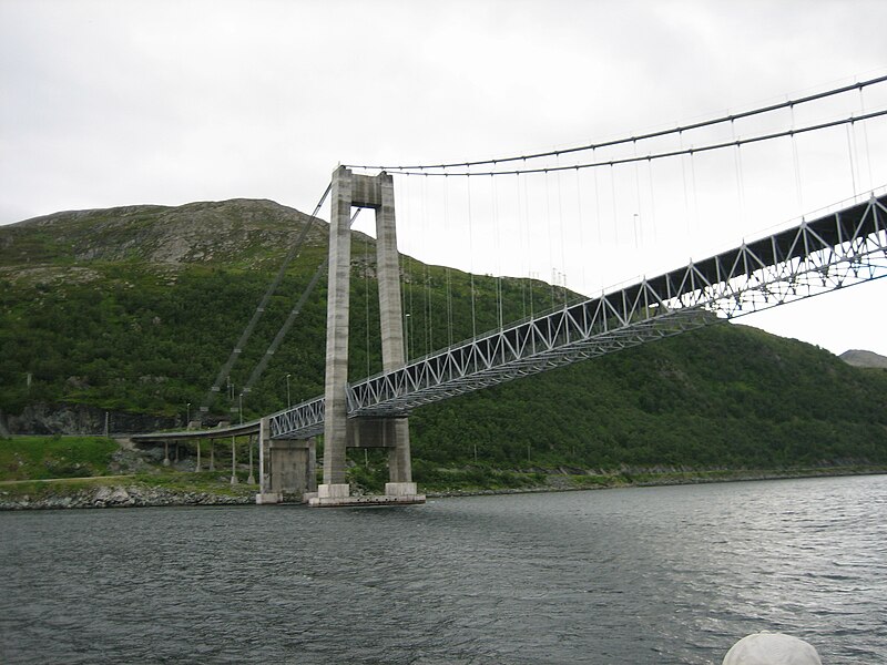
| Description | Kvalsund Bridge, taken from a boat in July 2006. Manxruler 14:37, 17 April 2007 (UTC) |
| Date | |
| Source | Originally from English Wikipedia, description page was here |
| Author | Manxruler |
| Camera location |
| View this and other nearby images on: OpenStreetMap |
|
|---|
Licensing
| I, the copyright holder of this work, release this work into the
public domain. This applies worldwide. In some countries this may not be legally possible; if so: I grant anyone the right to use this work for any purpose, without any conditions, unless such conditions are required by law. |
File history
Click on a date/time to view the file as it appeared at that time.
| Date/Time | Thumbnail | Dimensions | User | Comment | |
|---|---|---|---|---|---|
| current | 11:28, 7 July 2007 |
| 2,592 × 1,944 (1.09 MB) | Junafani | {{Information |Description=Kvalsund Bridge, taken from a boat in July 2006. Manxruler 14:37, 17 April 2007 (UTC) |Source=Originally from English Wikipedia, description page was here |Date=17 April, 2007 | |
File usage
The following pages on the English Wikipedia use this file (pages on other projects are not listed):
Global file usage
The following other wikis use this file:
- Usage on cs.wikipedia.org
- Usage on da.wikipedia.org
- Usage on et.wikipedia.org
- Usage on fi.wikipedia.org
- Usage on fr.wikipedia.org
- Usage on hy.wikipedia.org
- Usage on ja.wikipedia.org
- Usage on la.wikipedia.org
- Usage on www.mediawiki.org
- Usage on nn.wikipedia.org
- Usage on no.wikimedia.org
- Prosjekt:Undervisningspilot Samisk kunnskap på nett/Oppgave 1
- Prosjekt:Undervisningspilot Samisk kunnskap på nett/Oppgave 1/Steder i Troms og Finnmark
- Prosjekt:Samisk kunnskap på nett/Undervisning/For studenter/Oppgave 1/Steder i Troms og Finnmark
- Prosjekt:Undervisningspilot Samisk kunnskap på nett/Oppgave 1/nb
- Prosjekt:Undervisningspilot Samisk kunnskap på nett/Oppgave 1/se
- Usage on ru.wikipedia.org
- Usage on sv.wikipedia.org
Metadata
Size of this preview:
800 × 600 pixels. Other resolutions:
320 × 240 pixels |
640 × 480 pixels |
1,024 × 768 pixels |
1,280 × 960 pixels |
2,592 × 1,944 pixels.
Original file (2,592 × 1,944 pixels, file size: 1.09 MB, MIME type: image/jpeg)
| This is a file from the
Wikimedia Commons. Information from its
description page there is shown below. Commons is a freely licensed media file repository. You can help. |
Summary
| Description | Kvalsund Bridge, taken from a boat in July 2006. Manxruler 14:37, 17 April 2007 (UTC) |
| Date | |
| Source | Originally from English Wikipedia, description page was here |
| Author | Manxruler |
| Camera location |
| View this and other nearby images on: OpenStreetMap |
|
|---|
Licensing
| I, the copyright holder of this work, release this work into the
public domain. This applies worldwide. In some countries this may not be legally possible; if so: I grant anyone the right to use this work for any purpose, without any conditions, unless such conditions are required by law. |
File history
Click on a date/time to view the file as it appeared at that time.
| Date/Time | Thumbnail | Dimensions | User | Comment | |
|---|---|---|---|---|---|
| current | 11:28, 7 July 2007 |
| 2,592 × 1,944 (1.09 MB) | Junafani | {{Information |Description=Kvalsund Bridge, taken from a boat in July 2006. Manxruler 14:37, 17 April 2007 (UTC) |Source=Originally from English Wikipedia, description page was here |Date=17 April, 2007 | |
File usage
The following pages on the English Wikipedia use this file (pages on other projects are not listed):
Global file usage
The following other wikis use this file:
- Usage on cs.wikipedia.org
- Usage on da.wikipedia.org
- Usage on et.wikipedia.org
- Usage on fi.wikipedia.org
- Usage on fr.wikipedia.org
- Usage on hy.wikipedia.org
- Usage on ja.wikipedia.org
- Usage on la.wikipedia.org
- Usage on www.mediawiki.org
- Usage on nn.wikipedia.org
- Usage on no.wikimedia.org
- Prosjekt:Undervisningspilot Samisk kunnskap på nett/Oppgave 1
- Prosjekt:Undervisningspilot Samisk kunnskap på nett/Oppgave 1/Steder i Troms og Finnmark
- Prosjekt:Samisk kunnskap på nett/Undervisning/For studenter/Oppgave 1/Steder i Troms og Finnmark
- Prosjekt:Undervisningspilot Samisk kunnskap på nett/Oppgave 1/nb
- Prosjekt:Undervisningspilot Samisk kunnskap på nett/Oppgave 1/se
- Usage on ru.wikipedia.org
- Usage on sv.wikipedia.org