Photos • Location


Size of this preview:
450 × 600 pixels. Other resolutions:
180 × 240 pixels |
576 × 768 pixels.
Original file (576 × 768 pixels, file size: 96 KB, MIME type: image/jpeg)
| This is a file from the
Wikimedia Commons. Information from its
description page there is shown below. Commons is a freely licensed media file repository. You can help. |
| Description |
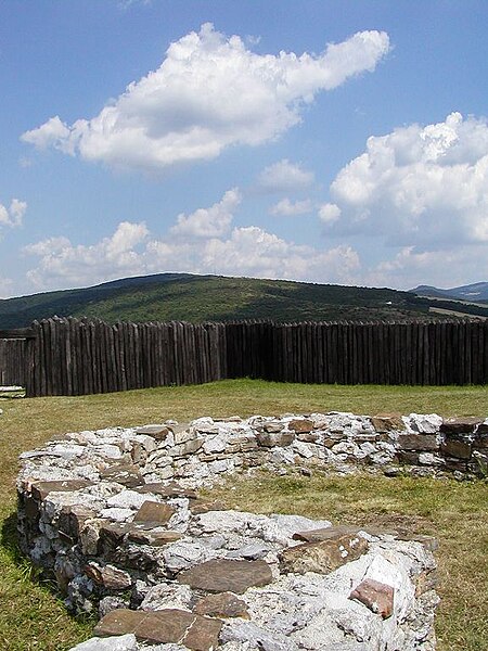
Slovenčina: Kostolec, veľkomoravské hradisko, Ducové. |
|||
| Date | ||||
| Source | Own work | |||
| Author | Martin Hlauka (Pescan) 21:04, 12 Jun 2005 (UTC) | |||
| Permission ( Reusing this file) |
|

| Camera location |
| View this and other nearby images on: OpenStreetMap |
|
|---|
File history
Click on a date/time to view the file as it appeared at that time.
| Date/Time | Thumbnail | Dimensions | User | Comment | |
|---|---|---|---|---|---|
| current | 12:39, 17 June 2007 |
| 576 × 768 (96 KB) | Pescan | |
| 21:03, 12 June 2005 |
 | 300 × 400 (27 KB) | Pescan | Kostolec, veľkomoravské hradisko, Ducové. |
File usage
The following pages on the English Wikipedia use this file (pages on other projects are not listed):
Global file usage
The following other wikis use this file:
- Usage on azb.wikipedia.org
- Usage on cs.wikipedia.org
- Usage on de.wikipedia.org
- Usage on eo.wikipedia.org
- Usage on es.wikipedia.org
- Usage on fa.wikipedia.org
- Usage on fr.wikipedia.org
- Usage on hu.wikipedia.org
- Usage on id.wikipedia.org
- Usage on it.wikipedia.org
- Usage on ja.wikipedia.org
- Usage on ko.wikipedia.org
- Usage on nl.wikipedia.org
- Usage on no.wikipedia.org
- Usage on pl.wikipedia.org
- Usage on ru.wikipedia.org
- Usage on sk.wikipedia.org
- Usage on sl.wikipedia.org
- Usage on uk.wikipedia.org
- Usage on vi.wikipedia.org
- Usage on www.wikidata.org
- Usage on zh-min-nan.wikipedia.org
Size of this preview:
450 × 600 pixels. Other resolutions:
180 × 240 pixels |
576 × 768 pixels.
Original file (576 × 768 pixels, file size: 96 KB, MIME type: image/jpeg)
| This is a file from the
Wikimedia Commons. Information from its
description page there is shown below. Commons is a freely licensed media file repository. You can help. |
| Description |
Slovenčina: Kostolec, veľkomoravské hradisko, Ducové. |
|||
| Date | ||||
| Source | Own work | |||
| Author | Martin Hlauka (Pescan) 21:04, 12 Jun 2005 (UTC) | |||
| Permission ( Reusing this file) |
|
| Camera location |
| View this and other nearby images on: OpenStreetMap |
|
|---|
File history
Click on a date/time to view the file as it appeared at that time.
| Date/Time | Thumbnail | Dimensions | User | Comment | |
|---|---|---|---|---|---|
| current | 12:39, 17 June 2007 |
| 576 × 768 (96 KB) | Pescan | |
| 21:03, 12 June 2005 |
| 300 × 400 (27 KB) | Pescan | Kostolec, veľkomoravské hradisko, Ducové. |
File usage
The following pages on the English Wikipedia use this file (pages on other projects are not listed):
Global file usage
The following other wikis use this file:
- Usage on azb.wikipedia.org
- Usage on cs.wikipedia.org
- Usage on de.wikipedia.org
- Usage on eo.wikipedia.org
- Usage on es.wikipedia.org
- Usage on fa.wikipedia.org
- Usage on fr.wikipedia.org
- Usage on hu.wikipedia.org
- Usage on id.wikipedia.org
- Usage on it.wikipedia.org
- Usage on ja.wikipedia.org
- Usage on ko.wikipedia.org
- Usage on nl.wikipedia.org
- Usage on no.wikipedia.org
- Usage on pl.wikipedia.org
- Usage on ru.wikipedia.org
- Usage on sk.wikipedia.org
- Usage on sl.wikipedia.org
- Usage on uk.wikipedia.org
- Usage on vi.wikipedia.org
- Usage on www.wikidata.org
- Usage on zh-min-nan.wikipedia.org