Photos • Location


No higher resolution available.
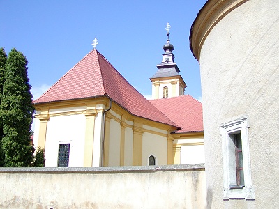
Kostol_sv.Michala_Archanjela_-_Pobedim.jpg (400 × 300 pixels, file size: 53 KB, MIME type: image/jpeg)
| This is a file from the
Wikimedia Commons. Information from its
description page there is shown below. Commons is a freely licensed media file repository. You can help. |
| Description |
Slovenčina: Kostol sv.Michala Archanjela, Pobedim.
|
||||
| Date | |||||
| Source | Own work | ||||
| Author | Martin Hlauka (Pescan) 06:53, 16 October 2005 (UTC) | ||||
| Permission ( Reusing this file) |
|

| Camera location |
| View this and other nearby images on: OpenStreetMap |
|
|---|
File history
Click on a date/time to view the file as it appeared at that time.
| Date/Time | Thumbnail | Dimensions | User | Comment | |
|---|---|---|---|---|---|
| current | 06:51, 16 October 2005 |
| 400 × 300 (53 KB) | Pescan |
File usage
The following pages on the English Wikipedia use this file (pages on other projects are not listed):
Global file usage
The following other wikis use this file:
- Usage on de.wikipedia.org
- Usage on eo.wikipedia.org
- Usage on fr.wikipedia.org
- Usage on hu.wikipedia.org
- Usage on it.wikipedia.org
- Usage on nl.wikipedia.org
- Usage on pl.wikipedia.org
- Usage on pt.wikipedia.org
- Usage on sh.wikipedia.org
- Usage on sk.wikipedia.org
- Usage on sr.wikipedia.org
- Usage on www.wikidata.org
- Usage on zh-min-nan.wikipedia.org
No higher resolution available.
Kostol_sv.Michala_Archanjela_-_Pobedim.jpg (400 × 300 pixels, file size: 53 KB, MIME type: image/jpeg)
| This is a file from the
Wikimedia Commons. Information from its
description page there is shown below. Commons is a freely licensed media file repository. You can help. |
| Description |
Slovenčina: Kostol sv.Michala Archanjela, Pobedim.
|
||||
| Date | |||||
| Source | Own work | ||||
| Author | Martin Hlauka (Pescan) 06:53, 16 October 2005 (UTC) | ||||
| Permission ( Reusing this file) |
|
| Camera location |
| View this and other nearby images on: OpenStreetMap |
|
|---|
File history
Click on a date/time to view the file as it appeared at that time.
| Date/Time | Thumbnail | Dimensions | User | Comment | |
|---|---|---|---|---|---|
| current | 06:51, 16 October 2005 |
| 400 × 300 (53 KB) | Pescan |
File usage
The following pages on the English Wikipedia use this file (pages on other projects are not listed):
Global file usage
The following other wikis use this file:
- Usage on de.wikipedia.org
- Usage on eo.wikipedia.org
- Usage on fr.wikipedia.org
- Usage on hu.wikipedia.org
- Usage on it.wikipedia.org
- Usage on nl.wikipedia.org
- Usage on pl.wikipedia.org
- Usage on pt.wikipedia.org
- Usage on sh.wikipedia.org
- Usage on sk.wikipedia.org
- Usage on sr.wikipedia.org
- Usage on www.wikidata.org
- Usage on zh-min-nan.wikipedia.org