Photos • Location


Size of this preview:
800 × 600 pixels. Other resolutions:
320 × 240 pixels |
640 × 480 pixels |
1,024 × 768 pixels |
1,280 × 960 pixels |
2,560 × 1,920 pixels |
3,264 × 2,448 pixels.
Original file (3,264 × 2,448 pixels, file size: 2.24 MB, MIME type: image/jpeg)
| This is a file from the
Wikimedia Commons. Information from its
description page there is shown below. Commons is a freely licensed media file repository. You can help. |
Summary
| Description |
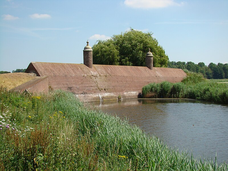
Nederlands: Zicht op een deel van de Stenen Poppen, een gemetselde dam uit 1583, onderdeel van de vestingwerken van Klundert English: Stenen Poppen, part of the fortifications of Klundert, Netherlands |
| Date | |
| Source | Own work |
| Author | Arch |
| Camera location |
| View this and other nearby images on: OpenStreetMap |
|
|---|
Licensing
| I, the copyright holder of this work, release this work into the
public domain. This applies worldwide. In some countries this may not be legally possible; if so: I grant anyone the right to use this work for any purpose, without any conditions, unless such conditions are required by law. |
File history
Click on a date/time to view the file as it appeared at that time.
| Date/Time | Thumbnail | Dimensions | User | Comment | |
|---|---|---|---|---|---|
| current | 15:20, 4 July 2010 |
| 3,264 × 2,448 (2.24 MB) | Arch | {{Information |Description={{en|1=fortifications at Klundert, Netherlands}} {{nl|1=fortificaties te Klundert}} |Source={{own}} |Author= Arch |Date=2010 |Permission=see below |other_versions= }} Category:Klundert |
File usage
The following pages on the English Wikipedia use this file (pages on other projects are not listed):
Global file usage
The following other wikis use this file:
- Usage on nl.wikipedia.org
Metadata
Size of this preview:
800 × 600 pixels. Other resolutions:
320 × 240 pixels |
640 × 480 pixels |
1,024 × 768 pixels |
1,280 × 960 pixels |
2,560 × 1,920 pixels |
3,264 × 2,448 pixels.
Original file (3,264 × 2,448 pixels, file size: 2.24 MB, MIME type: image/jpeg)
| This is a file from the
Wikimedia Commons. Information from its
description page there is shown below. Commons is a freely licensed media file repository. You can help. |
Summary
| Description |
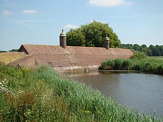
Nederlands: Zicht op een deel van de Stenen Poppen, een gemetselde dam uit 1583, onderdeel van de vestingwerken van Klundert English: Stenen Poppen, part of the fortifications of Klundert, Netherlands |
| Date | |
| Source | Own work |
| Author | Arch |
| Camera location |
| View this and other nearby images on: OpenStreetMap |
|
|---|
Licensing
| I, the copyright holder of this work, release this work into the
public domain. This applies worldwide. In some countries this may not be legally possible; if so: I grant anyone the right to use this work for any purpose, without any conditions, unless such conditions are required by law. |
File history
Click on a date/time to view the file as it appeared at that time.
| Date/Time | Thumbnail | Dimensions | User | Comment | |
|---|---|---|---|---|---|
| current | 15:20, 4 July 2010 |
| 3,264 × 2,448 (2.24 MB) | Arch | {{Information |Description={{en|1=fortifications at Klundert, Netherlands}} {{nl|1=fortificaties te Klundert}} |Source={{own}} |Author= Arch |Date=2010 |Permission=see below |other_versions= }} Category:Klundert |
File usage
The following pages on the English Wikipedia use this file (pages on other projects are not listed):
Global file usage
The following other wikis use this file:
- Usage on nl.wikipedia.org