
Size of this PNG preview of this SVG file:
772 × 600 pixels. Other resolutions:
309 × 240 pixels |
618 × 480 pixels |
989 × 768 pixels |
1,280 × 994 pixels |
2,560 × 1,989 pixels |
1,425 × 1,107 pixels.
Original file (SVG file, nominally 1,425 × 1,107 pixels, file size: 767 KB)
| This is a file from the
Wikimedia Commons. Information from its
description page there is shown below. Commons is a freely licensed media file repository. You can help. |
| Description |
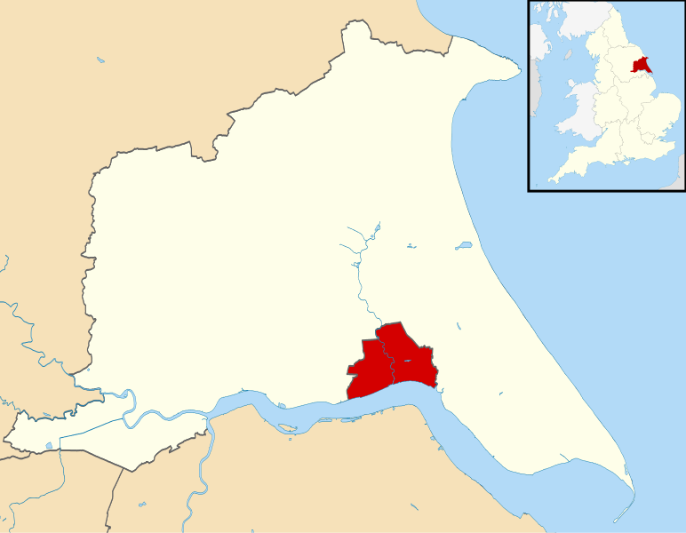
Map of the East Riding of Yorkshire, UK with Kingston upon Hull highlighted. Equirectangular map projection on WGS 84 datum, with N/S stretched 165% |
| Date | |
| Source | Ordnance Survey OpenData. Most data from Boundary-Line product. Lake data from Meridian 2 product. Inset derived from England location map.svg by Spischot. |
| Author | Nilfanion, created using Ordnance Survey data |
| Permission ( Reusing this file) |
This file is licensed under the
Creative Commons
Attribution-Share Alike 3.0 Unported license. Attribution: Contains Ordnance Survey data © Crown copyright and database right
|
File history
Click on a date/time to view the file as it appeared at that time.
| Date/Time | Thumbnail | Dimensions | User | Comment | |
|---|---|---|---|---|---|
| current | 20:50, 1 September 2013 |
| 1,425 × 1,107 (767 KB) | Nilfanion | {{Information |Description=Map of the East Riding of Yorkshire, UK with Kingston upon Hull highlighted. Equirectangular map projection on WGS 84 datum, with N/S stretched 165% |Source=[[w:Ordnance Survey|Ordnance Survey]... |
File usage
The following pages on the English Wikipedia use this file (pages on other projects are not listed):
Global file usage
The following other wikis use this file:
- Usage on azb.wikipedia.org
- Usage on bn.wikipedia.org
- Usage on cy.wikipedia.org
- Usage on fi.wikipedia.org
- Usage on he.wikipedia.org
- Usage on ja.wikipedia.org
- Usage on nl.wikipedia.org
- Usage on simple.wikipedia.org
- Usage on sv.wikipedia.org
- Usage on tr.wikipedia.org
- Usage on ur.wikipedia.org
- Usage on zh-yue.wikipedia.org
Metadata
Size of this PNG preview of this SVG file:
772 × 600 pixels. Other resolutions:
309 × 240 pixels |
618 × 480 pixels |
989 × 768 pixels |
1,280 × 994 pixels |
2,560 × 1,989 pixels |
1,425 × 1,107 pixels.
Original file (SVG file, nominally 1,425 × 1,107 pixels, file size: 767 KB)
| This is a file from the
Wikimedia Commons. Information from its
description page there is shown below. Commons is a freely licensed media file repository. You can help. |
| Description |
Map of the East Riding of Yorkshire, UK with Kingston upon Hull highlighted. Equirectangular map projection on WGS 84 datum, with N/S stretched 165% |
| Date | |
| Source | Ordnance Survey OpenData. Most data from Boundary-Line product. Lake data from Meridian 2 product. Inset derived from England location map.svg by Spischot. |
| Author | Nilfanion, created using Ordnance Survey data |
| Permission ( Reusing this file) |
This file is licensed under the
Creative Commons
Attribution-Share Alike 3.0 Unported license. Attribution: Contains Ordnance Survey data © Crown copyright and database right
|
File history
Click on a date/time to view the file as it appeared at that time.
| Date/Time | Thumbnail | Dimensions | User | Comment | |
|---|---|---|---|---|---|
| current | 20:50, 1 September 2013 |
| 1,425 × 1,107 (767 KB) | Nilfanion | {{Information |Description=Map of the East Riding of Yorkshire, UK with Kingston upon Hull highlighted. Equirectangular map projection on WGS 84 datum, with N/S stretched 165% |Source=[[w:Ordnance Survey|Ordnance Survey]... |
File usage
The following pages on the English Wikipedia use this file (pages on other projects are not listed):
Global file usage
The following other wikis use this file:
- Usage on azb.wikipedia.org
- Usage on bn.wikipedia.org
- Usage on cy.wikipedia.org
- Usage on fi.wikipedia.org
- Usage on he.wikipedia.org
- Usage on ja.wikipedia.org
- Usage on nl.wikipedia.org
- Usage on simple.wikipedia.org
- Usage on sv.wikipedia.org
- Usage on tr.wikipedia.org
- Usage on ur.wikipedia.org
- Usage on zh-yue.wikipedia.org