Photos • Location


Size of this preview:
750 × 600 pixels. Other resolutions:
300 × 240 pixels |
600 × 480 pixels |
960 × 768 pixels |
1,280 × 1,024 pixels.
Original file (1,280 × 1,024 pixels, file size: 683 KB, MIME type: image/jpeg)
| This is a file from the
Wikimedia Commons. Information from its
description page there is shown below. Commons is a freely licensed media file repository. You can help. |
Summary
| Description |
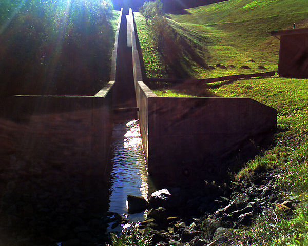
Deutsch: Abfluß in den Rieschengraben (Rödelbachgraben) Seitwärts rechts mündet der Grundablaß, von oben kommt der Überlauf (also nur wassergefüllt bei Vollstau - vorher fließt die Vorsperre in den Frankenteich ab). |
| Date | |
| Source | Own work |
| Author | Sarkana |
| Other versions | 10_1011_151334 |
| Camera location |
| View this and other nearby images on: OpenStreetMap |
|
|---|
Licensing
|
English: If you want to use this file commercially, you have to do these under the terms of the Free Art License.
Deutsch: Wenn Sie diese Datei kommerziell nutzen möchten, müssen Sie dies unter den Bedingungen der Licence Art Libre tun.
English: Otherwise you may choose out of of the following Creative Commons licence:
Deutsch: Andernfalls können Sie auch die folgende Creative Commons-Lizenz nutzen:
|
File history
Click on a date/time to view the file as it appeared at that time.
| Date/Time | Thumbnail | Dimensions | User | Comment | |
|---|---|---|---|---|---|
| current | 22:38, 13 November 2010 |
| 1,280 × 1,024 (683 KB) | Sarkana | {{Information |Description={{de|Abfluß in den Rödelbach<br />Seitwärts rechts mündet der Grundablaß, von oben kommt der Überlauf (also nur wassergefüllt bei Vollstau - vorher fließt die Vorsperre in den Frankenteich ab).}} |Source={{own}} |Date=20 |
File usage
The following pages on the English Wikipedia use this file (pages on other projects are not listed):
Global file usage
The following other wikis use this file:
- Usage on arz.wikipedia.org
- Usage on da.wikipedia.org
- Usage on www.wikidata.org
Metadata
Size of this preview:
750 × 600 pixels. Other resolutions:
300 × 240 pixels |
600 × 480 pixels |
960 × 768 pixels |
1,280 × 1,024 pixels.
Original file (1,280 × 1,024 pixels, file size: 683 KB, MIME type: image/jpeg)
| This is a file from the
Wikimedia Commons. Information from its
description page there is shown below. Commons is a freely licensed media file repository. You can help. |
Summary
| Description |
Deutsch: Abfluß in den Rieschengraben (Rödelbachgraben) Seitwärts rechts mündet der Grundablaß, von oben kommt der Überlauf (also nur wassergefüllt bei Vollstau - vorher fließt die Vorsperre in den Frankenteich ab). |
| Date | |
| Source | Own work |
| Author | Sarkana |
| Other versions | 10_1011_151334 |
| Camera location |
| View this and other nearby images on: OpenStreetMap |
|
|---|
Licensing
|
English: If you want to use this file commercially, you have to do these under the terms of the Free Art License.
Deutsch: Wenn Sie diese Datei kommerziell nutzen möchten, müssen Sie dies unter den Bedingungen der Licence Art Libre tun.
English: Otherwise you may choose out of of the following Creative Commons licence:
Deutsch: Andernfalls können Sie auch die folgende Creative Commons-Lizenz nutzen:
|
File history
Click on a date/time to view the file as it appeared at that time.
| Date/Time | Thumbnail | Dimensions | User | Comment | |
|---|---|---|---|---|---|
| current | 22:38, 13 November 2010 |
| 1,280 × 1,024 (683 KB) | Sarkana | {{Information |Description={{de|Abfluß in den Rödelbach<br />Seitwärts rechts mündet der Grundablaß, von oben kommt der Überlauf (also nur wassergefüllt bei Vollstau - vorher fließt die Vorsperre in den Frankenteich ab).}} |Source={{own}} |Date=20 |
File usage
The following pages on the English Wikipedia use this file (pages on other projects are not listed):
Global file usage
The following other wikis use this file:
- Usage on arz.wikipedia.org
- Usage on da.wikipedia.org
- Usage on www.wikidata.org