
Original file (SVG file, nominally 2,160 × 1,696 pixels, file size: 679 KB)
| This is a file from the
Wikimedia Commons. Information from its
description page there is shown below. Commons is a freely licensed media file repository. You can help. |
| Title |
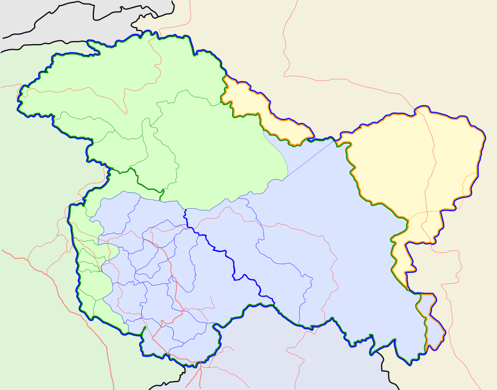
Jammu and Kashmir locator map |
||
| Description |
Locator map for the state of
w:Jammu and Kashmir |
||
| Date | |||
| Source |
Own work |
||
| Creator |
|
||
| Permission ( Reusing this file) |
I, the copyright holder of this work, hereby publish it under the following license: This file is licensed under the
Creative Commons
Attribution-Share Alike 3.0 Unported license.
|
||
| Geotemporal data | |||
| Date depicted | second half of 20th century and 21st century | ||
| Georeferencing | If inappropriate please set warp_status = skip to hide. | ||
| Archival data | |||
| Notes | Part of WikiProject India Maps | ||
File history
Click on a date/time to view the file as it appeared at that time.
| Date/Time | Thumbnail | Dimensions | User | Comment | |
|---|---|---|---|---|---|
| current | 10:31, 6 October 2020 |
| 2,160 × 1,696 (679 KB) | Hindian1947 | Fixed colour |
| 10:26, 6 October 2020 |
 | 2,700 × 2,120 (153 KB) | Hindian1947 | Ladakh, Gilgit Baltistan borders fixed | |
| 18:00, 9 April 2007 |
 | 2,160 × 1,696 (211 KB) | Planemad | {{WikiProject_India_Maps |Title=Jammu and Kashmir locator map |Description=Locator map for the state of [w:Jammu and Kashmir]] |Source= [http://www.koausa.org/Nature/maps.html Map of Kashmir], |Date=April 2007 |Author= w:user:Planemad }} [[Category:W |
File usage
Global file usage
The following other wikis use this file:
- Usage on ar.wikipedia.org
- Usage on bn.wikipedia.org
- Usage on bpy.wikipedia.org
- Usage on ceb.wikipedia.org
- Usage on de.wikipedia.org
- Usage on en.wiktionary.org
- Usage on fa.wikipedia.org
- Usage on gu.wikipedia.org
- Usage on hi.wikipedia.org
- साँचा:ज्ञानसन्दूक भारत के क्षेत्र
- साँचा:ज्ञानसन्दूक भारत के क्षेत्र/doc
- अनंतनाग लोक सभा निर्वाचन क्षेत्र
- बारामूला लोक सभा निर्वाचन क्षेत्र
- जम्मू लोक सभा निर्वाचन क्षेत्र
- लद्दाख लोक सभा निर्वाचन क्षेत्र
- श्रीनगर लोक सभा निर्वाचन क्षेत्र
- उधमपुर लोक सभा निर्वाचन क्षेत्र
- शारदापीठ
- रिमो मुज़ताग़
- Module:Location map/data/Kashmir
- Module:Location map/data/Kashmir/doc
- हाजी पीर की लड़ाई
- शाह मीर राजवंश
- Usage on id.wikipedia.org
- Usage on it.wikipedia.org
- Usage on ja.wikipedia.org
- Usage on ks.wikipedia.org
- Usage on mai.wikipedia.org
- Usage on ml.wikipedia.org
View more global usage of this file.
Metadata
Original file (SVG file, nominally 2,160 × 1,696 pixels, file size: 679 KB)
| This is a file from the
Wikimedia Commons. Information from its
description page there is shown below. Commons is a freely licensed media file repository. You can help. |
| Title |
Jammu and Kashmir locator map |
||
| Description |
Locator map for the state of
w:Jammu and Kashmir |
||
| Date | |||
| Source |
Own work |
||
| Creator |
|
||
| Permission ( Reusing this file) |
I, the copyright holder of this work, hereby publish it under the following license: This file is licensed under the
Creative Commons
Attribution-Share Alike 3.0 Unported license.
|
||
| Geotemporal data | |||
| Date depicted | second half of 20th century and 21st century | ||
| Georeferencing | If inappropriate please set warp_status = skip to hide. | ||
| Archival data | |||
| Notes | Part of WikiProject India Maps | ||
File history
Click on a date/time to view the file as it appeared at that time.
| Date/Time | Thumbnail | Dimensions | User | Comment | |
|---|---|---|---|---|---|
| current | 10:31, 6 October 2020 |
| 2,160 × 1,696 (679 KB) | Hindian1947 | Fixed colour |
| 10:26, 6 October 2020 |
| 2,700 × 2,120 (153 KB) | Hindian1947 | Ladakh, Gilgit Baltistan borders fixed | |
| 18:00, 9 April 2007 |
| 2,160 × 1,696 (211 KB) | Planemad | {{WikiProject_India_Maps |Title=Jammu and Kashmir locator map |Description=Locator map for the state of [w:Jammu and Kashmir]] |Source= [http://www.koausa.org/Nature/maps.html Map of Kashmir], |Date=April 2007 |Author= w:user:Planemad }} [[Category:W |
File usage
Global file usage
The following other wikis use this file:
- Usage on ar.wikipedia.org
- Usage on bn.wikipedia.org
- Usage on bpy.wikipedia.org
- Usage on ceb.wikipedia.org
- Usage on de.wikipedia.org
- Usage on en.wiktionary.org
- Usage on fa.wikipedia.org
- Usage on gu.wikipedia.org
- Usage on hi.wikipedia.org
- साँचा:ज्ञानसन्दूक भारत के क्षेत्र
- साँचा:ज्ञानसन्दूक भारत के क्षेत्र/doc
- अनंतनाग लोक सभा निर्वाचन क्षेत्र
- बारामूला लोक सभा निर्वाचन क्षेत्र
- जम्मू लोक सभा निर्वाचन क्षेत्र
- लद्दाख लोक सभा निर्वाचन क्षेत्र
- श्रीनगर लोक सभा निर्वाचन क्षेत्र
- उधमपुर लोक सभा निर्वाचन क्षेत्र
- शारदापीठ
- रिमो मुज़ताग़
- Module:Location map/data/Kashmir
- Module:Location map/data/Kashmir/doc
- हाजी पीर की लड़ाई
- शाह मीर राजवंश
- Usage on id.wikipedia.org
- Usage on it.wikipedia.org
- Usage on ja.wikipedia.org
- Usage on ks.wikipedia.org
- Usage on mai.wikipedia.org
- Usage on ml.wikipedia.org
View more global usage of this file.