Ilford_Hill_-_geograph.org.uk_-_1626422.jpg (640 × 410 pixels, file size: 181 KB, MIME type: image/jpeg)
| This is a file from the
Wikimedia Commons. Information from its
description page there is shown below. Commons is a freely licensed media file repository. You can help. |
Summary
| Description |
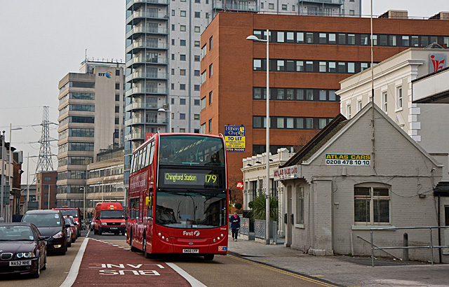
English: Ilford Hill, near to Ilford, Redbridge, Great Britain.
A 179 bus climbs towards the junction with Cranbrook Road and the bus stops outside Ilford Station. On the right is one of the ubiquitous minicab offices that can usually be found close to railway stations. The building looks like an ex-railway company building. |
| Date | |
| Source | From geograph.org.uk; transferred by User:oxyman using geograph_org2commons. |
| Author | Martin Addison |
| Permission ( Reusing this file) |
Creative Commons Attribution Share-alike license 2.0 |
| Attribution ( required by the license) | Martin Addison / Ilford Hill / |
| Camera location | | View this and other nearby images on: OpenStreetMap |
|
|---|
| Object location | | View this and other nearby images on: OpenStreetMap |
|
|---|
_region:GB-ENG_heading:247.00&language=en)
Licensing

|
This image was taken from the
Geograph project collection. See
this photograph's page on the Geograph website for the photographer's contact details. The copyright on this image is owned by Martin Addison and is licensed for reuse under the
Creative Commons Attribution-ShareAlike 2.0 license.
|
- You are free:
- to share – to copy, distribute and transmit the work
- to remix – to adapt the work
- Under the following conditions:
- attribution – You must give appropriate credit, provide a link to the license, and indicate if changes were made. You may do so in any reasonable manner, but not in any way that suggests the licensor endorses you or your use.
- share alike – If you remix, transform, or build upon the material, you must distribute your contributions under the same or compatible license as the original.
File history
Click on a date/time to view the file as it appeared at that time.
| Date/Time | Thumbnail | Dimensions | User | Comment | |
|---|---|---|---|---|---|
| current | 18:27, 4 July 2010 |
| 640 × 410 (181 KB) | File Upload Bot (Magnus Manske) | == {{int:filedesc}} == {{Information |Description={{en|1=Ilford Hill, near to Ilford, Redbridge, Great Britain. A 179 bus climbs towards the junction with Cranbrook Road and the bus stops outside Ilford Station. On the right is one of the ubiquitous min |
File usage
Global file usage
The following other wikis use this file:
- Usage on www.wikidata.org
Metadata
Ilford_Hill_-_geograph.org.uk_-_1626422.jpg (640 × 410 pixels, file size: 181 KB, MIME type: image/jpeg)
| This is a file from the
Wikimedia Commons. Information from its
description page there is shown below. Commons is a freely licensed media file repository. You can help. |
Summary
| Description |
English: Ilford Hill, near to Ilford, Redbridge, Great Britain.
A 179 bus climbs towards the junction with Cranbrook Road and the bus stops outside Ilford Station. On the right is one of the ubiquitous minicab offices that can usually be found close to railway stations. The building looks like an ex-railway company building. |
| Date | |
| Source | From geograph.org.uk; transferred by User:oxyman using geograph_org2commons. |
| Author | Martin Addison |
| Permission ( Reusing this file) |
Creative Commons Attribution Share-alike license 2.0 |
| Attribution ( required by the license) | Martin Addison / Ilford Hill / |
| Camera location | | View this and other nearby images on: OpenStreetMap |
|
|---|
| Object location | | View this and other nearby images on: OpenStreetMap |
|
|---|
Licensing
|
|
This image was taken from the
Geograph project collection. See
this photograph's page on the Geograph website for the photographer's contact details. The copyright on this image is owned by Martin Addison and is licensed for reuse under the
Creative Commons Attribution-ShareAlike 2.0 license.
|
- You are free:
- to share – to copy, distribute and transmit the work
- to remix – to adapt the work
- Under the following conditions:
- attribution – You must give appropriate credit, provide a link to the license, and indicate if changes were made. You may do so in any reasonable manner, but not in any way that suggests the licensor endorses you or your use.
- share alike – If you remix, transform, or build upon the material, you must distribute your contributions under the same or compatible license as the original.
File history
Click on a date/time to view the file as it appeared at that time.
| Date/Time | Thumbnail | Dimensions | User | Comment | |
|---|---|---|---|---|---|
| current | 18:27, 4 July 2010 |
| 640 × 410 (181 KB) | File Upload Bot (Magnus Manske) | == {{int:filedesc}} == {{Information |Description={{en|1=Ilford Hill, near to Ilford, Redbridge, Great Britain. A 179 bus climbs towards the junction with Cranbrook Road and the bus stops outside Ilford Station. On the right is one of the ubiquitous min |
File usage
Global file usage
The following other wikis use this file:
- Usage on www.wikidata.org