Photos • Location


Size of this preview:
775 × 600 pixels. Other resolutions:
310 × 240 pixels |
621 × 480 pixels |
993 × 768 pixels |
1,280 × 990 pixels |
2,560 × 1,980 pixels |
3,043 × 2,354 pixels.
Original file (3,043 × 2,354 pixels, file size: 4.7 MB, MIME type: image/jpeg)
| This is a file from the
Wikimedia Commons. Information from its
description page there is shown below. Commons is a freely licensed media file repository. You can help. |
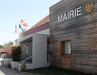
| Description |
Français : La mairie de
Heidwiller Deutsch: Rathaus der Gemeinde
Heidwiller |
||
| Date | |||
| Source | Self-photographed | ||
| Author | Rauenstein | ||
| Permission ( Reusing this file) |
|
| Object location |
| View this and other nearby images on: OpenStreetMap |
|
|---|
File history
Click on a date/time to view the file as it appeared at that time.
| Date/Time | Thumbnail | Dimensions | User | Comment | |
|---|---|---|---|---|---|
| current | 07:42, 23 April 2011 |
| 3,043 × 2,354 (4.7 MB) | Rauenstein | {{Information |Description={{fr|La mairie d' Heidwiller}} {{de|Rathaus in Heidwiller}} |Source=own photograph |Date=2011-04-10 |Author= Rauenstein |Permission={{cc-by-sa-3.0}} |other_versions= }} {{ |
File usage
The following pages on the English Wikipedia use this file (pages on other projects are not listed):
Global file usage
The following other wikis use this file:
- Usage on als.wikipedia.org
- Usage on ca.wikipedia.org
- Usage on ceb.wikipedia.org
- Usage on ce.wikipedia.org
- Usage on de.wikipedia.org
- Usage on diq.wikipedia.org
- Usage on eo.wikipedia.org
- Usage on es.wikipedia.org
- Usage on eu.wikipedia.org
- Usage on fr.wikipedia.org
- Usage on hu.wikipedia.org
- Usage on it.wikipedia.org
- Usage on ms.wikipedia.org
- Usage on nl.wikipedia.org
- Usage on oc.wikipedia.org
- Usage on pfl.wikipedia.org
- Usage on pl.wikipedia.org
- Usage on pt.wikipedia.org
- Usage on ro.wikipedia.org
- Usage on ru.wikipedia.org
- Usage on sk.wikipedia.org
- Usage on sl.wikipedia.org
- Usage on sr.wikipedia.org
- Usage on tt.wikipedia.org
- Usage on uk.wikipedia.org
- Usage on uz.wikipedia.org
- Usage on vec.wikipedia.org
- Usage on www.wikidata.org
- Usage on zh-min-nan.wikipedia.org
- Usage on zh.wikipedia.org
Metadata
Size of this preview:
775 × 600 pixels. Other resolutions:
310 × 240 pixels |
621 × 480 pixels |
993 × 768 pixels |
1,280 × 990 pixels |
2,560 × 1,980 pixels |
3,043 × 2,354 pixels.
Original file (3,043 × 2,354 pixels, file size: 4.7 MB, MIME type: image/jpeg)
| This is a file from the
Wikimedia Commons. Information from its
description page there is shown below. Commons is a freely licensed media file repository. You can help. |
| Description |
Français : La mairie de
Heidwiller Deutsch: Rathaus der Gemeinde
Heidwiller |
||
| Date | |||
| Source | Self-photographed | ||
| Author | Rauenstein | ||
| Permission ( Reusing this file) |
|
| Object location |
| View this and other nearby images on: OpenStreetMap |
|
|---|
File history
Click on a date/time to view the file as it appeared at that time.
| Date/Time | Thumbnail | Dimensions | User | Comment | |
|---|---|---|---|---|---|
| current | 07:42, 23 April 2011 |
| 3,043 × 2,354 (4.7 MB) | Rauenstein | {{Information |Description={{fr|La mairie d' Heidwiller}} {{de|Rathaus in Heidwiller}} |Source=own photograph |Date=2011-04-10 |Author= Rauenstein |Permission={{cc-by-sa-3.0}} |other_versions= }} {{ |
File usage
The following pages on the English Wikipedia use this file (pages on other projects are not listed):
Global file usage
The following other wikis use this file:
- Usage on als.wikipedia.org
- Usage on ca.wikipedia.org
- Usage on ceb.wikipedia.org
- Usage on ce.wikipedia.org
- Usage on de.wikipedia.org
- Usage on diq.wikipedia.org
- Usage on eo.wikipedia.org
- Usage on es.wikipedia.org
- Usage on eu.wikipedia.org
- Usage on fr.wikipedia.org
- Usage on hu.wikipedia.org
- Usage on it.wikipedia.org
- Usage on ms.wikipedia.org
- Usage on nl.wikipedia.org
- Usage on oc.wikipedia.org
- Usage on pfl.wikipedia.org
- Usage on pl.wikipedia.org
- Usage on pt.wikipedia.org
- Usage on ro.wikipedia.org
- Usage on ru.wikipedia.org
- Usage on sk.wikipedia.org
- Usage on sl.wikipedia.org
- Usage on sr.wikipedia.org
- Usage on tt.wikipedia.org
- Usage on uk.wikipedia.org
- Usage on uz.wikipedia.org
- Usage on vec.wikipedia.org
- Usage on www.wikidata.org
- Usage on zh-min-nan.wikipedia.org
- Usage on zh.wikipedia.org