Photos • Location


Size of this preview:
800 × 458 pixels. Other resolutions:
320 × 183 pixels |
640 × 366 pixels |
1,024 × 586 pixels |
1,280 × 732 pixels |
2,560 × 1,464 pixels |
3,785 × 2,165 pixels.
Original file (3,785 × 2,165 pixels, file size: 2.33 MB, MIME type: image/jpeg)
| This is a file from the
Wikimedia Commons. Information from its
description page there is shown below. Commons is a freely licensed media file repository. You can help. |
| Description |
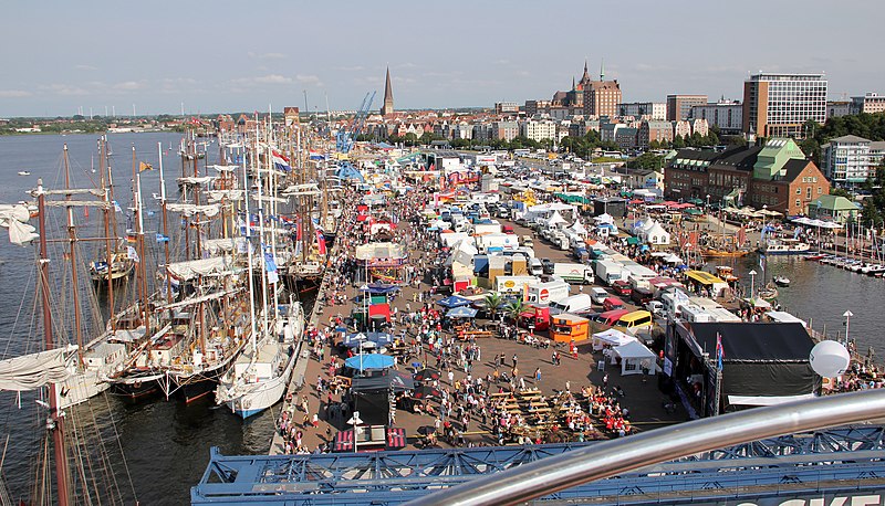
English: Baltic Sail, Hanse Sail Rostock 2010 Harbor
Deutsch: Baltic Sail, Hanse Sail Rostock 2010 Stadthafen |
||
| Date | |||
| Source | Own work (Original text: eigene Aufnahme) | ||
| Author | Andreas Kosmehl | ||
| Permission ( Reusing this file) |
|
| Camera location |
| View this and other nearby images on: OpenStreetMap |
|
|---|
File history
Click on a date/time to view the file as it appeared at that time.
| Date/Time | Thumbnail | Dimensions | User | Comment | |
|---|---|---|---|---|---|
| current | 12:29, 12 August 2010 |
| 3,785 × 2,165 (2.33 MB) | Andreas 2010 | {{Information |Description={{en|1=Baltic Sail, Hanse Sail Rostock 2010 Harbor}} {{de|1=Baltic Sail, Hanse Sail Rostock 2010 Stadthafen}} |Source=eigene Aufnahme |Author=Andreas Kosmehl |Date=2010-08-06 |Permission= |other_versions= }} 54° 5' 36.3" N, 12� |
File usage
The following pages on the English Wikipedia use this file (pages on other projects are not listed):
Global file usage
The following other wikis use this file:
- Usage on ar.wikipedia.org
- Usage on cv.wikipedia.org
- Usage on de.wikipedia.org
- Usage on de.wikivoyage.org
- Usage on fr.wikipedia.org
- Usage on hu.wikipedia.org
- Usage on mk.wikipedia.org
- Usage on pl.wikivoyage.org
- Usage on pt.wikipedia.org
- Usage on ru.wikipedia.org
- Usage on sr.wikipedia.org
Metadata
Size of this preview:
800 × 458 pixels. Other resolutions:
320 × 183 pixels |
640 × 366 pixels |
1,024 × 586 pixels |
1,280 × 732 pixels |
2,560 × 1,464 pixels |
3,785 × 2,165 pixels.
Original file (3,785 × 2,165 pixels, file size: 2.33 MB, MIME type: image/jpeg)
| This is a file from the
Wikimedia Commons. Information from its
description page there is shown below. Commons is a freely licensed media file repository. You can help. |
| Description |
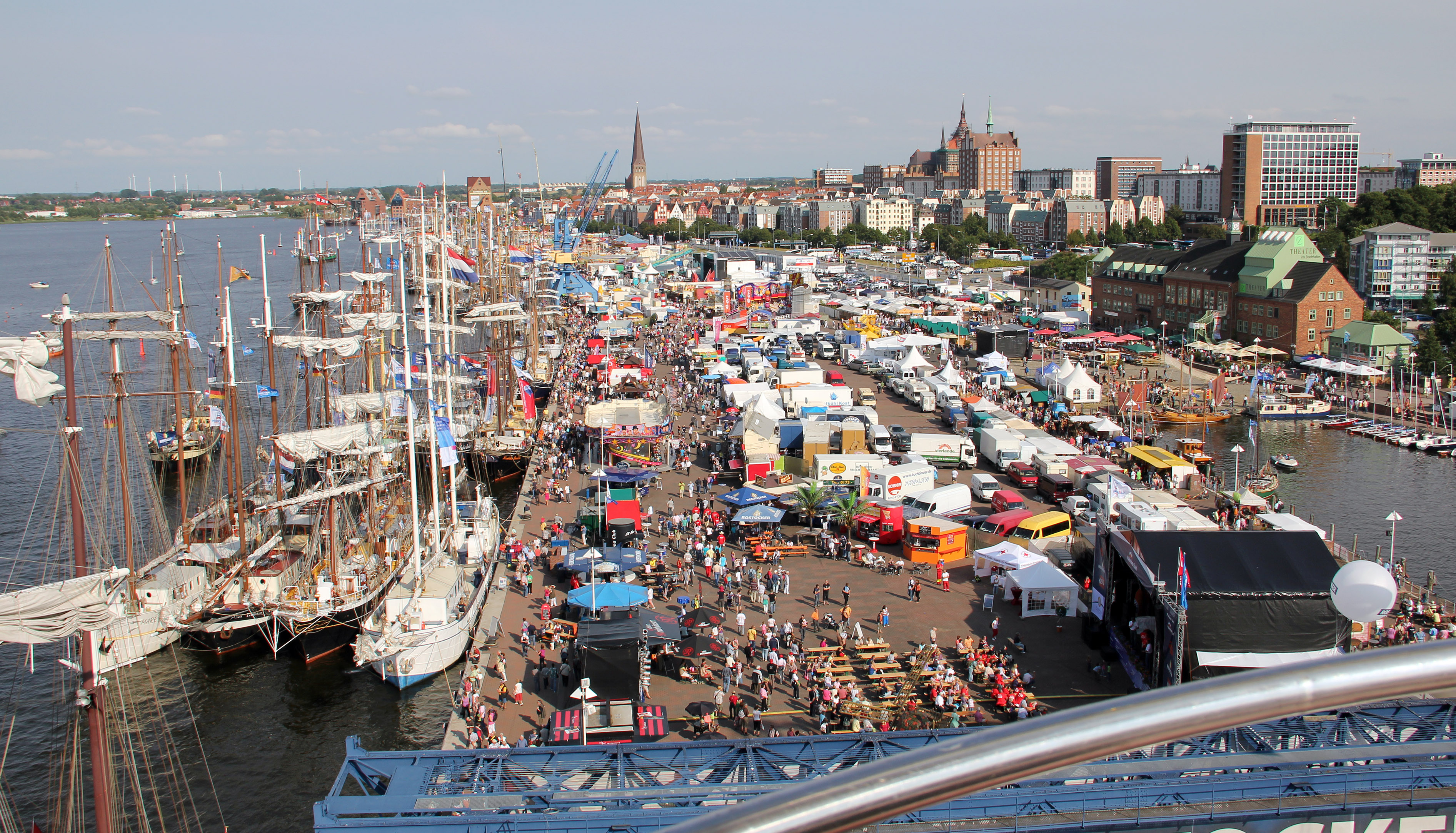
English: Baltic Sail, Hanse Sail Rostock 2010 Harbor
Deutsch: Baltic Sail, Hanse Sail Rostock 2010 Stadthafen |
||
| Date | |||
| Source | Own work (Original text: eigene Aufnahme) | ||
| Author | Andreas Kosmehl | ||
| Permission ( Reusing this file) |
|
| Camera location |
| View this and other nearby images on: OpenStreetMap |
|
|---|
File history
Click on a date/time to view the file as it appeared at that time.
| Date/Time | Thumbnail | Dimensions | User | Comment | |
|---|---|---|---|---|---|
| current | 12:29, 12 August 2010 |
| 3,785 × 2,165 (2.33 MB) | Andreas 2010 | {{Information |Description={{en|1=Baltic Sail, Hanse Sail Rostock 2010 Harbor}} {{de|1=Baltic Sail, Hanse Sail Rostock 2010 Stadthafen}} |Source=eigene Aufnahme |Author=Andreas Kosmehl |Date=2010-08-06 |Permission= |other_versions= }} 54° 5' 36.3" N, 12� |
File usage
The following pages on the English Wikipedia use this file (pages on other projects are not listed):
Global file usage
The following other wikis use this file:
- Usage on ar.wikipedia.org
- Usage on cv.wikipedia.org
- Usage on de.wikipedia.org
- Usage on de.wikivoyage.org
- Usage on fr.wikipedia.org
- Usage on hu.wikipedia.org
- Usage on mk.wikipedia.org
- Usage on pl.wikivoyage.org
- Usage on pt.wikipedia.org
- Usage on ru.wikipedia.org
- Usage on sr.wikipedia.org