Size of this preview:
800 × 540 pixels. Other resolutions:
320 × 216 pixels |
640 × 432 pixels |
1,024 × 692 pixels |
1,233 × 833 pixels.
Original file (1,233 × 833 pixels, file size: 1.35 MB, MIME type: image/png)
| This is a file from the
Wikimedia Commons. Information from its
description page there is shown below. Commons is a freely licensed media file repository. You can help. |
Summary
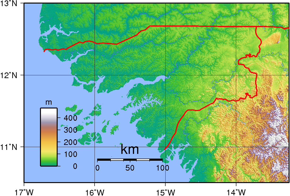
| Description | Topographic map of Guinea-Bissau. Created with GMT from SRTM data |
| Date | |
| Source | Own work |
| Author | Sadalmelik |
Licensing
| This work has been released into the
public domain by its author, I,
Sadalmelik. This applies worldwide. In some countries this may not be legally possible; if so: I, Sadalmelik grants anyone the right to use this work for any purpose, without any conditions, unless such conditions are required by law. |
File history
Click on a date/time to view the file as it appeared at that time.
| Date/Time | Thumbnail | Dimensions | User | Comment | |
|---|---|---|---|---|---|
| current | 20:03, 29 June 2007 |
| 1,233 × 833 (1.35 MB) | Sadalmelik | {{Information |Description=Topographic map of Guinea-Bissau. Created with GMT from SRTM data |Source=self-made |Date=June 29, 2007 |Author= Sadalmelik }} Category:Maps of Guinea-Bissau Category:Topographic maps of Africa |
File usage
The following pages on the English Wikipedia use this file (pages on other projects are not listed):
Global file usage
The following other wikis use this file:
- Usage on ca.wikipedia.org
- Usage on es.wikipedia.org
- Usage on fa.wikipedia.org
- Usage on fi.wikipedia.org
- Usage on ha.wikipedia.org
- Usage on hu.wikipedia.org
- Usage on ig.wikipedia.org
- Usage on it.wikipedia.org
- Usage on mdf.wikipedia.org
- Usage on smn.wikipedia.org
- Usage on uk.wikipedia.org
- Usage on vep.wikipedia.org
Size of this preview:
800 × 540 pixels. Other resolutions:
320 × 216 pixels |
640 × 432 pixels |
1,024 × 692 pixels |
1,233 × 833 pixels.
Original file (1,233 × 833 pixels, file size: 1.35 MB, MIME type: image/png)
| This is a file from the
Wikimedia Commons. Information from its
description page there is shown below. Commons is a freely licensed media file repository. You can help. |
Summary
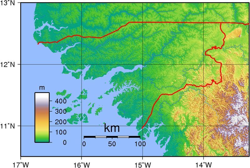
| Description | Topographic map of Guinea-Bissau. Created with GMT from SRTM data |
| Date | |
| Source | Own work |
| Author | Sadalmelik |
Licensing
| This work has been released into the
public domain by its author, I,
Sadalmelik. This applies worldwide. In some countries this may not be legally possible; if so: I, Sadalmelik grants anyone the right to use this work for any purpose, without any conditions, unless such conditions are required by law. |
File history
Click on a date/time to view the file as it appeared at that time.
| Date/Time | Thumbnail | Dimensions | User | Comment | |
|---|---|---|---|---|---|
| current | 20:03, 29 June 2007 |
| 1,233 × 833 (1.35 MB) | Sadalmelik | {{Information |Description=Topographic map of Guinea-Bissau. Created with GMT from SRTM data |Source=self-made |Date=June 29, 2007 |Author= Sadalmelik }} Category:Maps of Guinea-Bissau Category:Topographic maps of Africa |
File usage
The following pages on the English Wikipedia use this file (pages on other projects are not listed):
Global file usage
The following other wikis use this file:
- Usage on ca.wikipedia.org
- Usage on es.wikipedia.org
- Usage on fa.wikipedia.org
- Usage on fi.wikipedia.org
- Usage on ha.wikipedia.org
- Usage on hu.wikipedia.org
- Usage on ig.wikipedia.org
- Usage on it.wikipedia.org
- Usage on mdf.wikipedia.org
- Usage on smn.wikipedia.org
- Usage on uk.wikipedia.org
- Usage on vep.wikipedia.org