
Size of this PNG preview of this SVG file:
634 × 599 pixels. Other resolutions:
254 × 240 pixels |
508 × 480 pixels |
813 × 768 pixels |
1,084 × 1,024 pixels |
2,167 × 2,048 pixels |
1,435 × 1,356 pixels.
Original file (SVG file, nominally 1,435 × 1,356 pixels, file size: 134 KB)
| This is a file from the
Wikimedia Commons. Information from its
description page there is shown below. Commons is a freely licensed media file repository. You can help. |
Summary
| Description |
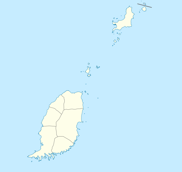
Deutsch: Positionskarte von
Grenada
Geographische Begrenzung der Karte:
English: Location map of
Grenada
Geographic limits of the map:
|
||||||||||||
| Date | |||||||||||||
| Source | Own work | ||||||||||||
| Author | NordNordWest | ||||||||||||
| Permission ( Reusing this file) |
|

|
This map has been made or improved in the German
Kartenwerkstatt (Map Lab). You can
propose maps to improve as well.
|
File history
Click on a date/time to view the file as it appeared at that time.
| Date/Time | Thumbnail | Dimensions | User | Comment | |
|---|---|---|---|---|---|
| current | 19:56, 18 December 2009 |
| 1,435 × 1,356 (134 KB) | NordNordWest | == {{int:filedesc}} == {{Information |Description= {{de|Positionskarte von Grenada}} Geographische Begrenzung der Karte: * N: 12.55° N * S: 11.95° N * W: 61.9° W * O: 61.25° W {{en|Location map of Grenada}} Geographic l |
File usage
The following pages on the English Wikipedia use this file (pages on other projects are not listed):
- 2015 GFA Premier Division
- 2016 GFA Premier Division
- 2017 Windward Islands Tournament
- Amber Belair
- Bacolet, Grenada
- Barique
- Becke Moui
- Belmont, Grenada
- Bogles
- Bois de Gannes
- Calivigny
- Chantimelle
- Chutz
- Clabony
- Crochu
- Deblando
- Diego Piece
- Elie Hall
- Gouyave
- Grand Roy
- Grenada National Museum
- Grenville, Grenada
- Hermitage (Carriacou)
- Ka-fe Beau
- L'Anse Aux Epines
- Lauriston Airport
- List of cricket grounds in the West Indies
- Mamma Cannes
- Marquis, Grenada
- Maulti
- Maurice Bishop International Airport
- Morne Docteur
- Morne Fendue
- Morne Jaloux
- Morne Jaloux Ridge
- Morne Longue
- Morne Rouge, Grenada
- Morne Tranquille
- Mount Craven
- Mount St. Catherine Forest Reserve
- Mt. Rich Petroglyphs
- Paradise, Grenada
- Pearls Airport
- Richmond Hill Prison
- Saint David Parish, Grenada
- Tivoli, Grenada
- Union, Grenada
- Union Village, Grenada
- Upper Capitol
- Upper Conference
- Upper La Tante
- Upper La Taste
- Upper Pearls
- Victoria, Grenada
- Willis, Grenada
- Module:Location map/data/Grenada
- Module:Location map/data/Grenada/doc
Global file usage
The following other wikis use this file:
- Usage on af.wikipedia.org
- Usage on an.wikipedia.org
- Usage on ar.wikipedia.org
- Usage on ast.wikipedia.org
- Usage on ba.wikipedia.org
- Usage on be-tarask.wikipedia.org
- Usage on be.wikipedia.org
- Usage on bg.wikipedia.org
- Usage on bn.wikipedia.org
- Usage on bs.wikipedia.org
- Usage on ceb.wikipedia.org
- Plantilya:Location map Grenada
- The Sisters
- Sandy Island
- Sandy Islet
- Saint John
- Saint George
- Redonda
- Green Island
- Green Islet
- Goat Point
- Bird Island
- Bird Islet
- North Point
- Victoria
- Saint George’s Bay
- Rose Rock
- Black Rock
- Long Point
- Sugar Loaf
- Hog Island
- Southwest Point
- Sister Rocks
- Gun Point
- Flamingo Bay
- Ross Point
- Bird
- White Island
View more global usage of this file.
Size of this PNG preview of this SVG file:
634 × 599 pixels. Other resolutions:
254 × 240 pixels |
508 × 480 pixels |
813 × 768 pixels |
1,084 × 1,024 pixels |
2,167 × 2,048 pixels |
1,435 × 1,356 pixels.
Original file (SVG file, nominally 1,435 × 1,356 pixels, file size: 134 KB)
| This is a file from the
Wikimedia Commons. Information from its
description page there is shown below. Commons is a freely licensed media file repository. You can help. |
Summary
| Description |
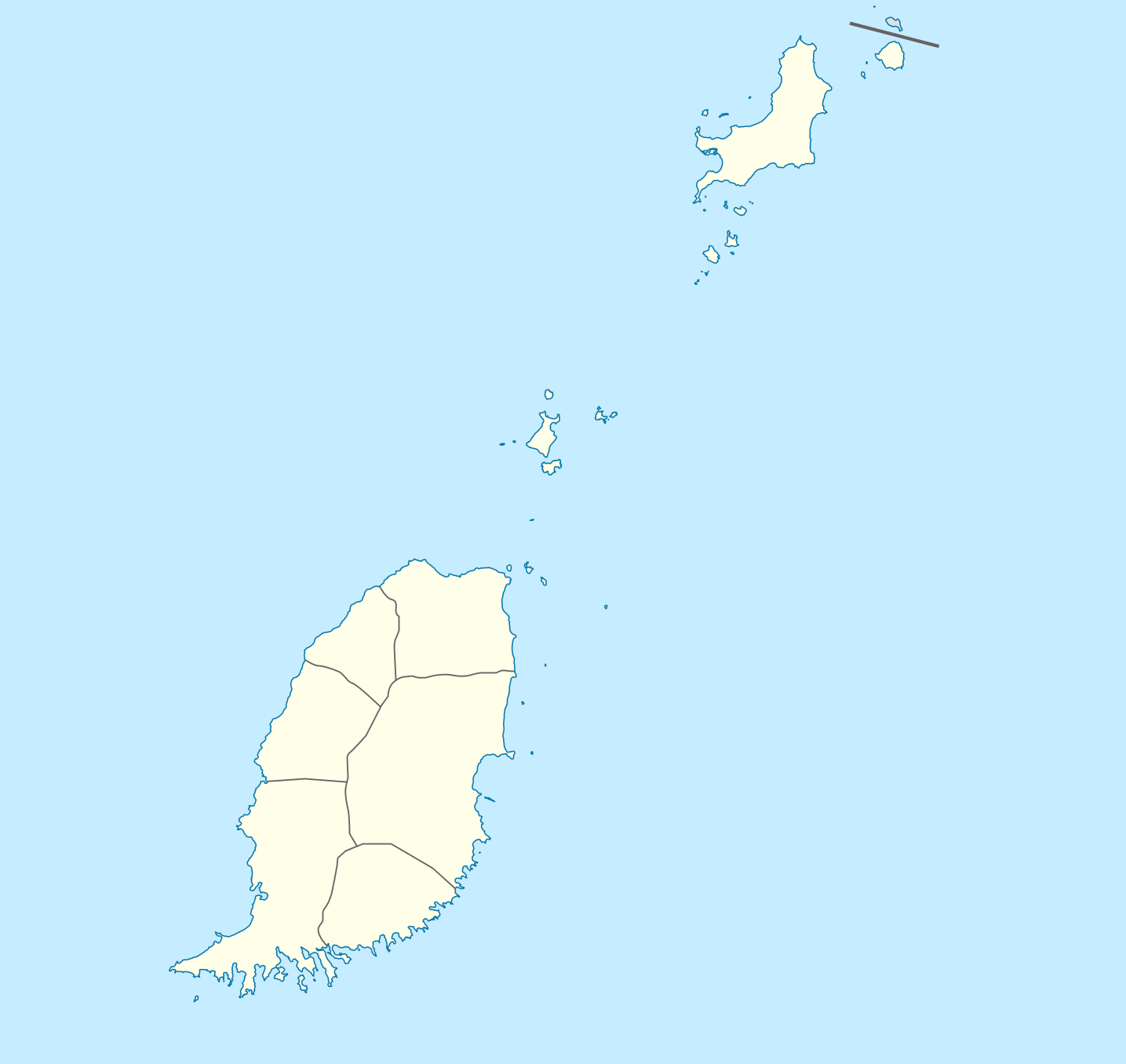
Deutsch: Positionskarte von
Grenada
Geographische Begrenzung der Karte:
English: Location map of
Grenada
Geographic limits of the map:
|
||||||||||||
| Date | |||||||||||||
| Source | Own work | ||||||||||||
| Author | NordNordWest | ||||||||||||
| Permission ( Reusing this file) |
|
|
|
This map has been made or improved in the German
Kartenwerkstatt (Map Lab). You can
propose maps to improve as well.
|
File history
Click on a date/time to view the file as it appeared at that time.
| Date/Time | Thumbnail | Dimensions | User | Comment | |
|---|---|---|---|---|---|
| current | 19:56, 18 December 2009 |
| 1,435 × 1,356 (134 KB) | NordNordWest | == {{int:filedesc}} == {{Information |Description= {{de|Positionskarte von Grenada}} Geographische Begrenzung der Karte: * N: 12.55° N * S: 11.95° N * W: 61.9° W * O: 61.25° W {{en|Location map of Grenada}} Geographic l |
File usage
The following pages on the English Wikipedia use this file (pages on other projects are not listed):
- 2015 GFA Premier Division
- 2016 GFA Premier Division
- 2017 Windward Islands Tournament
- Amber Belair
- Bacolet, Grenada
- Barique
- Becke Moui
- Belmont, Grenada
- Bogles
- Bois de Gannes
- Calivigny
- Chantimelle
- Chutz
- Clabony
- Crochu
- Deblando
- Diego Piece
- Elie Hall
- Gouyave
- Grand Roy
- Grenada National Museum
- Grenville, Grenada
- Hermitage (Carriacou)
- Ka-fe Beau
- L'Anse Aux Epines
- Lauriston Airport
- List of cricket grounds in the West Indies
- Mamma Cannes
- Marquis, Grenada
- Maulti
- Maurice Bishop International Airport
- Morne Docteur
- Morne Fendue
- Morne Jaloux
- Morne Jaloux Ridge
- Morne Longue
- Morne Rouge, Grenada
- Morne Tranquille
- Mount Craven
- Mount St. Catherine Forest Reserve
- Mt. Rich Petroglyphs
- Paradise, Grenada
- Pearls Airport
- Richmond Hill Prison
- Saint David Parish, Grenada
- Tivoli, Grenada
- Union, Grenada
- Union Village, Grenada
- Upper Capitol
- Upper Conference
- Upper La Tante
- Upper La Taste
- Upper Pearls
- Victoria, Grenada
- Willis, Grenada
- Module:Location map/data/Grenada
- Module:Location map/data/Grenada/doc
Global file usage
The following other wikis use this file:
- Usage on af.wikipedia.org
- Usage on an.wikipedia.org
- Usage on ar.wikipedia.org
- Usage on ast.wikipedia.org
- Usage on ba.wikipedia.org
- Usage on be-tarask.wikipedia.org
- Usage on be.wikipedia.org
- Usage on bg.wikipedia.org
- Usage on bn.wikipedia.org
- Usage on bs.wikipedia.org
- Usage on ceb.wikipedia.org
- Plantilya:Location map Grenada
- The Sisters
- Sandy Island
- Sandy Islet
- Saint John
- Saint George
- Redonda
- Green Island
- Green Islet
- Goat Point
- Bird Island
- Bird Islet
- North Point
- Victoria
- Saint George’s Bay
- Rose Rock
- Black Rock
- Long Point
- Sugar Loaf
- Hog Island
- Southwest Point
- Sister Rocks
- Gun Point
- Flamingo Bay
- Ross Point
- Bird
- White Island
View more global usage of this file.