
Original file (SVG file, nominally 2,095 × 1,971 pixels, file size: 13.21 MB)
| This is a file from the
Wikimedia Commons. Information from its
description page there is shown below. Commons is a freely licensed media file repository. You can help. |
Summary
| Description |
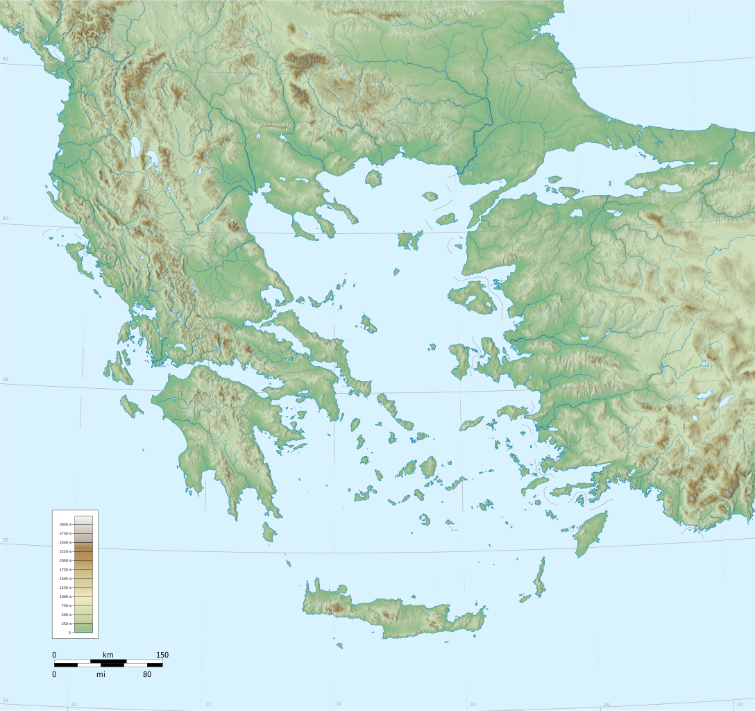
English: Southern
Balkans (incl.
Greece,
Albania,
Macedonia),
Aegean and western
Anatolia.
Blank topographic basemap: coastlines + water bodies as per SWBD, elevation contours from SRTM. Modern international boundaries added from VMAP0. Coverage: c.34°N 19°E – 42.4°N 31°E. Projection: Lambert Conformal Conic, Lon0=24,Lat0=38.5,Lat1=43,Lat2=34 Relief coloring and shading is an embedded bitmap; coastlines and other layers in SVG |
| Date | |
| Source | Own work |
| Author | Fut.Perf. |
| Other versions |
Derivative works of this file:
|
| SVG development |
Licensing
| I, the copyright holder of this work, release this work into the
public domain. This applies worldwide. In some countries this may not be legally possible; if so: I grant anyone the right to use this work for any purpose, without any conditions, unless such conditions are required by law. |
File history
Click on a date/time to view the file as it appeared at that time.
| Date/Time | Thumbnail | Dimensions | User | Comment | |
|---|---|---|---|---|---|
| current | 18:25, 6 September 2009 |
| 2,095 × 1,971 (13.21 MB) | Future Perfect at Sunrise | added rivers and color scale |
| 13:21, 1 September 2009 |
 | 2,095 × 1,971 (12.43 MB) | Future Perfect at Sunrise | some fixes | |
| 08:26, 30 August 2009 |
 | 2,095 × 1,971 (13.29 MB) | Future Perfect at Sunrise | reduced even further, still not displaying | |
| 07:46, 30 August 2009 |
 | 2,095 × 1,971 (21.09 MB) | Future Perfect at Sunrise | try smaller embedded bitmap, since previous version wouldn't display | |
| 05:14, 30 August 2009 |
 | 2,095 × 1,971 (29.08 MB) | Future Perfect at Sunrise | {{Information |Description={{en|1=Southern Balkans (incl. Greece, Albania, Macedonia), Aegean and western Anatolia. Blank topographic basemap |
File usage
Global file usage
The following other wikis use this file:
- Usage on fr.wikipedia.org
- Usage on he.wikipedia.org
- Usage on hyw.wikipedia.org
- Usage on lv.wikipedia.org
Original file (SVG file, nominally 2,095 × 1,971 pixels, file size: 13.21 MB)
| This is a file from the
Wikimedia Commons. Information from its
description page there is shown below. Commons is a freely licensed media file repository. You can help. |
Summary
| Description |
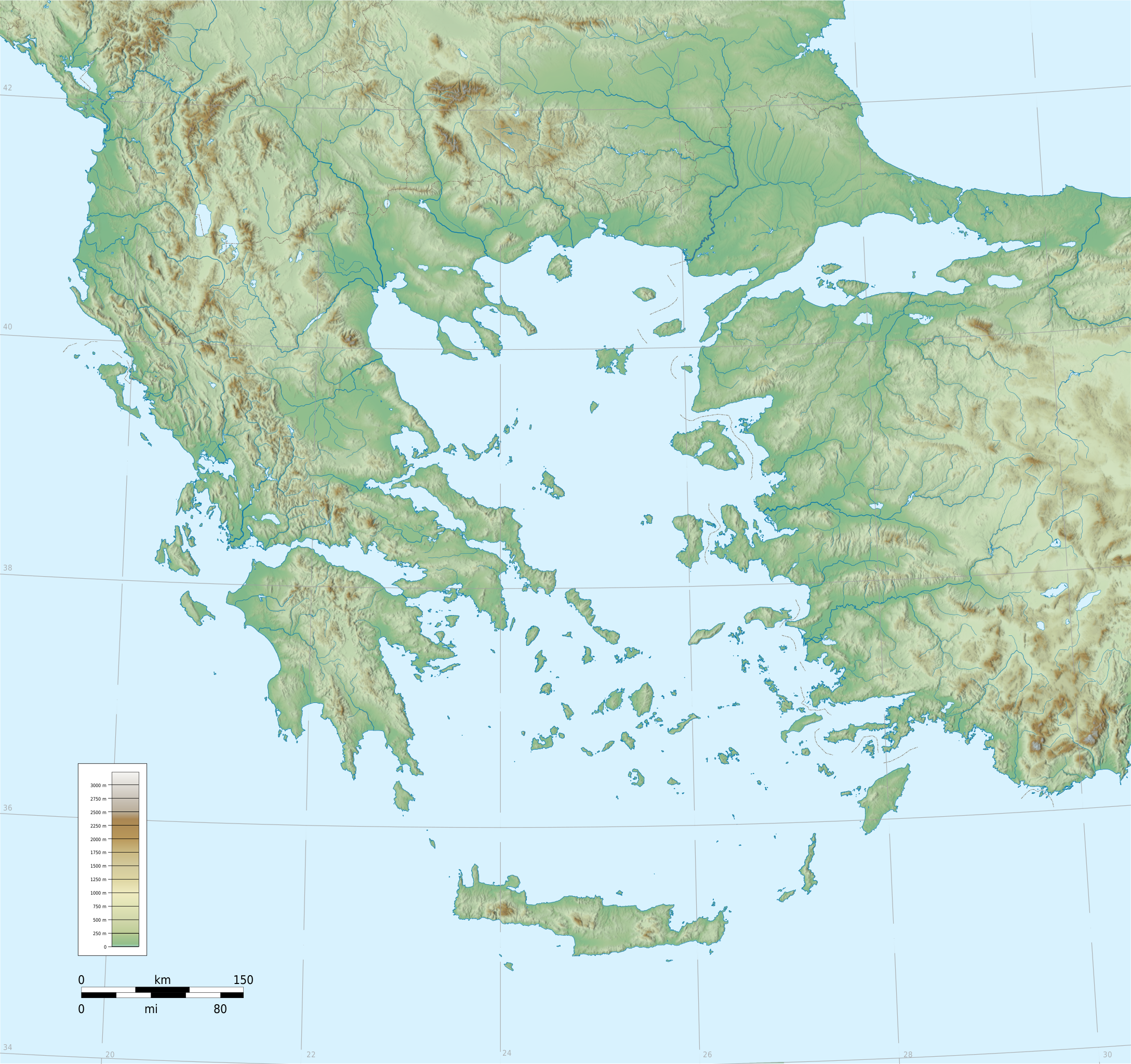
English: Southern
Balkans (incl.
Greece,
Albania,
Macedonia),
Aegean and western
Anatolia.
Blank topographic basemap: coastlines + water bodies as per SWBD, elevation contours from SRTM. Modern international boundaries added from VMAP0. Coverage: c.34°N 19°E – 42.4°N 31°E. Projection: Lambert Conformal Conic, Lon0=24,Lat0=38.5,Lat1=43,Lat2=34 Relief coloring and shading is an embedded bitmap; coastlines and other layers in SVG |
| Date | |
| Source | Own work |
| Author | Fut.Perf. |
| Other versions |
Derivative works of this file:
|
| SVG development |
Licensing
| I, the copyright holder of this work, release this work into the
public domain. This applies worldwide. In some countries this may not be legally possible; if so: I grant anyone the right to use this work for any purpose, without any conditions, unless such conditions are required by law. |
File history
Click on a date/time to view the file as it appeared at that time.
| Date/Time | Thumbnail | Dimensions | User | Comment | |
|---|---|---|---|---|---|
| current | 18:25, 6 September 2009 |
| 2,095 × 1,971 (13.21 MB) | Future Perfect at Sunrise | added rivers and color scale |
| 13:21, 1 September 2009 |
| 2,095 × 1,971 (12.43 MB) | Future Perfect at Sunrise | some fixes | |
| 08:26, 30 August 2009 |
| 2,095 × 1,971 (13.29 MB) | Future Perfect at Sunrise | reduced even further, still not displaying | |
| 07:46, 30 August 2009 |
| 2,095 × 1,971 (21.09 MB) | Future Perfect at Sunrise | try smaller embedded bitmap, since previous version wouldn't display | |
| 05:14, 30 August 2009 |
| 2,095 × 1,971 (29.08 MB) | Future Perfect at Sunrise | {{Information |Description={{en|1=Southern Balkans (incl. Greece, Albania, Macedonia), Aegean and western Anatolia. Blank topographic basemap |
File usage
Global file usage
The following other wikis use this file:
- Usage on fr.wikipedia.org
- Usage on he.wikipedia.org
- Usage on hyw.wikipedia.org
- Usage on lv.wikipedia.org