Photos • Location


No higher resolution available.
Gnadenhutten_Tract.png (762 × 544 pixels, file size: 91 KB, MIME type: image/png)
| This is a file from the
Wikimedia Commons. Information from its
description page there is shown below. Commons is a freely licensed media file repository. You can help. |
Summary
| Description |
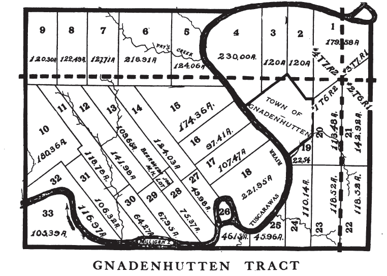
English: A map of a tract of land in
Tuscarawas County, Ohio set aside for
Christian Munsee in the 18th century. see
Moravian Indian Grants |
| Date | |
| Source | Peters, William E (1918) Ohio Lands and Their Subdivision, W.E. Peters, p. 208 |
| Author | William Peters |
| Camera location |
| View this and other nearby images on: OpenStreetMap |
|
|---|
Licensing
This work is in the
public domain in the
United States because it was
published (or registered with the
U.S. Copyright Office) before January 1, 1929.
Public domain works must be out of copyright in both the United States and in the source country of the work in order to be hosted on the Commons. If the work is not a U.S. work, the file must have an additional
copyright tag indicating the copyright status in the source country.
Note: This tag should not be used for sound recordings. |
File history
Click on a date/time to view the file as it appeared at that time.
| Date/Time | Thumbnail | Dimensions | User | Comment | |
|---|---|---|---|---|---|
| current | 21:26, 17 October 2014 |
| 762 × 544 (91 KB) | Roseohioresident | {{Information |Description ={{en|1=A map of a tract of land in {{w|Tuscarawas County,Ohio}} set aside for {{w|Christian Munsee}} in the 18th century. see {{w|Moravian Indian Grants}}}} |Source ={{cite book |title=Ohio Lands and Their Subdiv... |
File usage
The following pages on the English Wikipedia use this file (pages on other projects are not listed):
Metadata
No higher resolution available.
Gnadenhutten_Tract.png (762 × 544 pixels, file size: 91 KB, MIME type: image/png)
| This is a file from the
Wikimedia Commons. Information from its
description page there is shown below. Commons is a freely licensed media file repository. You can help. |
Summary
| Description |
English: A map of a tract of land in
Tuscarawas County, Ohio set aside for
Christian Munsee in the 18th century. see
Moravian Indian Grants |
| Date | |
| Source | Peters, William E (1918) Ohio Lands and Their Subdivision, W.E. Peters, p. 208 |
| Author | William Peters |
| Camera location |
| View this and other nearby images on: OpenStreetMap |
|
|---|
Licensing
This work is in the
public domain in the
United States because it was
published (or registered with the
U.S. Copyright Office) before January 1, 1929.
Public domain works must be out of copyright in both the United States and in the source country of the work in order to be hosted on the Commons. If the work is not a U.S. work, the file must have an additional
copyright tag indicating the copyright status in the source country.
Note: This tag should not be used for sound recordings. |
File history
Click on a date/time to view the file as it appeared at that time.
| Date/Time | Thumbnail | Dimensions | User | Comment | |
|---|---|---|---|---|---|
| current | 21:26, 17 October 2014 |
| 762 × 544 (91 KB) | Roseohioresident | {{Information |Description ={{en|1=A map of a tract of land in {{w|Tuscarawas County,Ohio}} set aside for {{w|Christian Munsee}} in the 18th century. see {{w|Moravian Indian Grants}}}} |Source ={{cite book |title=Ohio Lands and Their Subdiv... |
File usage
The following pages on the English Wikipedia use this file (pages on other projects are not listed):