Photos • Location


No higher resolution available.
Gara_Timisoara_Nord.png (600 × 398 pixels, file size: 256 KB, MIME type: image/png)
| This is a file from the
Wikimedia Commons. Information from its
description page there is shown below. Commons is a freely licensed media file repository. You can help. |
Summary
| Description |
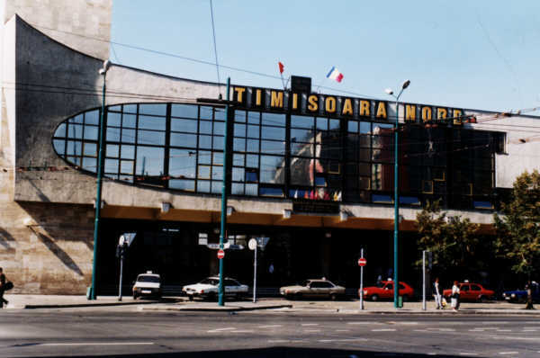
Română: Gara Timisoara Nord. |
| Date | |
| Source | |
| Author |
| Camera location | | View this and other nearby images on: OpenStreetMap |
|
|---|
Licensing
| |
This work has been released into the
public domain by its author,
Goliath, at the
English Wikipedia project. This applies worldwide. In case this is not legally possible: |
File history
Click on a date/time to view the file as it appeared at that time.
| Date/Time | Thumbnail | Dimensions | User | Comment | |
|---|---|---|---|---|---|
| current | 17:07, 12 November 2009 |
| 600 × 398 (256 KB) | Dr-Victor-von-Doom | {{Information |Description=Gara Timisoara Nord |Source= ro:Fişier:Gara Timisoara Nord.png |Date=2007-02-16 |Author= ro:Utilizator:Goliath |Permission={{PD-user-w|ro|wikipedia|Goliath}} |other_versions= }} Category:Timişoara |
File usage
The following pages on the English Wikipedia use this file (pages on other projects are not listed):
Global file usage
The following other wikis use this file:
- Usage on de.wikipedia.org
- Usage on es.wikipedia.org
- Usage on ja.wikipedia.org
- Usage on pl.wikipedia.org
- Usage on ro.wikipedia.org
No higher resolution available.
Gara_Timisoara_Nord.png (600 × 398 pixels, file size: 256 KB, MIME type: image/png)
| This is a file from the
Wikimedia Commons. Information from its
description page there is shown below. Commons is a freely licensed media file repository. You can help. |
Summary
| Description |
Română: Gara Timisoara Nord. |
| Date | |
| Source | |
| Author |
| Camera location | | View this and other nearby images on: OpenStreetMap |
|
|---|
Licensing
| |
This work has been released into the
public domain by its author,
Goliath, at the
English Wikipedia project. This applies worldwide. In case this is not legally possible: |
File history
Click on a date/time to view the file as it appeared at that time.
| Date/Time | Thumbnail | Dimensions | User | Comment | |
|---|---|---|---|---|---|
| current | 17:07, 12 November 2009 |
| 600 × 398 (256 KB) | Dr-Victor-von-Doom | {{Information |Description=Gara Timisoara Nord |Source= ro:Fişier:Gara Timisoara Nord.png |Date=2007-02-16 |Author= ro:Utilizator:Goliath |Permission={{PD-user-w|ro|wikipedia|Goliath}} |other_versions= }} Category:Timişoara |
File usage
The following pages on the English Wikipedia use this file (pages on other projects are not listed):
Global file usage
The following other wikis use this file:
- Usage on de.wikipedia.org
- Usage on es.wikipedia.org
- Usage on ja.wikipedia.org
- Usage on pl.wikipedia.org
- Usage on ro.wikipedia.org