Photos • Location


Size of this preview:
800 × 533 pixels. Other resolutions:
320 × 213 pixels |
640 × 427 pixels |
1,024 × 683 pixels |
1,280 × 853 pixels |
2,560 × 1,707 pixels |
3,456 × 2,304 pixels.
Original file (3,456 × 2,304 pixels, file size: 2.79 MB, MIME type: image/jpeg)
| This is a file from the
Wikimedia Commons. Information from its
description page there is shown below. Commons is a freely licensed media file repository. You can help. |
Summary
| Description |
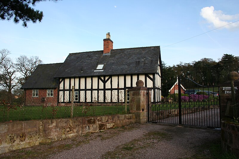
English: Black-and-white cottage below Kidnal Hill Half-timbered cottage at foot of byway Overton BY11 over Kidnal Hill. |
| Date | |
| Source | Own work |
| Author | Dave Dunford |
| Other versions | |
| Attribution ( required by the license) | Dave Dunford / Black-and-white cottage below Kidnal Hill / |
| Camera location | | View this and other nearby images on: OpenStreetMap |
|
|---|
_heading:112.00&language=en)
| Object location | | View this and other nearby images on: OpenStreetMap |
|
|---|
_heading:112.00&language=en)
Licensing
This file is licensed under the
Creative Commons
Attribution-Share Alike 2.0 Generic license.
Attribution: Dave Dunford
- You are free:
- to share – to copy, distribute and transmit the work
- to remix – to adapt the work
- Under the following conditions:
- attribution – You must give appropriate credit, provide a link to the license, and indicate if changes were made. You may do so in any reasonable manner, but not in any way that suggests the licensor endorses you or your use.
- share alike – If you remix, transform, or build upon the material, you must distribute your contributions under the same or compatible license as the original.
File history
Click on a date/time to view the file as it appeared at that time.
| Date/Time | Thumbnail | Dimensions | User | Comment | |
|---|---|---|---|---|---|
| current | 19:22, 21 December 2020 |
| 3,456 × 2,304 (2.79 MB) | Dave.Dunford | Uploaded own work with UploadWizard |
| 15:58, 26 February 2011 |
 | 640 × 426 (43 KB) | GeographBot | == {{int:filedesc}} == {{Information |description={{en|1=Black-and-white cottage below Kidnal Hill Half-timbered cottage at foot of byway Overton BY11 over Kidnal Hill.}} |date=2009-04-05 |source=From [http://www.geograph.org.uk/photo/1244375 geograph.org |
File usage
The following pages on the English Wikipedia use this file (pages on other projects are not listed):
Global file usage
The following other wikis use this file:
- Usage on www.wikidata.org
Metadata
Size of this preview:
800 × 533 pixels. Other resolutions:
320 × 213 pixels |
640 × 427 pixels |
1,024 × 683 pixels |
1,280 × 853 pixels |
2,560 × 1,707 pixels |
3,456 × 2,304 pixels.
Original file (3,456 × 2,304 pixels, file size: 2.79 MB, MIME type: image/jpeg)
| This is a file from the
Wikimedia Commons. Information from its
description page there is shown below. Commons is a freely licensed media file repository. You can help. |
Summary
| Description |
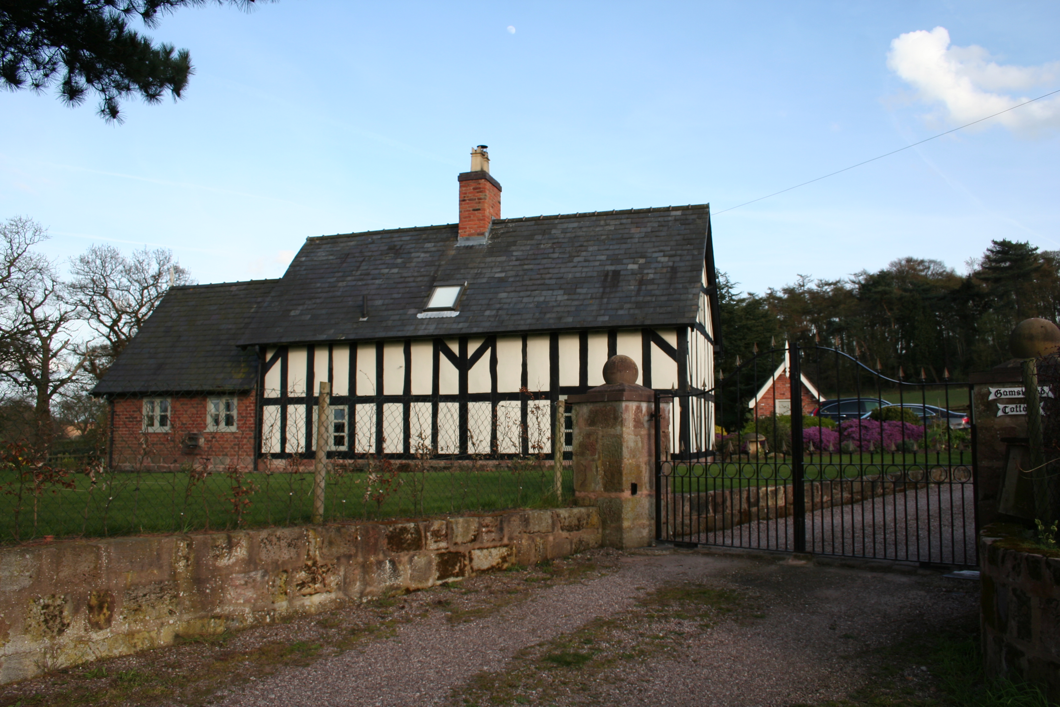
English: Black-and-white cottage below Kidnal Hill Half-timbered cottage at foot of byway Overton BY11 over Kidnal Hill. |
| Date | |
| Source | Own work |
| Author | Dave Dunford |
| Other versions | |
| Attribution ( required by the license) | Dave Dunford / Black-and-white cottage below Kidnal Hill / |
| Camera location | | View this and other nearby images on: OpenStreetMap |
|
|---|
| Object location | | View this and other nearby images on: OpenStreetMap |
|
|---|
Licensing
This file is licensed under the
Creative Commons
Attribution-Share Alike 2.0 Generic license.
Attribution: Dave Dunford
- You are free:
- to share – to copy, distribute and transmit the work
- to remix – to adapt the work
- Under the following conditions:
- attribution – You must give appropriate credit, provide a link to the license, and indicate if changes were made. You may do so in any reasonable manner, but not in any way that suggests the licensor endorses you or your use.
- share alike – If you remix, transform, or build upon the material, you must distribute your contributions under the same or compatible license as the original.
File history
Click on a date/time to view the file as it appeared at that time.
| Date/Time | Thumbnail | Dimensions | User | Comment | |
|---|---|---|---|---|---|
| current | 19:22, 21 December 2020 |
| 3,456 × 2,304 (2.79 MB) | Dave.Dunford | Uploaded own work with UploadWizard |
| 15:58, 26 February 2011 |
| 640 × 426 (43 KB) | GeographBot | == {{int:filedesc}} == {{Information |description={{en|1=Black-and-white cottage below Kidnal Hill Half-timbered cottage at foot of byway Overton BY11 over Kidnal Hill.}} |date=2009-04-05 |source=From [http://www.geograph.org.uk/photo/1244375 geograph.org |
File usage
The following pages on the English Wikipedia use this file (pages on other projects are not listed):
Global file usage
The following other wikis use this file:
- Usage on www.wikidata.org