Fort_Tombecbe.jpg (475 × 449 pixels, file size: 244 KB, MIME type: image/jpeg)
| This is a file from the
Wikimedia Commons. Information from its
description page there is shown below. Commons is a freely licensed media file repository. You can help. |
|
This is an image of a place or building that is listed on the
National Register of Historic Places in the
United States of America. Its reference number is
73000373. |
Summary
| Description |
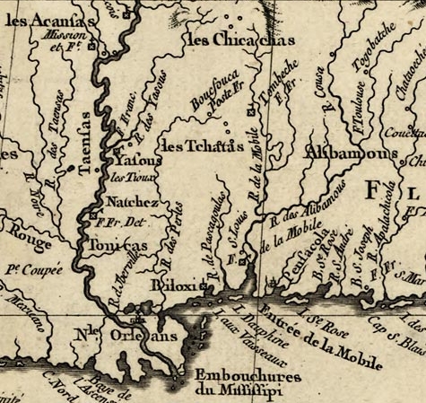
English: A portion of the original map: Louisiana and adjoining countries. Showing the location of Fort Tombecbe in what is now Sumter County, Alabama. Français : La Lousiane et Pays Voisins |
||||
| Date | |||||
| Source |
|
||||
| Author | Jacques Nicolas Bellin | ||||
| Permission ( Reusing this file) |
|
||||

File history
Click on a date/time to view the file as it appeared at that time.
| Date/Time | Thumbnail | Dimensions | User | Comment | |
|---|---|---|---|---|---|
| current | 21:42, 2 December 2008 |
| 475 × 449 (244 KB) | Altairisfar | == Summary == {{Information |Description={{en|A portion of the origianl map: Louisiana and adjoining countries.}}{{fr|La Lousiane et Pays Voisins}} |Source={{LOC-image|id=g3300.ar011101}} |Date=1764 |Author=Jacques Nicolas Bellin |Permission={{PD-old}} |o |
File usage
Global file usage
The following other wikis use this file:
- Usage on arz.wikipedia.org
- Usage on de.wikipedia.org
- Usage on es.wikipedia.org
- Usage on fr.wikipedia.org
- Usage on www.wikidata.org
Metadata
Fort_Tombecbe.jpg (475 × 449 pixels, file size: 244 KB, MIME type: image/jpeg)
| This is a file from the
Wikimedia Commons. Information from its
description page there is shown below. Commons is a freely licensed media file repository. You can help. |
|
This is an image of a place or building that is listed on the
National Register of Historic Places in the
United States of America. Its reference number is
73000373. |
Summary
| Description |
English: A portion of the original map: Louisiana and adjoining countries. Showing the location of Fort Tombecbe in what is now Sumter County, Alabama. Français : La Lousiane et Pays Voisins |
||||
| Date | |||||
| Source |
|
||||
| Author | Jacques Nicolas Bellin | ||||
| Permission ( Reusing this file) |
|
||||
File history
Click on a date/time to view the file as it appeared at that time.
| Date/Time | Thumbnail | Dimensions | User | Comment | |
|---|---|---|---|---|---|
| current | 21:42, 2 December 2008 |
| 475 × 449 (244 KB) | Altairisfar | == Summary == {{Information |Description={{en|A portion of the origianl map: Louisiana and adjoining countries.}}{{fr|La Lousiane et Pays Voisins}} |Source={{LOC-image|id=g3300.ar011101}} |Date=1764 |Author=Jacques Nicolas Bellin |Permission={{PD-old}} |o |
File usage
Global file usage
The following other wikis use this file:
- Usage on arz.wikipedia.org
- Usage on de.wikipedia.org
- Usage on es.wikipedia.org
- Usage on fr.wikipedia.org
- Usage on www.wikidata.org