
Size of this preview:
800 × 533 pixels. Other resolutions:
320 × 213 pixels |
640 × 427 pixels |
879 × 586 pixels.
Original file (879 × 586 pixels, file size: 237 KB, MIME type: image/jpeg)
| This is a file from the
Wikimedia Commons. Information from its
description page there is shown below. Commons is a freely licensed media file repository. You can help. |
Summary
| Description |
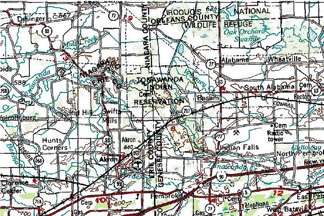
English: Topographic map of former NY 267 routing in Erie and Genesee Counties, New York. |
| Date | |
| Source | Microsoft Research Maps (formerly TerraServer-USA) |
| Author | United States Geological Survey (image blown up by Ngs61) |
Licensing
This image is in the
public domain in the United States because it only contains materials that originally came from the
United States Geological Survey, an agency of the
United States Department of the Interior. For more information, see
the official USGS copyright policy.
|
File history
Click on a date/time to view the file as it appeared at that time.
| Date/Time | Thumbnail | Dimensions | User | Comment | |
|---|---|---|---|---|---|
| current | 17:54, 2 March 2009 |
| 879 × 586 (237 KB) | Ngs61 | {{Information {{Information |Description=1948 topographic quadrangle of former New York State Route 17J |Source=[http://terraserver-usa.com/usgsentry.aspx?T=2&S=15&Z=17&X=110&Y=744&W=3 TerraServer USA] |Date=2009-03-02 |Author=United states geological sur |
File usage
The following pages on the English Wikipedia use this file (pages on other projects are not listed):
Size of this preview:
800 × 533 pixels. Other resolutions:
320 × 213 pixels |
640 × 427 pixels |
879 × 586 pixels.
Original file (879 × 586 pixels, file size: 237 KB, MIME type: image/jpeg)
| This is a file from the
Wikimedia Commons. Information from its
description page there is shown below. Commons is a freely licensed media file repository. You can help. |
Summary
| Description |
English: Topographic map of former NY 267 routing in Erie and Genesee Counties, New York. |
| Date | |
| Source | Microsoft Research Maps (formerly TerraServer-USA) |
| Author | United States Geological Survey (image blown up by Ngs61) |
Licensing
This image is in the
public domain in the United States because it only contains materials that originally came from the
United States Geological Survey, an agency of the
United States Department of the Interior. For more information, see
the official USGS copyright policy.
|
File history
Click on a date/time to view the file as it appeared at that time.
| Date/Time | Thumbnail | Dimensions | User | Comment | |
|---|---|---|---|---|---|
| current | 17:54, 2 March 2009 |
| 879 × 586 (237 KB) | Ngs61 | {{Information {{Information |Description=1948 topographic quadrangle of former New York State Route 17J |Source=[http://terraserver-usa.com/usgsentry.aspx?T=2&S=15&Z=17&X=110&Y=744&W=3 TerraServer USA] |Date=2009-03-02 |Author=United states geological sur |
File usage
The following pages on the English Wikipedia use this file (pages on other projects are not listed):