Photos • Location


Size of this preview:
800 × 533 pixels. Other resolutions:
320 × 213 pixels |
640 × 427 pixels |
1,024 × 683 pixels |
1,280 × 853 pixels |
2,560 × 1,707 pixels |
4,200 × 2,800 pixels.
Original file (4,200 × 2,800 pixels, file size: 4.78 MB, MIME type: image/jpeg)
| This is a file from the
Wikimedia Commons. Information from its
description page there is shown below. Commons is a freely licensed media file repository. You can help. |
Summary
| Description |
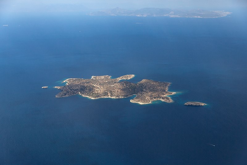
Deutsch: Die Insel
Fleves, im Hintergund
Ägina, im
Saronischen Golf vor dem
griechischen Festland nahe
Athen.
|
| Date | |
| Source | Own work |
| Author | Manfred Werner (Tsui) |
| Permission ( Reusing this file) |
Manfred Werner (Tsui) cc-by-sa4.0 |
| Object location |
| View this and other nearby images on: OpenStreetMap |
|
|---|
| Camera location | | View this and other nearby images on: OpenStreetMap |
|
|---|
|
The making of this work was supported by Wikimedia Austria. For other files made with the support of Wikimedia Austria, please see the category Supported by Wikimedia Österreich. |
Licensing
This file is licensed under the
Creative Commons
Attribution-Share Alike 4.0 International license.
Attribution:
Manfred Werner (Tsui)
- You are free:
- to share – to copy, distribute and transmit the work
- to remix – to adapt the work
- Under the following conditions:
- attribution – You must give appropriate credit, provide a link to the license, and indicate if changes were made. You may do so in any reasonable manner, but not in any way that suggests the licensor endorses you or your use.
- share alike – If you remix, transform, or build upon the material, you must distribute your contributions under the same or compatible license as the original.
File history
Click on a date/time to view the file as it appeared at that time.
| Date/Time | Thumbnail | Dimensions | User | Comment | |
|---|---|---|---|---|---|
| current | 17:33, 23 October 2020 |
| 4,200 × 2,800 (4.78 MB) | Tsui | == {{int:filedesc}} == {{Information |description={{de|1=Die Insel Fleves, im Hintergund Ägina, im Saronischen Golf vor dem griechischen Festland nahe Athen.}} {{el| Φλέβες, Σαρωνικός κόλπος, Ελλάδα.}} {{en|1= Fleves island, Saronic Gulf, Greece.}} |date=2020-08-21 |source={{own}} |Au... |
File usage
The following pages on the English Wikipedia use this file (pages on other projects are not listed):
Global file usage
The following other wikis use this file:
- Usage on ceb.wikipedia.org
- Usage on cs.wikipedia.org
- Usage on el.wikipedia.org
- Usage on el.wiktionary.org
- Usage on en.wikivoyage.org
- Usage on es.wikipedia.org
- Usage on fi.wikipedia.org
- Usage on gl.wikipedia.org
- Usage on hyw.wikipedia.org
- Usage on it.wikivoyage.org
- Usage on ru.wikipedia.org
- Usage on www.wikidata.org
Metadata
Size of this preview:
800 × 533 pixels. Other resolutions:
320 × 213 pixels |
640 × 427 pixels |
1,024 × 683 pixels |
1,280 × 853 pixels |
2,560 × 1,707 pixels |
4,200 × 2,800 pixels.
Original file (4,200 × 2,800 pixels, file size: 4.78 MB, MIME type: image/jpeg)
| This is a file from the
Wikimedia Commons. Information from its
description page there is shown below. Commons is a freely licensed media file repository. You can help. |
Summary
| Description |
Deutsch: Die Insel
Fleves, im Hintergund
Ägina, im
Saronischen Golf vor dem
griechischen Festland nahe
Athen.
|
| Date | |
| Source | Own work |
| Author | Manfred Werner (Tsui) |
| Permission ( Reusing this file) |
Manfred Werner (Tsui) cc-by-sa4.0 |
| Object location |
| View this and other nearby images on: OpenStreetMap |
|
|---|
| Camera location | | View this and other nearby images on: OpenStreetMap |
|
|---|
|
The making of this work was supported by Wikimedia Austria. For other files made with the support of Wikimedia Austria, please see the category Supported by Wikimedia Österreich. |
Licensing
This file is licensed under the
Creative Commons
Attribution-Share Alike 4.0 International license.
Attribution:
Manfred Werner (Tsui)
- You are free:
- to share – to copy, distribute and transmit the work
- to remix – to adapt the work
- Under the following conditions:
- attribution – You must give appropriate credit, provide a link to the license, and indicate if changes were made. You may do so in any reasonable manner, but not in any way that suggests the licensor endorses you or your use.
- share alike – If you remix, transform, or build upon the material, you must distribute your contributions under the same or compatible license as the original.
File history
Click on a date/time to view the file as it appeared at that time.
| Date/Time | Thumbnail | Dimensions | User | Comment | |
|---|---|---|---|---|---|
| current | 17:33, 23 October 2020 |
| 4,200 × 2,800 (4.78 MB) | Tsui | == {{int:filedesc}} == {{Information |description={{de|1=Die Insel Fleves, im Hintergund Ägina, im Saronischen Golf vor dem griechischen Festland nahe Athen.}} {{el| Φλέβες, Σαρωνικός κόλπος, Ελλάδα.}} {{en|1= Fleves island, Saronic Gulf, Greece.}} |date=2020-08-21 |source={{own}} |Au... |
File usage
The following pages on the English Wikipedia use this file (pages on other projects are not listed):
Global file usage
The following other wikis use this file:
- Usage on ceb.wikipedia.org
- Usage on cs.wikipedia.org
- Usage on el.wikipedia.org
- Usage on el.wiktionary.org
- Usage on en.wikivoyage.org
- Usage on es.wikipedia.org
- Usage on fi.wikipedia.org
- Usage on gl.wikipedia.org
- Usage on hyw.wikipedia.org
- Usage on it.wikivoyage.org
- Usage on ru.wikipedia.org
- Usage on www.wikidata.org