Photos • Location


Size of this preview:
693 × 600 pixels. Other resolutions:
277 × 240 pixels |
555 × 480 pixels |
887 × 768 pixels |
1,183 × 1,024 pixels |
2,366 × 2,048 pixels |
3,612 × 3,126 pixels.
Original file (3,612 × 3,126 pixels, file size: 850 KB, MIME type: image/jpeg)
| This is a file from the
Wikimedia Commons. Information from its
description page there is shown below. Commons is a freely licensed media file repository. You can help. |
Summary
| Description |
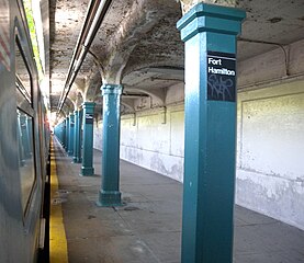
English: Looking south along southbound platform at
en:Fort Hamilton Parkway (BMT Sea Beach Line) station platform. |
| Date | |
| Source | Own work |
| Author | Jim.henderson |
| Camera location | | View this and other nearby images on: OpenStreetMap |
|
|---|
Licensing
| I, the copyright holder of this work, release this work into the
public domain. This applies worldwide. In some countries this may not be legally possible; if so: I grant anyone the right to use this work for any purpose, without any conditions, unless such conditions are required by law. |
File history
Click on a date/time to view the file as it appeared at that time.
| Date/Time | Thumbnail | Dimensions | User | Comment | |
|---|---|---|---|---|---|
| current | 01:27, 5 June 2009 |
| 3,612 × 3,126 (850 KB) | Jim.henderson | {{Information |Description={{en|1=Looking east along southbound platform at Fort Hamilton Parkway station platform.}} |Source=Own work by uploader |Author= Jim.henderson |Date=2009-05-20 |Permission= |other_versions= }} <!--{{ImageU |
File usage
The following pages on the English Wikipedia use this file (pages on other projects are not listed):
Global file usage
The following other wikis use this file:
- Usage on es.wikipedia.org
- Usage on pl.wikipedia.org
- Usage on ru.wikipedia.org
- Usage on zh.wikipedia.org
Metadata
Size of this preview:
693 × 600 pixels. Other resolutions:
277 × 240 pixels |
555 × 480 pixels |
887 × 768 pixels |
1,183 × 1,024 pixels |
2,366 × 2,048 pixels |
3,612 × 3,126 pixels.
Original file (3,612 × 3,126 pixels, file size: 850 KB, MIME type: image/jpeg)
| This is a file from the
Wikimedia Commons. Information from its
description page there is shown below. Commons is a freely licensed media file repository. You can help. |
Summary
| Description |
English: Looking south along southbound platform at
en:Fort Hamilton Parkway (BMT Sea Beach Line) station platform. |
| Date | |
| Source | Own work |
| Author | Jim.henderson |
| Camera location | | View this and other nearby images on: OpenStreetMap |
|
|---|
Licensing
| I, the copyright holder of this work, release this work into the
public domain. This applies worldwide. In some countries this may not be legally possible; if so: I grant anyone the right to use this work for any purpose, without any conditions, unless such conditions are required by law. |
File history
Click on a date/time to view the file as it appeared at that time.
| Date/Time | Thumbnail | Dimensions | User | Comment | |
|---|---|---|---|---|---|
| current | 01:27, 5 June 2009 |
| 3,612 × 3,126 (850 KB) | Jim.henderson | {{Information |Description={{en|1=Looking east along southbound platform at Fort Hamilton Parkway station platform.}} |Source=Own work by uploader |Author= Jim.henderson |Date=2009-05-20 |Permission= |other_versions= }} <!--{{ImageU |
File usage
The following pages on the English Wikipedia use this file (pages on other projects are not listed):
Global file usage
The following other wikis use this file:
- Usage on es.wikipedia.org
- Usage on pl.wikipedia.org
- Usage on ru.wikipedia.org
- Usage on zh.wikipedia.org