Photos • Location


Size of this preview:
800 × 520 pixels. Other resolutions:
320 × 208 pixels |
640 × 416 pixels |
1,024 × 666 pixels |
1,280 × 832 pixels |
2,394 × 1,557 pixels.
Original file (2,394 × 1,557 pixels, file size: 3.27 MB, MIME type: image/jpeg)
| This is a file from the
Wikimedia Commons. Information from its
description page there is shown below. Commons is a freely licensed media file repository. You can help. |
Summary
| Description |
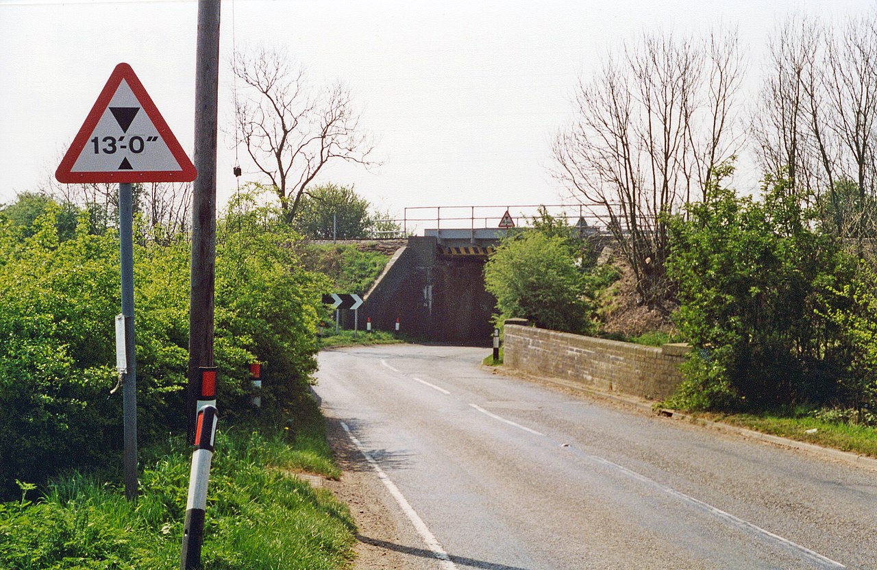
English: Site of former East Langton station. View southward on B6047, to the bridge carrying the ex-Midland London St Pancras - Kettering (to left) - (to right) Leicester and the North. The station, which had been on the left, was closed from 1/1/68. |
| Date | |
| Source | From geograph.org.uk |
| Author | Ben Brooksbank |
| Permission ( Reusing this file) |
Creative Commons Attribution Share-alike license 2.0 |
| Attribution ( required by the license) | Ben Brooksbank / Site of former East Langton station / |
| Camera location | | View this and other nearby images on: OpenStreetMap |
|
|---|
Licensing

|
This image was taken from the
Geograph project collection. See
this photograph's page on the Geograph website for the photographer's contact details. The copyright on this image is owned by Ben Brooksbank and is licensed for reuse under the
Creative Commons Attribution-ShareAlike 2.0 license.
|
This file is licensed under the
Creative Commons
Attribution-Share Alike 2.0 Generic license.
Attribution: Ben Brooksbank
- You are free:
- to share – to copy, distribute and transmit the work
- to remix – to adapt the work
- Under the following conditions:
- attribution – You must give appropriate credit, provide a link to the license, and indicate if changes were made. You may do so in any reasonable manner, but not in any way that suggests the licensor endorses you or your use.
- share alike – If you remix, transform, or build upon the material, you must distribute your contributions under the same or compatible license as the original.
File history
Click on a date/time to view the file as it appeared at that time.
| Date/Time | Thumbnail | Dimensions | User | Comment | |
|---|---|---|---|---|---|
| current | 10:35, 23 March 2014 |
| 2,394 × 1,557 (3.27 MB) | Chevin | == {{int:filedesc}} == {{Information |Description={{en|1='''Site of former East Langton station.'''<br/> View southward on B6047, to the bridge carrying the ex-Midland London St Pancras - Kettering (to left) - (to right) Leicester and the North. The st... |
File usage
The following pages on the English Wikipedia use this file (pages on other projects are not listed):
Global file usage
The following other wikis use this file:
- Usage on www.wikidata.org
Metadata
Size of this preview:
800 × 520 pixels. Other resolutions:
320 × 208 pixels |
640 × 416 pixels |
1,024 × 666 pixels |
1,280 × 832 pixels |
2,394 × 1,557 pixels.
Original file (2,394 × 1,557 pixels, file size: 3.27 MB, MIME type: image/jpeg)
| This is a file from the
Wikimedia Commons. Information from its
description page there is shown below. Commons is a freely licensed media file repository. You can help. |
Summary
| Description |
English: Site of former East Langton station. View southward on B6047, to the bridge carrying the ex-Midland London St Pancras - Kettering (to left) - (to right) Leicester and the North. The station, which had been on the left, was closed from 1/1/68. |
| Date | |
| Source | From geograph.org.uk |
| Author | Ben Brooksbank |
| Permission ( Reusing this file) |
Creative Commons Attribution Share-alike license 2.0 |
| Attribution ( required by the license) | Ben Brooksbank / Site of former East Langton station / |
| Camera location | | View this and other nearby images on: OpenStreetMap |
|
|---|
Licensing
|
|
This image was taken from the
Geograph project collection. See
this photograph's page on the Geograph website for the photographer's contact details. The copyright on this image is owned by Ben Brooksbank and is licensed for reuse under the
Creative Commons Attribution-ShareAlike 2.0 license.
|
This file is licensed under the
Creative Commons
Attribution-Share Alike 2.0 Generic license.
Attribution: Ben Brooksbank
- You are free:
- to share – to copy, distribute and transmit the work
- to remix – to adapt the work
- Under the following conditions:
- attribution – You must give appropriate credit, provide a link to the license, and indicate if changes were made. You may do so in any reasonable manner, but not in any way that suggests the licensor endorses you or your use.
- share alike – If you remix, transform, or build upon the material, you must distribute your contributions under the same or compatible license as the original.
File history
Click on a date/time to view the file as it appeared at that time.
| Date/Time | Thumbnail | Dimensions | User | Comment | |
|---|---|---|---|---|---|
| current | 10:35, 23 March 2014 |
| 2,394 × 1,557 (3.27 MB) | Chevin | == {{int:filedesc}} == {{Information |Description={{en|1='''Site of former East Langton station.'''<br/> View southward on B6047, to the bridge carrying the ex-Midland London St Pancras - Kettering (to left) - (to right) Leicester and the North. The st... |
File usage
The following pages on the English Wikipedia use this file (pages on other projects are not listed):
Global file usage
The following other wikis use this file:
- Usage on www.wikidata.org