
Size of this PNG preview of this SVG file:
800 × 345 pixels. Other resolutions:
320 × 138 pixels |
640 × 276 pixels |
1,024 × 442 pixels |
1,280 × 552 pixels |
2,560 × 1,104 pixels |
1,152 × 497 pixels.
Original file (SVG file, nominally 1,152 × 497 pixels, file size: 493 KB)
| This is a file from the
Wikimedia Commons. Information from its
description page there is shown below. Commons is a freely licensed media file repository. You can help. |
.svg)
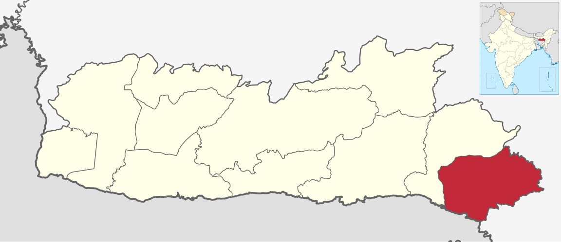
| Description | Map of East Jaintia Hills district of Meghalaya |
| Date | 9 March 2021 |
| Source | Derivative of File:India Meghalaya location map.svg |
| Author | Own work based on User:Milenioscuro |
| Permission ( Reusing this file) |
This file is licensed under the
Creative Commons
Attribution-Share Alike 3.0 Unported license.
|
File history
Click on a date/time to view the file as it appeared at that time.
| Date/Time | Thumbnail | Dimensions | User | Comment | |
|---|---|---|---|---|---|
| current | 05:50, 18 January 2022 |
| 1,152 × 497 (493 KB) | C1MM | updated bounds |
| 03:20, 10 March 2021 |
 | 1,152 × 497 (787 KB) | C1MM | {{Information|Description=Map of East Jaintia Hills district of Meghalaya|Source=Derivative of File:India Meghalaya location map.svg|Date=9 March 2021|Author=Own work based on User:Milenioscuro|Permission={{Cc-by-sa-3.0}}}} Category:SVG locator maps of districts of Meghalaya |
File usage
The following pages on the English Wikipedia use this file (pages on other projects are not listed):
Global file usage
The following other wikis use this file:
- Usage on arz.wikipedia.org
- Usage on as.wikipedia.org
- Usage on bn.wikipedia.org
- Usage on de.wikipedia.org
- Usage on eu.wikipedia.org
- Usage on fa.wikipedia.org
- Usage on fr.wikipedia.org
- Usage on hi.wikipedia.org
- Usage on mr.wikipedia.org
- Usage on oc.wikipedia.org
- Usage on sat.wikipedia.org
- Usage on ta.wikipedia.org
- Usage on te.wikipedia.org
- Usage on ur.wikipedia.org
- Usage on www.wikidata.org
Metadata
.svg)
Size of this PNG preview of this SVG file:
800 × 345 pixels. Other resolutions:
320 × 138 pixels |
640 × 276 pixels |
1,024 × 442 pixels |
1,280 × 552 pixels |
2,560 × 1,104 pixels |
1,152 × 497 pixels.
Original file (SVG file, nominally 1,152 × 497 pixels, file size: 493 KB)
| This is a file from the
Wikimedia Commons. Information from its
description page there is shown below. Commons is a freely licensed media file repository. You can help. |
| Description | Map of East Jaintia Hills district of Meghalaya |
| Date | 9 March 2021 |
| Source | Derivative of File:India Meghalaya location map.svg |
| Author | Own work based on User:Milenioscuro |
| Permission ( Reusing this file) |
This file is licensed under the
Creative Commons
Attribution-Share Alike 3.0 Unported license.
|
File history
Click on a date/time to view the file as it appeared at that time.
| Date/Time | Thumbnail | Dimensions | User | Comment | |
|---|---|---|---|---|---|
| current | 05:50, 18 January 2022 |
| 1,152 × 497 (493 KB) | C1MM | updated bounds |
| 03:20, 10 March 2021 |
| 1,152 × 497 (787 KB) | C1MM | {{Information|Description=Map of East Jaintia Hills district of Meghalaya|Source=Derivative of File:India Meghalaya location map.svg|Date=9 March 2021|Author=Own work based on User:Milenioscuro|Permission={{Cc-by-sa-3.0}}}} Category:SVG locator maps of districts of Meghalaya |
File usage
The following pages on the English Wikipedia use this file (pages on other projects are not listed):
Global file usage
The following other wikis use this file:
- Usage on arz.wikipedia.org
- Usage on as.wikipedia.org
- Usage on bn.wikipedia.org
- Usage on de.wikipedia.org
- Usage on eu.wikipedia.org
- Usage on fa.wikipedia.org
- Usage on fr.wikipedia.org
- Usage on hi.wikipedia.org
- Usage on mr.wikipedia.org
- Usage on oc.wikipedia.org
- Usage on sat.wikipedia.org
- Usage on ta.wikipedia.org
- Usage on te.wikipedia.org
- Usage on ur.wikipedia.org
- Usage on www.wikidata.org