Photos • Location


No higher resolution available.
Ducklington_village.jpg (640 × 480 pixels, file size: 85 KB, MIME type: image/jpeg)
| This is a file from the
Wikimedia Commons. Information from its
description page there is shown below. Commons is a freely licensed media file repository. You can help. |
This is a photo of
listed building number
1183324. |
| Camera location | | View this and other nearby images on: OpenStreetMap |
|
|---|
| Object location | | View this and other nearby images on: OpenStreetMap |
|
|---|
| Description |
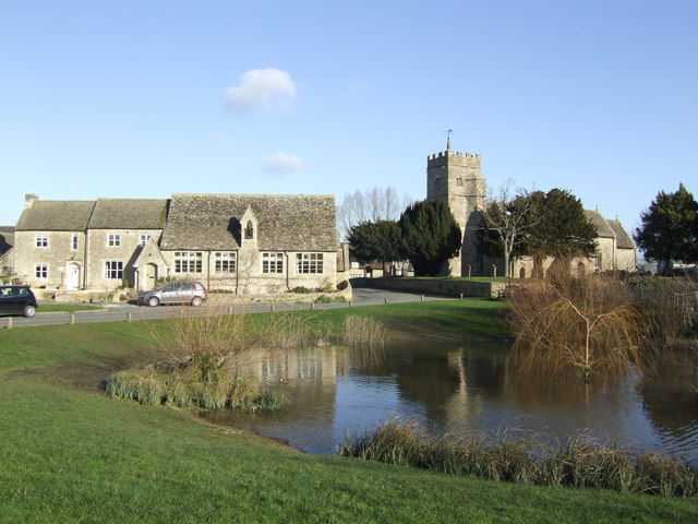
English: Ducklington, Oxfordshire: parish school and St Bartholomew's parish church
This village scene has church, school, and village pond all in shot |
||
| Date | |||
| Source | https://www.geograph.org.uk/photo/319477 | ||
| Author | Jonathan Billinger | ||
| Permission ( Reusing this file) |
This file is licensed under the
Creative Commons
Attribution-Share Alike 2.0 Generic license. Attribution: Johnathan Billinger
|

_region:GB-ENG_heading:67.00&language=en)
File history
Click on a date/time to view the file as it appeared at that time.
| Date/Time | Thumbnail | Dimensions | User | Comment | |
|---|---|---|---|---|---|
| current | 14:34, 6 May 2008 |
| 640 × 480 (85 KB) | Polly | {{Information |Description=Village scene, Ducklington This village scene has church, school, and village pond all in shot |Source=http://www.geograph.org.uk/photo/319477 |Date=Tuesday, 23 January, 2007 |Author=Johnathan Billinger |Permission={{geograph|31 |
File usage
The following pages on the English Wikipedia use this file (pages on other projects are not listed):
Global file usage
The following other wikis use this file:
- Usage on ceb.wikipedia.org
- Usage on fr.wikipedia.org
- Usage on lld.wikipedia.org
- Usage on pl.wikipedia.org
- Usage on www.wikidata.org
- Usage on zh-min-nan.wikipedia.org
Metadata
No higher resolution available.
Ducklington_village.jpg (640 × 480 pixels, file size: 85 KB, MIME type: image/jpeg)
| This is a file from the
Wikimedia Commons. Information from its
description page there is shown below. Commons is a freely licensed media file repository. You can help. |
This is a photo of
listed building number
1183324. |
| Camera location | | View this and other nearby images on: OpenStreetMap |
|
|---|
| Object location | | View this and other nearby images on: OpenStreetMap |
|
|---|
| Description |
English: Ducklington, Oxfordshire: parish school and St Bartholomew's parish church
This village scene has church, school, and village pond all in shot |
||
| Date | |||
| Source | https://www.geograph.org.uk/photo/319477 | ||
| Author | Jonathan Billinger | ||
| Permission ( Reusing this file) |
This file is licensed under the
Creative Commons
Attribution-Share Alike 2.0 Generic license. Attribution: Johnathan Billinger
|
File history
Click on a date/time to view the file as it appeared at that time.
| Date/Time | Thumbnail | Dimensions | User | Comment | |
|---|---|---|---|---|---|
| current | 14:34, 6 May 2008 |
| 640 × 480 (85 KB) | Polly | {{Information |Description=Village scene, Ducklington This village scene has church, school, and village pond all in shot |Source=http://www.geograph.org.uk/photo/319477 |Date=Tuesday, 23 January, 2007 |Author=Johnathan Billinger |Permission={{geograph|31 |
File usage
The following pages on the English Wikipedia use this file (pages on other projects are not listed):
Global file usage
The following other wikis use this file:
- Usage on ceb.wikipedia.org
- Usage on fr.wikipedia.org
- Usage on lld.wikipedia.org
- Usage on pl.wikipedia.org
- Usage on www.wikidata.org
- Usage on zh-min-nan.wikipedia.org