Photos • Location


Size of this preview:
800 × 533 pixels. Other resolutions:
320 × 213 pixels |
640 × 427 pixels |
1,024 × 683 pixels |
1,280 × 853 pixels |
1,920 × 1,280 pixels.
Original file (1,920 × 1,280 pixels, file size: 630 KB, MIME type: image/jpeg)
| This is a file from the
Wikimedia Commons. Information from its
description page there is shown below. Commons is a freely licensed media file repository. You can help. |
Summary
| Description |
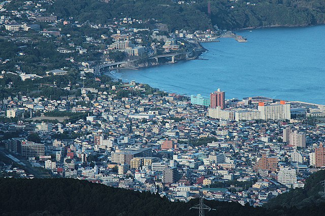
English: Downtown of
Yugawara as seen from the west by south. Taken from Jukkoku Pass. |
||
| Date | |||
| Source | Own work | ||
| Author | Batholith | ||
| Permission ( Reusing this file) |
|
| Object location |
| View this and other nearby images on: OpenStreetMap |
|
|---|
File history
Click on a date/time to view the file as it appeared at that time.
| Date/Time | Thumbnail | Dimensions | User | Comment | |
|---|---|---|---|---|---|
| current | 12:29, 23 August 2012 |
| 1,920 × 1,280 (630 KB) | Batholith | {{Information |Description={{en|Downtown Yugawara.}}{{ja| 神奈川県 湯河原町の中心街。}} |Source={{Own}} |Author= Batholith (Wikimedia Commons)<br />[[:ja... |
File usage
The following pages on the English Wikipedia use this file (pages on other projects are not listed):
Global file usage
The following other wikis use this file:
Metadata
Size of this preview:
800 × 533 pixels. Other resolutions:
320 × 213 pixels |
640 × 427 pixels |
1,024 × 683 pixels |
1,280 × 853 pixels |
1,920 × 1,280 pixels.
Original file (1,920 × 1,280 pixels, file size: 630 KB, MIME type: image/jpeg)
| This is a file from the
Wikimedia Commons. Information from its
description page there is shown below. Commons is a freely licensed media file repository. You can help. |
Summary
| Description |
English: Downtown of
Yugawara as seen from the west by south. Taken from Jukkoku Pass. |
||
| Date | |||
| Source | Own work | ||
| Author | Batholith | ||
| Permission ( Reusing this file) |
|
| Object location |
| View this and other nearby images on: OpenStreetMap |
|
|---|
File history
Click on a date/time to view the file as it appeared at that time.
| Date/Time | Thumbnail | Dimensions | User | Comment | |
|---|---|---|---|---|---|
| current | 12:29, 23 August 2012 |
| 1,920 × 1,280 (630 KB) | Batholith | {{Information |Description={{en|Downtown Yugawara.}}{{ja| 神奈川県 湯河原町の中心街。}} |Source={{Own}} |Author= Batholith (Wikimedia Commons)<br />[[:ja... |
File usage
The following pages on the English Wikipedia use this file (pages on other projects are not listed):
Global file usage
The following other wikis use this file: