Photos • Location


Size of this preview:
443 × 599 pixels. Other resolutions:
177 × 240 pixels |
355 × 480 pixels |
568 × 768 pixels |
757 × 1,024 pixels |
2,202 × 2,977 pixels.
Original file (2,202 × 2,977 pixels, file size: 1.12 MB, MIME type: image/jpeg)
| This is a file from the
Wikimedia Commons. Information from its
description page there is shown below. Commons is a freely licensed media file repository. You can help. |
Summary
| Description |
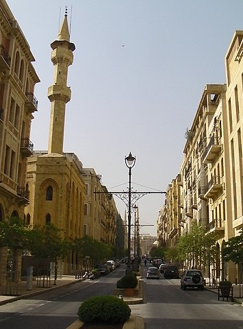
English: Beirut's upscale central business district, just north-west of Martyrs' Square (or Sahet el Shouhada ساحة الشهداء).
Français : le centre-ville de Beyrouth, près de Place des Martyrs
Deutsch: eine Straße in der Innenstadt von Beirut |
| Date | |
| Source | Own work |
| Author | Brian Dell Bdell555 |
| Other versions | Derivative works of this file: Beirut Central District Collage.jpg |
| Camera location | | View this and other nearby images on: OpenStreetMap |
|
|---|
Licensing
| I, the copyright holder of this work, release this work into the
public domain. This applies worldwide. In some countries this may not be legally possible; if so: I grant anyone the right to use this work for any purpose, without any conditions, unless such conditions are required by law. |
File history
Click on a date/time to view the file as it appeared at that time.
| Date/Time | Thumbnail | Dimensions | User | Comment | |
|---|---|---|---|---|---|
| current | 02:33, 18 August 2010 |
| 2,202 × 2,977 (1.12 MB) | Bdell555 | {{Information |Description={{en|1=Beirut's upscale central business district, just north of Martyrs' Square (or Sahet el Shouhada ساحة الشهداء). }} {{fr|1=le centre-ville de Beyrouth, près de Place des Martyrs}} {{de|1=eine Straße in der |
File usage
The following pages on the English Wikipedia use this file (pages on other projects are not listed):
Global file usage
The following other wikis use this file:
- Usage on ar.wikipedia.org
- Usage on es.wikipedia.org
- Usage on fr.wikipedia.org
- Usage on pt.wikipedia.org
- Usage on zh.wikipedia.org
Metadata
Size of this preview:
443 × 599 pixels. Other resolutions:
177 × 240 pixels |
355 × 480 pixels |
568 × 768 pixels |
757 × 1,024 pixels |
2,202 × 2,977 pixels.
Original file (2,202 × 2,977 pixels, file size: 1.12 MB, MIME type: image/jpeg)
| This is a file from the
Wikimedia Commons. Information from its
description page there is shown below. Commons is a freely licensed media file repository. You can help. |
Summary
| Description |
English: Beirut's upscale central business district, just north-west of Martyrs' Square (or Sahet el Shouhada ساحة الشهداء).
Français : le centre-ville de Beyrouth, près de Place des Martyrs
Deutsch: eine Straße in der Innenstadt von Beirut |
| Date | |
| Source | Own work |
| Author | Brian Dell Bdell555 |
| Other versions | Derivative works of this file: Beirut Central District Collage.jpg |
| Camera location | | View this and other nearby images on: OpenStreetMap |
|
|---|
Licensing
| I, the copyright holder of this work, release this work into the
public domain. This applies worldwide. In some countries this may not be legally possible; if so: I grant anyone the right to use this work for any purpose, without any conditions, unless such conditions are required by law. |
File history
Click on a date/time to view the file as it appeared at that time.
| Date/Time | Thumbnail | Dimensions | User | Comment | |
|---|---|---|---|---|---|
| current | 02:33, 18 August 2010 |
| 2,202 × 2,977 (1.12 MB) | Bdell555 | {{Information |Description={{en|1=Beirut's upscale central business district, just north of Martyrs' Square (or Sahet el Shouhada ساحة الشهداء). }} {{fr|1=le centre-ville de Beyrouth, près de Place des Martyrs}} {{de|1=eine Straße in der |
File usage
The following pages on the English Wikipedia use this file (pages on other projects are not listed):
Global file usage
The following other wikis use this file:
- Usage on ar.wikipedia.org
- Usage on es.wikipedia.org
- Usage on fr.wikipedia.org
- Usage on pt.wikipedia.org
- Usage on zh.wikipedia.org