
Size of this PNG preview of this SVG file:
525 × 599 pixels. Other resolutions:
210 × 240 pixels |
421 × 480 pixels |
673 × 768 pixels |
897 × 1,024 pixels |
1,794 × 2,048 pixels |
1,104 × 1,260 pixels.
Original file (SVG file, nominally 1,104 × 1,260 pixels, file size: 78 KB)
| This is a file from the
Wikimedia Commons. Information from its
description page there is shown below. Commons is a freely licensed media file repository. You can help. |
Summary
| Description |
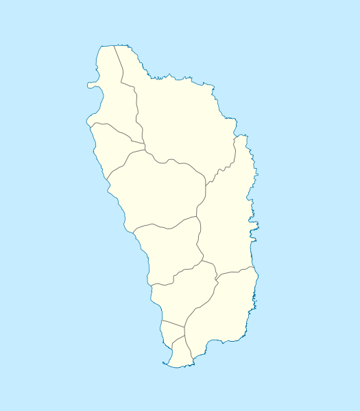
Deutsch: Positionskarte von
Dominica
Geographische Begrenzung der Karte:
English: Location map of
Dominica
Geographic limits of the map:
|
||||||||||||
| Date | |||||||||||||
| Source | Own work | ||||||||||||
| Author | NordNordWest | ||||||||||||
| Permission ( Reusing this file) |
|

|
This map has been made or improved in the German
Kartenwerkstatt (Map Lab). You can
propose maps to improve as well.
|
File history
Click on a date/time to view the file as it appeared at that time.
| Date/Time | Thumbnail | Dimensions | User | Comment | |
|---|---|---|---|---|---|
| current | 10:18, 17 December 2009 |
| 1,104 × 1,260 (78 KB) | NordNordWest | == {{int:filedesc}} == {{Information |Description= {{de|Positionskarte von Dominica}} Geographische Begrenzung der Karte: * N: 15.7° N * S: 15.15° N * W: 61.6° W * O: 61.1° W {{en|Location map of Dominica}} Geographic |
File usage
The following pages on the English Wikipedia use this file (pages on other projects are not listed):
- Anse du Mé
- Bataka
- Belles
- Bense
- Cabrits National Park
- Calibishie
- Canefield
- Canefield Airport
- Delices
- Dominica Premier League
- Douglas–Charles Airport
- Dublanc
- Fort Cachacrou
- Fort Shirley (Dominica)
- Fort Young (Dominica)
- Fort Young Hotel
- Galion, Dominica
- Garraway Hotel
- Good Hope, Dominica
- Grand Bay, Dominica
- Hampstead, Dominica
- Laudat
- List of World Heritage Sites in Dominica
- List of cricket grounds in the West Indies
- Mahaut, Dominica
- Marigot, Dominica
- Massacre, Dominica
- Paix Bouche
- Penville
- Portsmouth, Dominica
- Roseau
- Roseau Cathedral
- Salisbury, Dominica
- Soufrière, Dominica
- Trafalgar, Dominica
- Vieille Case
- Wesley, Dominica
- Woodford Hill, Dominica
- Wotten Waven
- User:Humbleeditor/sandbox
- Module:Location map/data/Dominica
- Module:Location map/data/Dominica/doc
Global file usage
The following other wikis use this file:
- Usage on af.wikipedia.org
- Usage on an.wikipedia.org
- Usage on ar.wikipedia.org
- Usage on ast.wikipedia.org
- Usage on ba.wikipedia.org
- Usage on be-tarask.wikipedia.org
- Usage on be.wikipedia.org
- Usage on bg.wikipedia.org
- Usage on bn.wikipedia.org
- Usage on bs.wikipedia.org
- Usage on ceb.wikipedia.org
- Plantilya:Location map Dominica
- Saint Paul
- Saint John
- Saint George
- Jenny Point
- Indian River
- Noble
- Salisbury
- Douglas Point
- Saint Joseph (pagklaro)
- Sugarloaf
- North River
- Cape Melville
- Saint Davids Bay
- Tweed River
- Scotts Head
- Saint Joseph River
- Rosalie
- National Park
- Lagoon River
- Clyde River
- Middle Bay
- Douglas Bay
- Rough Bay
- Fresh Water Lake
- Woodford Hill
- Bellevue Mountain
- Grand Bay
- Hampstead
- Hillsborough Bay
View more global usage of this file.
Size of this PNG preview of this SVG file:
525 × 599 pixels. Other resolutions:
210 × 240 pixels |
421 × 480 pixels |
673 × 768 pixels |
897 × 1,024 pixels |
1,794 × 2,048 pixels |
1,104 × 1,260 pixels.
Original file (SVG file, nominally 1,104 × 1,260 pixels, file size: 78 KB)
| This is a file from the
Wikimedia Commons. Information from its
description page there is shown below. Commons is a freely licensed media file repository. You can help. |
Summary
| Description |
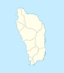
Deutsch: Positionskarte von
Dominica
Geographische Begrenzung der Karte:
English: Location map of
Dominica
Geographic limits of the map:
|
||||||||||||
| Date | |||||||||||||
| Source | Own work | ||||||||||||
| Author | NordNordWest | ||||||||||||
| Permission ( Reusing this file) |
|
|
|
This map has been made or improved in the German
Kartenwerkstatt (Map Lab). You can
propose maps to improve as well.
|
File history
Click on a date/time to view the file as it appeared at that time.
| Date/Time | Thumbnail | Dimensions | User | Comment | |
|---|---|---|---|---|---|
| current | 10:18, 17 December 2009 |
| 1,104 × 1,260 (78 KB) | NordNordWest | == {{int:filedesc}} == {{Information |Description= {{de|Positionskarte von Dominica}} Geographische Begrenzung der Karte: * N: 15.7° N * S: 15.15° N * W: 61.6° W * O: 61.1° W {{en|Location map of Dominica}} Geographic |
File usage
The following pages on the English Wikipedia use this file (pages on other projects are not listed):
- Anse du Mé
- Bataka
- Belles
- Bense
- Cabrits National Park
- Calibishie
- Canefield
- Canefield Airport
- Delices
- Dominica Premier League
- Douglas–Charles Airport
- Dublanc
- Fort Cachacrou
- Fort Shirley (Dominica)
- Fort Young (Dominica)
- Fort Young Hotel
- Galion, Dominica
- Garraway Hotel
- Good Hope, Dominica
- Grand Bay, Dominica
- Hampstead, Dominica
- Laudat
- List of World Heritage Sites in Dominica
- List of cricket grounds in the West Indies
- Mahaut, Dominica
- Marigot, Dominica
- Massacre, Dominica
- Paix Bouche
- Penville
- Portsmouth, Dominica
- Roseau
- Roseau Cathedral
- Salisbury, Dominica
- Soufrière, Dominica
- Trafalgar, Dominica
- Vieille Case
- Wesley, Dominica
- Woodford Hill, Dominica
- Wotten Waven
- User:Humbleeditor/sandbox
- Module:Location map/data/Dominica
- Module:Location map/data/Dominica/doc
Global file usage
The following other wikis use this file:
- Usage on af.wikipedia.org
- Usage on an.wikipedia.org
- Usage on ar.wikipedia.org
- Usage on ast.wikipedia.org
- Usage on ba.wikipedia.org
- Usage on be-tarask.wikipedia.org
- Usage on be.wikipedia.org
- Usage on bg.wikipedia.org
- Usage on bn.wikipedia.org
- Usage on bs.wikipedia.org
- Usage on ceb.wikipedia.org
- Plantilya:Location map Dominica
- Saint Paul
- Saint John
- Saint George
- Jenny Point
- Indian River
- Noble
- Salisbury
- Douglas Point
- Saint Joseph (pagklaro)
- Sugarloaf
- North River
- Cape Melville
- Saint Davids Bay
- Tweed River
- Scotts Head
- Saint Joseph River
- Rosalie
- National Park
- Lagoon River
- Clyde River
- Middle Bay
- Douglas Bay
- Rough Bay
- Fresh Water Lake
- Woodford Hill
- Bellevue Mountain
- Grand Bay
- Hampstead
- Hillsborough Bay
View more global usage of this file.