
Size of this PNG preview of this SVG file:
650 × 545 pixels. Other resolutions:
286 × 240 pixels |
573 × 480 pixels |
916 × 768 pixels |
1,221 × 1,024 pixels |
2,443 × 2,048 pixels.
Original file (SVG file, nominally 650 × 545 pixels, file size: 1.04 MB)
| This is a file from the
Wikimedia Commons. Information from its
description page there is shown below. Commons is a freely licensed media file repository. You can help. |
_Waldeck.svg)
| Description |
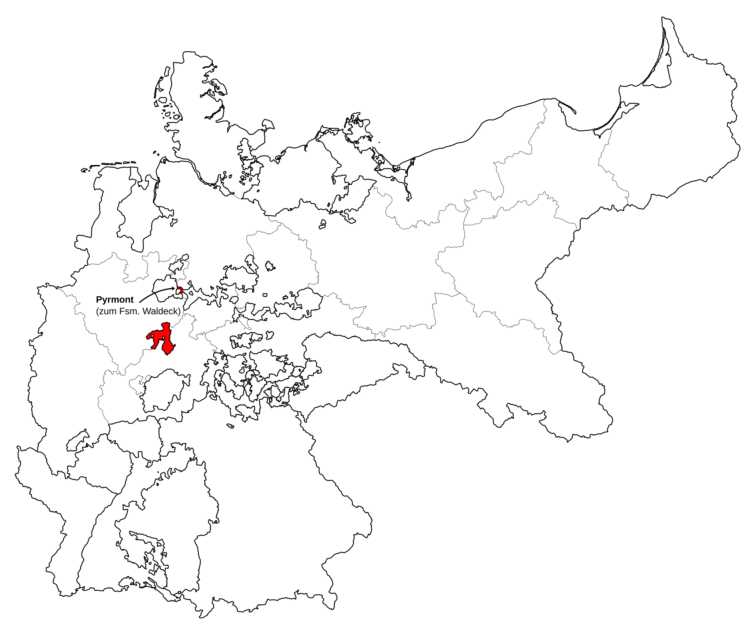
Deutsch: Karte des Deutschen Reiches zu Anbeginn des 20. Jahrhunderts. Neben den einzelnen Gliedstaaten sind auch die preußischen Provinzen auf der Karte verzeichnet. Die Lage von Waldeck ist hervorgehoben. |
| Date | |
| Source | Map based upon map data of the IEG-Maps project by Andreas Kunz, B. Johnen and Joachim Robert Moeschl of the University of Mainz. For further info visit: http://www.ieg-maps.uni-mainz.de |
| Author | David Liuzzo |
| Permission ( Reusing this file) |
This file is licensed under the
Creative Commons
Attribution-Share Alike 2.0 Germany license.
 |
File history
Click on a date/time to view the file as it appeared at that time.
| Date/Time | Thumbnail | Dimensions | User | Comment | |
|---|---|---|---|---|---|
| current | 18:45, 9 January 2010 |
| 650 × 545 (1.04 MB) | Maproom | Made Waldeck red, as for other small German state maps, to make it more conspicuous |
| 08:37, 30 June 2007 |
 | 650 × 545 (1.04 MB) | N3MO | ||
| 08:03, 30 June 2007 |
 | 650 × 545 (1.04 MB) | N3MO | ||
| 14:22, 30 July 2006 |
 | 650 × 545 (800 KB) | David Liuzzo | {{Information| |Description= {{de|Karte des Deutschen Reiches zu Anbeginn des 20. Jahrhunderts. Neben den einzelnen Gliedstaaten sind auch die preußischen Provinzen auf der Karte verzeichnet. Die Lage von '''Waldeck''' ist hervorgehoben.}} |Source= Map b |
File usage
The following pages on the English Wikipedia use this file (pages on other projects are not listed):
Global file usage
The following other wikis use this file:
- Usage on fr.wikipedia.org
_Waldeck.svg)
Size of this PNG preview of this SVG file:
650 × 545 pixels. Other resolutions:
286 × 240 pixels |
573 × 480 pixels |
916 × 768 pixels |
1,221 × 1,024 pixels |
2,443 × 2,048 pixels.
Original file (SVG file, nominally 650 × 545 pixels, file size: 1.04 MB)
| This is a file from the
Wikimedia Commons. Information from its
description page there is shown below. Commons is a freely licensed media file repository. You can help. |
| Description |
Deutsch: Karte des Deutschen Reiches zu Anbeginn des 20. Jahrhunderts. Neben den einzelnen Gliedstaaten sind auch die preußischen Provinzen auf der Karte verzeichnet. Die Lage von Waldeck ist hervorgehoben. |
| Date | |
| Source | Map based upon map data of the IEG-Maps project by Andreas Kunz, B. Johnen and Joachim Robert Moeschl of the University of Mainz. For further info visit: http://www.ieg-maps.uni-mainz.de |
| Author | David Liuzzo |
| Permission ( Reusing this file) |
This file is licensed under the
Creative Commons
Attribution-Share Alike 2.0 Germany license.
|
File history
Click on a date/time to view the file as it appeared at that time.
| Date/Time | Thumbnail | Dimensions | User | Comment | |
|---|---|---|---|---|---|
| current | 18:45, 9 January 2010 |
| 650 × 545 (1.04 MB) | Maproom | Made Waldeck red, as for other small German state maps, to make it more conspicuous |
| 08:37, 30 June 2007 |
| 650 × 545 (1.04 MB) | N3MO | ||
| 08:03, 30 June 2007 |
| 650 × 545 (1.04 MB) | N3MO | ||
| 14:22, 30 July 2006 |
| 650 × 545 (800 KB) | David Liuzzo | {{Information| |Description= {{de|Karte des Deutschen Reiches zu Anbeginn des 20. Jahrhunderts. Neben den einzelnen Gliedstaaten sind auch die preußischen Provinzen auf der Karte verzeichnet. Die Lage von '''Waldeck''' ist hervorgehoben.}} |Source= Map b |
File usage
The following pages on the English Wikipedia use this file (pages on other projects are not listed):
Global file usage
The following other wikis use this file:
- Usage on fr.wikipedia.org