Photos • Location


Size of this preview:
800 × 600 pixels. Other resolutions:
320 × 240 pixels |
640 × 480 pixels |
1,024 × 768 pixels |
1,280 × 960 pixels |
2,560 × 1,920 pixels |
3,648 × 2,736 pixels.
Original file (3,648 × 2,736 pixels, file size: 2.8 MB, MIME type: image/jpeg)
| This is a file from the
Wikimedia Commons. Information from its
description page there is shown below. Commons is a freely licensed media file repository. You can help. |
Summary
|
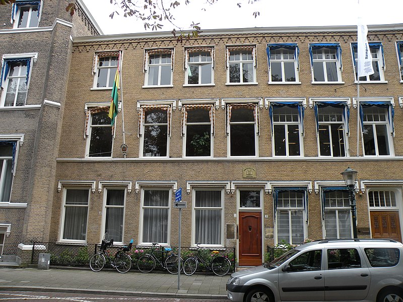
This is an image of
rijksmonument number
17781 Information from structured data: |
Summary
| Description |
Nederlands: Den Haag - Nassaulaan 5 - Rijksmonument |
| Date | |
| Source | Own work |
| Author | Magalhães |
| Object location |
| View this and other nearby images on: OpenStreetMap |
|
|---|
|
|
This image was uploaded as part of
Wiki Loves Monuments 2010.
|
Licensing
| I, the copyright holder of this work, release this work into the
public domain. This applies worldwide. In some countries this may not be legally possible; if so: I grant anyone the right to use this work for any purpose, without any conditions, unless such conditions are required by law. |
File history
Click on a date/time to view the file as it appeared at that time.
| Date/Time | Thumbnail | Dimensions | User | Comment | |
|---|---|---|---|---|---|
| current | 13:04, 2 September 2010 |
| 3,648 × 2,736 (2.8 MB) | Magalhães | == Summary == {{Rijksmonument|17781}} == Summary == {{Information |Description={{nl|1=Den_Haag_-_Nassaulaan_5- Rijksmonument}} |Source={{own}} |Author= Magalhães |Date=2010-09-02 |Permission= |other_versions= }} [[Category:Rijksmonume |
File usage
The following pages on the English Wikipedia use this file (pages on other projects are not listed):
Global file usage
The following other wikis use this file:
- Usage on de.wikipedia.org
- Usage on es.wikipedia.org
- Usage on fa.wikipedia.org
- Usage on fr.wikipedia.org
- Usage on ko.wikipedia.org
- Usage on nl.wikipedia.org
- Usage on pt.wikipedia.org
- Usage on www.wikidata.org
- Usage on zh.wikipedia.org
Metadata
Size of this preview:
800 × 600 pixels. Other resolutions:
320 × 240 pixels |
640 × 480 pixels |
1,024 × 768 pixels |
1,280 × 960 pixels |
2,560 × 1,920 pixels |
3,648 × 2,736 pixels.
Original file (3,648 × 2,736 pixels, file size: 2.8 MB, MIME type: image/jpeg)
| This is a file from the
Wikimedia Commons. Information from its
description page there is shown below. Commons is a freely licensed media file repository. You can help. |
Summary
|
This is an image of
rijksmonument number
17781 Information from structured data: |
Summary
| Description |
Nederlands: Den Haag - Nassaulaan 5 - Rijksmonument |
| Date | |
| Source | Own work |
| Author | Magalhães |
| Object location |
| View this and other nearby images on: OpenStreetMap |
|
|---|
|
|
This image was uploaded as part of
Wiki Loves Monuments 2010.
|
Licensing
| I, the copyright holder of this work, release this work into the
public domain. This applies worldwide. In some countries this may not be legally possible; if so: I grant anyone the right to use this work for any purpose, without any conditions, unless such conditions are required by law. |
File history
Click on a date/time to view the file as it appeared at that time.
| Date/Time | Thumbnail | Dimensions | User | Comment | |
|---|---|---|---|---|---|
| current | 13:04, 2 September 2010 |
| 3,648 × 2,736 (2.8 MB) | Magalhães | == Summary == {{Rijksmonument|17781}} == Summary == {{Information |Description={{nl|1=Den_Haag_-_Nassaulaan_5- Rijksmonument}} |Source={{own}} |Author= Magalhães |Date=2010-09-02 |Permission= |other_versions= }} [[Category:Rijksmonume |
File usage
The following pages on the English Wikipedia use this file (pages on other projects are not listed):
Global file usage
The following other wikis use this file:
- Usage on de.wikipedia.org
- Usage on es.wikipedia.org
- Usage on fa.wikipedia.org
- Usage on fr.wikipedia.org
- Usage on ko.wikipedia.org
- Usage on nl.wikipedia.org
- Usage on pt.wikipedia.org
- Usage on www.wikidata.org
- Usage on zh.wikipedia.org