
Size of this preview:
610 × 600 pixels. Other resolutions:
244 × 240 pixels |
488 × 480 pixels |
781 × 768 pixels |
1,042 × 1,024 pixels |
2,002 × 1,968 pixels.
Original file (2,002 × 1,968 pixels, file size: 2.46 MB, MIME type: image/png)
| This is a file from the
Wikimedia Commons. Information from its
description page there is shown below. Commons is a freely licensed media file repository. You can help. |
| Description |
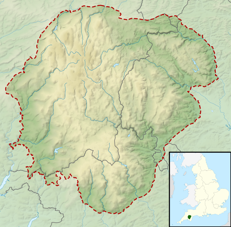
Relief map of the Dartmoor National Park, UK Equirectangular map projection on WGS 84 datum, with N/S stretched 170% Geographic limits:
|
| Date | |
| Source |
Office of National Statistics Geography
|
| Author | Nilfanion, created using Ordnance Survey data |
| Permission ( Reusing this file) |
This file is licensed under the
Creative Commons
Attribution-Share Alike 3.0 Unported license. Attribution: Contains Ordnance Survey data © Crown copyright and database right
|
File history
Click on a date/time to view the file as it appeared at that time.
| Date/Time | Thumbnail | Dimensions | User | Comment | |
|---|---|---|---|---|---|
| current | 10:49, 17 March 2012 |
| 2,002 × 1,968 (2.46 MB) | Nilfanion | {{Information |Description=Relief map of the Dartmoor National Park, UK Equirectangular map projection on WGS 84 datum, with N/S stretched 170% Geographic limits: *West: 4.18W *East: 3.60W *North: 50.75N *South: 50.37N |Source= [[w:Off... |
File usage
The following pages on the English Wikipedia use this file (pages on other projects are not listed):
- Aish Tor
- Beardown Tors
- Bellever Tor
- Berra Tor
- Buckland Beacon
- Butterdon Hill
- Chinkwell Tor
- Combestone Tor
- Cosdon Hill
- Easdon Tor
- Great Mis Tor
- Great Trowlesworthy Tor
- Greator Rocks
- High Willhays
- Hound Tor
- Hunter's Tor, Lustleigh Cleave
- Pil Tor
- Vixen Tor
- Module:Location map/data/United Kingdom Dartmoor
- Module:Location map/data/United Kingdom Dartmoor/doc
Global file usage
The following other wikis use this file:
- Usage on ar.wikipedia.org
- Usage on ceb.wikipedia.org
- Usage on fr.wikipedia.org
- Usage on he.wikipedia.org
- Usage on kn.wikipedia.org
- Usage on si.wikipedia.org
- Usage on tr.wikipedia.org
- Usage on uz.wikipedia.org
- Usage on war.wikipedia.org
Metadata
Size of this preview:
610 × 600 pixels. Other resolutions:
244 × 240 pixels |
488 × 480 pixels |
781 × 768 pixels |
1,042 × 1,024 pixels |
2,002 × 1,968 pixels.
Original file (2,002 × 1,968 pixels, file size: 2.46 MB, MIME type: image/png)
| This is a file from the
Wikimedia Commons. Information from its
description page there is shown below. Commons is a freely licensed media file repository. You can help. |
| Description |
Relief map of the Dartmoor National Park, UK Equirectangular map projection on WGS 84 datum, with N/S stretched 170% Geographic limits:
|
| Date | |
| Source |
Office of National Statistics Geography
|
| Author | Nilfanion, created using Ordnance Survey data |
| Permission ( Reusing this file) |
This file is licensed under the
Creative Commons
Attribution-Share Alike 3.0 Unported license. Attribution: Contains Ordnance Survey data © Crown copyright and database right
|
File history
Click on a date/time to view the file as it appeared at that time.
| Date/Time | Thumbnail | Dimensions | User | Comment | |
|---|---|---|---|---|---|
| current | 10:49, 17 March 2012 |
| 2,002 × 1,968 (2.46 MB) | Nilfanion | {{Information |Description=Relief map of the Dartmoor National Park, UK Equirectangular map projection on WGS 84 datum, with N/S stretched 170% Geographic limits: *West: 4.18W *East: 3.60W *North: 50.75N *South: 50.37N |Source= [[w:Off... |
File usage
The following pages on the English Wikipedia use this file (pages on other projects are not listed):
- Aish Tor
- Beardown Tors
- Bellever Tor
- Berra Tor
- Buckland Beacon
- Butterdon Hill
- Chinkwell Tor
- Combestone Tor
- Cosdon Hill
- Easdon Tor
- Great Mis Tor
- Great Trowlesworthy Tor
- Greator Rocks
- High Willhays
- Hound Tor
- Hunter's Tor, Lustleigh Cleave
- Pil Tor
- Vixen Tor
- Module:Location map/data/United Kingdom Dartmoor
- Module:Location map/data/United Kingdom Dartmoor/doc
Global file usage
The following other wikis use this file:
- Usage on ar.wikipedia.org
- Usage on ceb.wikipedia.org
- Usage on fr.wikipedia.org
- Usage on he.wikipedia.org
- Usage on kn.wikipedia.org
- Usage on si.wikipedia.org
- Usage on tr.wikipedia.org
- Usage on uz.wikipedia.org
- Usage on war.wikipedia.org