
Original file (SVG file, nominally 1,257 × 1,514 pixels, file size: 586 KB)
| This is a file from the
Wikimedia Commons. Information from its
description page there is shown below. Commons is a freely licensed media file repository. You can help. |
| Description |
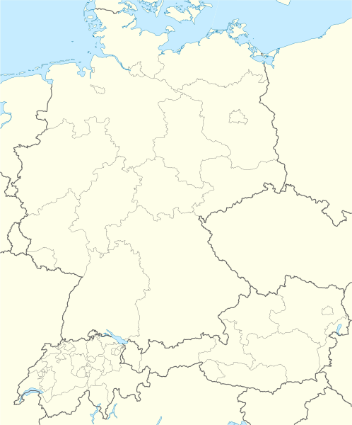
Deutsch: Positionskarte der
D-A-CH-Länder
Quadratische Plattkarte, N-S-Streckung 150 %. Geographische Begrenzung der Karte:
English: Location map of
German-speaking Europe (D-A-CH)
Equirectangular projection, N/S stretching 150 %. Geographic limits of the map:
|
| Date | |
| Source | own work, using United States National Imagery and Mapping Agency data |
| Author | NordNordWest |
| Other versions | Derivative works of this file: D-A-CH location map T(h)alheim Da(h)lheim.svg |
alheim_Da(h)lheim.svg)

|
This map has been made or improved in the German
Kartenwerkstatt (Map Lab). You can
propose maps to improve as well.
|
Licensing

|
Permission is granted to copy, distribute and/or modify this document under the terms of the GNU Free Documentation License, Version 1.2 or any later version published by the Free Software Foundation; with no Invariant Sections, no Front-Cover Texts, and no Back-Cover Texts. A copy of the license is included in the section entitled GNU Free Documentation License. |
- You are free:
- to share – to copy, distribute and transmit the work
- to remix – to adapt the work
- Under the following conditions:
- attribution – You must give appropriate credit, provide a link to the license, and indicate if changes were made. You may do so in any reasonable manner, but not in any way that suggests the licensor endorses you or your use.
- share alike – If you remix, transform, or build upon the material, you must distribute your contributions under the same or compatible license as the original.
File history
Click on a date/time to view the file as it appeared at that time.
| Date/Time | Thumbnail | Dimensions | User | Comment | |
|---|---|---|---|---|---|
| current | 19:28, 22 March 2021 |
| 1,257 × 1,514 (586 KB) | Pechristener | fix of border in Lake Constanz area. Between Stein am Rhein and Constanz, there is a defined border. |
| 10:20, 7 May 2009 |
 | 1,257 × 1,514 (950 KB) | NordNordWest | update | |
| 21:04, 6 May 2009 |
 | 1,257 × 1,514 (969 KB) | NordNordWest | {{Information |Description= {{de|Positionskarte der D-A-CH-Länder}} Quadratische Plattkarte, N-S-Streckung 150 %. Geographische Begrenzung der Karte: * N: 55.1° N * S: 45.7° N * W: 5.5° O * O: 17.2° O {{en|Location map of [[:en:German- |
File usage
Global file usage
The following other wikis use this file:
- Usage on ar.wikipedia.org
- Usage on bs.wikipedia.org
- Usage on ceb.wikipedia.org
- Usage on da.wikipedia.org
- Usage on de.wikipedia.org
- Tatort (Fernsehreihe)
- Technische Universität
- Nord-Süd-Leitung
- Niederschlagsradar
- Kartellverband katholischer deutscher Studentenvereine
- Soldatensender
- Liste der Mitgliedsvereine des KV
- Diskussion:Swingolf
- Wikipedia:Redaktion Chemie/Mitarbeiter
- Benutzer:Spischot/Sketchpad 3
- Liste von Apothekenmuseen
- Wikipedia:Mentorenprogramm/Treffen
- Benutzer Diskussion:PhiliM
- Wikipedia:Kartenwerkstatt/Positionskarten/Europa
- Vorlage:Positionskarte D-A-CH
- Vorlage:Karte der Mitgliedsvereine des KV
- Wikipedia:Kartenwerkstatt/Archiv/2009-05
- Wikipedia:Jungwikipedianer/Mitglieder
- Benutzer Diskussion:Kingofears/Mentees/Woltmers
- Wikipedia:Redaktion Film und Fernsehen/Redaktionstreffen
- Wikipedia:WikiCon
- Alte Buchenwälder und Buchenurwälder der Karpaten und anderer Regionen Europas
- Wikipedia:Jungwikipedianer/JWP-Karte
- Wikipedia:Redaktion Chemie/Treffen
- Wikipedia:Jungwikipedianer/Café/Archiv/2012
- Wikipedia Diskussion:Jungwikipedianer/Archiv/2012/1. Teilarchiv
- Wikipedia Diskussion:Kurier/Archiv/2013/12
- Benutzer:Gps-for-five/Spielwiese/Vorlage:Suche Poskarte
- Benutzer:Gps-for-five/Spielwiese/Vorlage:Suche Poskarte/Doku
- Vorlage:Suche Positionskarte
- Vorlage:Suche Positionskarte/Doku
- Wikipedia:AdminConvention
- Südostlink
- Wikipedia:Mentorenprogramm/Treffen/2016
- Wikipedia:Jungwikipedianer/Treffen
- Wikipedia:WikiCon 2015/Kurzkonzept
- Wikipedia:AdminConvention 2016
- Österreichische Staatsmeisterschaften im Eisschnelllauf 2016
- Wikipedia:WikiProjekt Kategorien/CatCon
- Faustball-Europacup der Männer 2010
- Reichssammelschiene
- Wikipedia:Kartenwerkstatt/Archiv/2016-09
- Wikipedia:AdminConvention 2017
- 380-kV-Leitung Wesel–Dörpen
- Wikipedia:Jungwikipedianer/Treffen/2017
- Vorlage:Interaktive Karte von Apothekenmuseen
View more global usage of this file.
Metadata
Original file (SVG file, nominally 1,257 × 1,514 pixels, file size: 586 KB)
| This is a file from the
Wikimedia Commons. Information from its
description page there is shown below. Commons is a freely licensed media file repository. You can help. |
| Description |
Deutsch: Positionskarte der
D-A-CH-Länder
Quadratische Plattkarte, N-S-Streckung 150 %. Geographische Begrenzung der Karte:
English: Location map of
German-speaking Europe (D-A-CH)
Equirectangular projection, N/S stretching 150 %. Geographic limits of the map:
|
| Date | |
| Source | own work, using United States National Imagery and Mapping Agency data |
| Author | NordNordWest |
| Other versions | Derivative works of this file: D-A-CH location map T(h)alheim Da(h)lheim.svg |
|
|
This map has been made or improved in the German
Kartenwerkstatt (Map Lab). You can
propose maps to improve as well.
|
Licensing
|
|
Permission is granted to copy, distribute and/or modify this document under the terms of the GNU Free Documentation License, Version 1.2 or any later version published by the Free Software Foundation; with no Invariant Sections, no Front-Cover Texts, and no Back-Cover Texts. A copy of the license is included in the section entitled GNU Free Documentation License. |
- You are free:
- to share – to copy, distribute and transmit the work
- to remix – to adapt the work
- Under the following conditions:
- attribution – You must give appropriate credit, provide a link to the license, and indicate if changes were made. You may do so in any reasonable manner, but not in any way that suggests the licensor endorses you or your use.
- share alike – If you remix, transform, or build upon the material, you must distribute your contributions under the same or compatible license as the original.
File history
Click on a date/time to view the file as it appeared at that time.
| Date/Time | Thumbnail | Dimensions | User | Comment | |
|---|---|---|---|---|---|
| current | 19:28, 22 March 2021 |
| 1,257 × 1,514 (586 KB) | Pechristener | fix of border in Lake Constanz area. Between Stein am Rhein and Constanz, there is a defined border. |
| 10:20, 7 May 2009 |
| 1,257 × 1,514 (950 KB) | NordNordWest | update | |
| 21:04, 6 May 2009 |
| 1,257 × 1,514 (969 KB) | NordNordWest | {{Information |Description= {{de|Positionskarte der D-A-CH-Länder}} Quadratische Plattkarte, N-S-Streckung 150 %. Geographische Begrenzung der Karte: * N: 55.1° N * S: 45.7° N * W: 5.5° O * O: 17.2° O {{en|Location map of [[:en:German- |
File usage
Global file usage
The following other wikis use this file:
- Usage on ar.wikipedia.org
- Usage on bs.wikipedia.org
- Usage on ceb.wikipedia.org
- Usage on da.wikipedia.org
- Usage on de.wikipedia.org
- Tatort (Fernsehreihe)
- Technische Universität
- Nord-Süd-Leitung
- Niederschlagsradar
- Kartellverband katholischer deutscher Studentenvereine
- Soldatensender
- Liste der Mitgliedsvereine des KV
- Diskussion:Swingolf
- Wikipedia:Redaktion Chemie/Mitarbeiter
- Benutzer:Spischot/Sketchpad 3
- Liste von Apothekenmuseen
- Wikipedia:Mentorenprogramm/Treffen
- Benutzer Diskussion:PhiliM
- Wikipedia:Kartenwerkstatt/Positionskarten/Europa
- Vorlage:Positionskarte D-A-CH
- Vorlage:Karte der Mitgliedsvereine des KV
- Wikipedia:Kartenwerkstatt/Archiv/2009-05
- Wikipedia:Jungwikipedianer/Mitglieder
- Benutzer Diskussion:Kingofears/Mentees/Woltmers
- Wikipedia:Redaktion Film und Fernsehen/Redaktionstreffen
- Wikipedia:WikiCon
- Alte Buchenwälder und Buchenurwälder der Karpaten und anderer Regionen Europas
- Wikipedia:Jungwikipedianer/JWP-Karte
- Wikipedia:Redaktion Chemie/Treffen
- Wikipedia:Jungwikipedianer/Café/Archiv/2012
- Wikipedia Diskussion:Jungwikipedianer/Archiv/2012/1. Teilarchiv
- Wikipedia Diskussion:Kurier/Archiv/2013/12
- Benutzer:Gps-for-five/Spielwiese/Vorlage:Suche Poskarte
- Benutzer:Gps-for-five/Spielwiese/Vorlage:Suche Poskarte/Doku
- Vorlage:Suche Positionskarte
- Vorlage:Suche Positionskarte/Doku
- Wikipedia:AdminConvention
- Südostlink
- Wikipedia:Mentorenprogramm/Treffen/2016
- Wikipedia:Jungwikipedianer/Treffen
- Wikipedia:WikiCon 2015/Kurzkonzept
- Wikipedia:AdminConvention 2016
- Österreichische Staatsmeisterschaften im Eisschnelllauf 2016
- Wikipedia:WikiProjekt Kategorien/CatCon
- Faustball-Europacup der Männer 2010
- Reichssammelschiene
- Wikipedia:Kartenwerkstatt/Archiv/2016-09
- Wikipedia:AdminConvention 2017
- 380-kV-Leitung Wesel–Dörpen
- Wikipedia:Jungwikipedianer/Treffen/2017
- Vorlage:Interaktive Karte von Apothekenmuseen
View more global usage of this file.