
Size of this PNG preview of this SVG file:
600 × 600 pixels. Other resolutions:
240 × 240 pixels |
480 × 480 pixels |
768 × 768 pixels |
1,024 × 1,024 pixels |
2,048 × 2,048 pixels |
601 × 601 pixels.
Original file (SVG file, nominally 601 × 601 pixels, file size: 13 KB)
| This is a file from the
Wikimedia Commons. Information from its
description page there is shown below. Commons is a freely licensed media file repository. You can help. |
| Description |
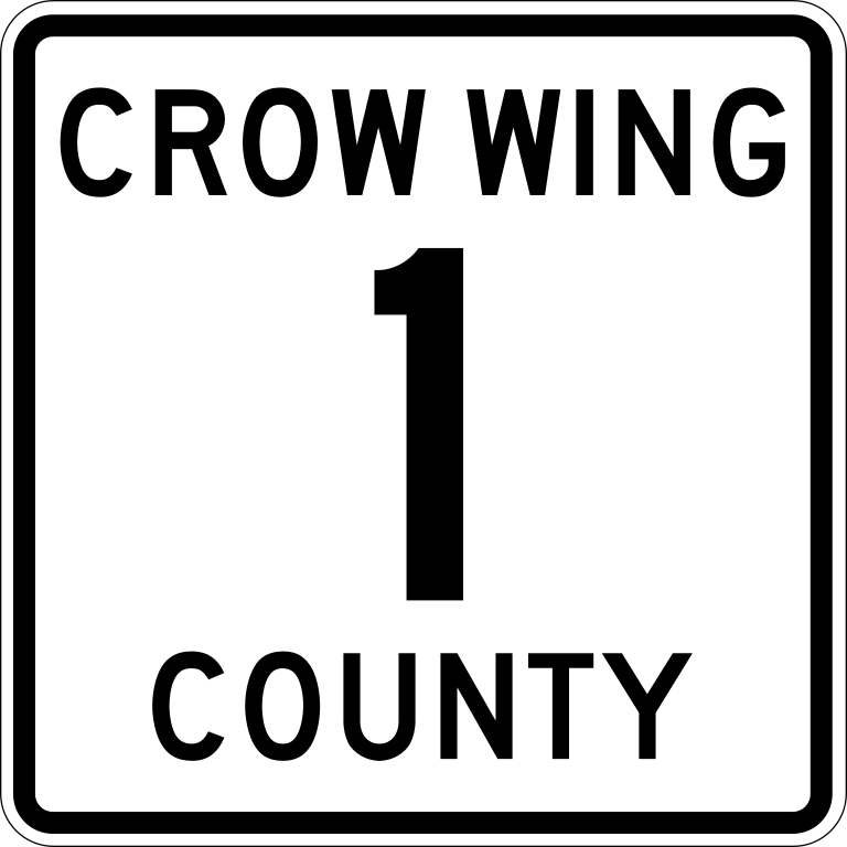
English: Diagram of a 24-by-24-inch (600 mm × 600 mm) county route marker, made to the specifications of the
2013 Minnesota Department of Transportation Standard Signs Manual. Uses the
Roadgeek 2005 fonts. (United States law does not permit the copyrighting of typeface designs, and the fonts are meant to be copies of a U.S. Government-produced work anyway.) Colors are from the Federal Highway Administration's
MUTCD Color Specifications (Pantone Blue 294 and Yellow 116). |
|||
| Date | ||||
| Source | Own work | |||
| Author | Vcap36 | |||
| Permission ( Reusing this file) |
|
File history
Click on a date/time to view the file as it appeared at that time.
| Date/Time | Thumbnail | Dimensions | User | Comment | |
|---|---|---|---|---|---|
| current | 23:19, 4 April 2016 |
| 601 × 601 (13 KB) | Vcap36 | {{Information |Description ={{en|1={{Minnesota county route marker}}}} |Source ={{own}} |Author = Vcap36 |Date =2016-04-04 |Permission ={{PD-MUTCD-MN|M1-6}} |other_versions = }} [[Category:Crow Wing Coun... |
File usage
The following pages on the English Wikipedia use this file (pages on other projects are not listed):
Metadata
Size of this PNG preview of this SVG file:
600 × 600 pixels. Other resolutions:
240 × 240 pixels |
480 × 480 pixels |
768 × 768 pixels |
1,024 × 1,024 pixels |
2,048 × 2,048 pixels |
601 × 601 pixels.
Original file (SVG file, nominally 601 × 601 pixels, file size: 13 KB)
| This is a file from the
Wikimedia Commons. Information from its
description page there is shown below. Commons is a freely licensed media file repository. You can help. |
| Description |
English: Diagram of a 24-by-24-inch (600 mm × 600 mm) county route marker, made to the specifications of the
2013 Minnesota Department of Transportation Standard Signs Manual. Uses the
Roadgeek 2005 fonts. (United States law does not permit the copyrighting of typeface designs, and the fonts are meant to be copies of a U.S. Government-produced work anyway.) Colors are from the Federal Highway Administration's
MUTCD Color Specifications (Pantone Blue 294 and Yellow 116). |
|||
| Date | ||||
| Source | Own work | |||
| Author | Vcap36 | |||
| Permission ( Reusing this file) |
|
File history
Click on a date/time to view the file as it appeared at that time.
| Date/Time | Thumbnail | Dimensions | User | Comment | |
|---|---|---|---|---|---|
| current | 23:19, 4 April 2016 |
| 601 × 601 (13 KB) | Vcap36 | {{Information |Description ={{en|1={{Minnesota county route marker}}}} |Source ={{own}} |Author = Vcap36 |Date =2016-04-04 |Permission ={{PD-MUTCD-MN|M1-6}} |other_versions = }} [[Category:Crow Wing Coun... |
File usage
The following pages on the English Wikipedia use this file (pages on other projects are not listed):